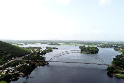
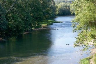


The Tano River, known also as Tanoé, represents a fundamental hydrological artery in West Africa, serving as a transboundary river basin shared between Ghana and Côte d’Ivoire. It constitutes one of Ghana’s four primary southwestern river systems, alongside the Ankobra, Bia, and Pra basins. The river’s total length spans approximately 400 kilometers (249 miles) to 512 kilometers. The vast majority of its drainage area, estimated between 15,000 and 16,060 square kilometers, lies within Ghana (approximately 92.6% to 93%), with the remaining 7.4% to 7% extending into Côte d’Ivoire. The Tano River flows predominantly southwestward, culminating its journey by discharging into the Ehy/Tano/Aby Lagoon complex, which straddles the international border before ultimately emptying into the Atlantic Ocean. It is important to note that the majority of this critical lagoon system is situated within Côte d’Ivoire.
This river system and its basin are ecologically and economically indispensable, providing sustenance and resources for millions of people. Its diverse ecosystems support a range of activities including agriculture, forestry, mining, tourism, and fisheries. Furthermore, the Tano provides essential ecosystem services such as water supply, biodiversity conservation, and climate regulation. This report meticulously traces the Tano River’s comprehensive journey from its highlands source in Ghana to its ultimate discharge into the Atlantic Ocean via the lagoon complex in Côte d’Ivoire, highlighting the significant geographical, ecological, climatic, and human-induced transformations it undergoes along its course.
The transboundary nature of the Tano River basin, with its headwaters largely in Ghana and its crucial mouth and lagoon complex predominantly in Côte d’Ivoire, establishes an inherent geopolitical and environmental complexity. This geographical arrangement means that environmental changes, such as pollution or deforestation, originating upstream in Ghana will directly and significantly affect the downstream ecosystems and the human communities reliant on them in Côte d’Ivoire. Consequently, effective management and conservation of the Tano River cannot be achieved through unilateral efforts by either nation. It necessitates robust international cooperation and the implementation of integrated water resource management plans, underscoring a shared responsibility for the river’s overall health and sustainability.
To provide a foundational understanding of the Tano River’s scale and geopolitical context, the following table summarizes its key geographical characteristics:
Table 1: Key Geographical Characteristics of the Tano River Basin
| Characteristic | Value |
| Total Length | 400-512 km (249-318 miles) |
| Basin Area | 15,000-16,060 km² |
| Countries Traversed | Ghana, Côte d’Ivoire |
| Percentage of Basin in Ghana | ~93% |
| Percentage of Basin in Côte d’Ivoire | ~7% |
| General Flow Direction | Southwestward / Roughly North-South |
| Ultimate Discharge Point | Ehy/Tano/Aby Lagoon complex (Côte d’Ivoire), Atlantic Ocean |
This table provides a concise, at-a-glance summary of the river’s fundamental dimensions and geopolitical context, enabling a rapid comprehension of the scale and scope of the Tano River system, and serving as a foundational reference point for the detailed narrative that follows.
I. The Tano’s Genesis: Highlands and Headwaters
A. Geographical Origins: Source Location, Elevation, and Initial Flow Dynamics
The Tano River’s journey commences in the elevated terrains of the Boyem Mountain Ranges, specifically near the town of Techiman, or Pooyem, located approximately 4 kilometers from Techiman, within the Bono East Region of Ghana. These upstream areas are characterized by highlands, with average elevations around 540 meters above sea level, and the general topography of the entire basin can reach up to 700 meters above mean sea level.
In its nascent upper course, the river exhibits a steep gradient, which generates a rapid and turbulent water flow. This high energy is the driving force behind vertical erosion, a process that carves deep V-shaped valleys, gorges, waterfalls, and rapids into the landscape. Interlocking spurs, which are ridges of land that the river winds around, are also common features in this section, as the water lacks sufficient energy to erode through more resistant landforms directly. The river’s sediment load in this initial stretch typically comprises large, coarse boulders and rocks, which are transported primarily by traction, meaning they roll along the riverbed. The channel itself is often shallow and narrow, and the substantial contact between the water and the rough bed and banks creates considerable friction, which can slow the flow despite the steep gradient.
B. Geological Foundations: Ancient Rocks and Early Landscapes
The geological underpinnings of the Tano Basin in its upper reaches are dominated by Ghana’s extensive Precambrian basement complex. This ancient formation is primarily composed of crystalline igneous and metamorphic rocks. A key geological system within this complex is the Birimian series, which includes a diverse array of rock types such as slates, phyllites, greywackes, tuffs, and minor lava flows. These Birimian rocks are extensively folded, foliated, and jointed. The presence of significant weathering along their fractures and weak zones facilitates water infiltration and groundwater movement, contributing to the hydrological dynamics of the basin.
In terms of areal distribution, Granite (Granitoids) is the most prevalent geological formation in the basin, accounting for 38.1% of the area. It is followed by Birimian Sediments at 31.9% and Birimian Volcanics at 25.5%. Other less dominant formations include Eocene & Cretaceous Sedimentary Rocks (2.1%), Upper Voltaian (Kwahu Group) (1.8%), and Tarkwaian Rocks (0.6%).
C. Climate and Pristine Ecology: Rainfall Patterns and Indigenous Biodiversity
The climate of the Tano Basin in its upper reaches falls under the wet semi-equatorial and south-western equatorial climatic zones of Ghana. This is characterized by a distinctive pattern of double rainfall maxima, meaning two peak rainy seasons occur annually. In the Bono East Region, where the river originates, annual rainfall typically ranges from 800 to 1400 millimeters, with an average temperature of 25.8 °C. Generally, rainfall distribution intensifies as one moves southward within the basin, and the annual relative humidity consistently ranges between 75% and 85%.
The source area itself is nestled within a forest. The terrestrial landscape in these upstream sections is composed of semi-deciduous dense forests and dry dense forests, reflecting the lush, humid conditions. Recognizing the ecological importance of these areas, several forest reserves have been specifically established to protect river headwaters, including the Boin Tano Forest Reserve, Tano Suraw Forest Reserve, Tano Suhien Forest Reserve, and Disue Forest Reserve. These reserves play a crucial role in maintaining the river’s initial water quality and flow.
While riparian vegetation in the immediate upper course can be sparse, consisting of hardy plants adapted to high elevations and fast-flowing water , the Tano River and its associated flora and fauna are notably well-preserved due to traditional beliefs. A significant ecological highlight is the confirmed presence of a sub-population of the globally endangered Common Hippopotamus and the Olive Colobus monkey within a 30-kilometer stretch of the Tano River. This area, located at its transition from the Brong Ahafo to the Ashanti/Western Region, underscores the rich biodiversity sustained even in these less-disturbed sections of the river.
D. Cultural Roots: The Sacred Source and Traditional Beliefs
The source of the Tano River holds profound cultural and spiritual significance for the indigenous Bono people, as well as the broader Akan communities. They believe that Taakora, or Ta Kora, the highest of their gods on Earth, resides at the river’s origin. This river deity is revered as a nature god, possessing heroic attributes, and was historically invoked as a war god, possibly even a thunder god. Tano is deeply associated with agriculture, fertility, the sustenance of life, healing, protection, and the upholding of moral order within the community.
The Sacred Grove of Tano, situated near the river’s source, stands as a historical and cultural landmark. For centuries, it has served as a central hub for religious and cultural activities, where offerings and sacrifices are made to honor the deity. The well-preserved natural environment of the grove is a direct reflection of its spiritual sanctity, with access often restricted to ritual specialists and members of the local community, reinforcing its sacred status.
A particularly noteworthy cultural practice is the religious taboo against consuming fish from the Tano River. This prohibition has historically contributed to the preservation of fish species within the river, demonstrating a powerful, informal conservation mechanism. This deep cultural reverence and associated taboo are not merely folklore; they represent a significant form of Traditional Ecological Knowledge (TEK) that has historically contributed to the preservation of the river’s “allied flora, aquatic and fauna diversities” in its upper reaches. The continued practice of these deeply rooted local beliefs and traditions can significantly enhance the effectiveness and cultural resonance of contemporary conservation strategies, illustrating that environmental protection can stem from intrinsic cultural values, not solely from extrinsic economic or regulatory pressures.
II. The Middle Passage: Navigating Ghana’s Heartlands
A. River Morphology and Flow Dynamics: Widening Channels, Meanders, and Tributary Influx
As the Tano River progresses into its middle course, a notable shift in its geomorphology and flow dynamics becomes apparent. The elevation gradually decreases from the initial highlands, dropping to an average of about 225 meters above sea level. This reduction in gradient translates to a decrease in the river’s vertical erosive power compared to its upper course.
The river channel in this section significantly widens and deepens. This expansion is primarily attributed to the increasing volume of water contributed by numerous tributaries that join the main stem. Key tributaries feeding the Tano River system in its middle course include the Abu, Amama, Bo, Disue, Soro, Atronie, Sabom, Gaw, Kwasa, Sumre, and Totua.
Table 2: Major Tributaries of the Tano River
| Tributary Name | Approximate Catchment Area (km²) | Notable Characteristics |
| Boin | 821 (655 in Ghana) | Headwaters protected by Boin Tano Forest Reserve |
| Disue | 1,715 (1,709 in Ghana) | Headwaters protected by Disue Forest Reserve |
| Amama | 958 | |
| Abu | 1,650 | |
| Gaw | 984 | |
| Suraw | 640 | Headwaters protected by Tano Suraw Forest Reserve |
| Samre | 487 | |
| Totua | 440 | |
| Disri | 370 | |
| Soro | Not specified | |
| Atronie | Not specified | |
| Sabom | Not specified | |
| Kwasa | Not specified |
This table systematically lists the key arteries feeding the Tano, illustrating the complexity and scale of its hydrological network. It underscores how these numerous smaller rivers collectively contribute to the main stem’s increasing volume and character as it flows downstream.
Meanders, characterized by sweeping curves and bends, become the most distinctive geomorphological feature of the middle course. These sinuous patterns develop as water flows faster on the outside of bends, leading to lateral (sideways) erosion and the formation of river cliffs. Conversely, the slower water on the inside of bends causes deposition, creating gentler slip-off slopes. A corkscrew-like motion of water known as helicoidal flow further accentuates these bends over time, transferring eroded material from the outer bank of one bend to the inner bank of the next. The river’s sediment load in the middle course consists of smaller, less angular particles compared to the upper course, and transportation is primarily by suspension. Both erosional and depositional processes actively occur in this section, concurrently shaping the developing floodplains.
B. Shifting Landscapes: Transition from Dense Forests to Agricultural Dominance
The middle course of the Tano River traverses several administrative regions within Ghana, including the Brong Ahafo, Ashanti, and Western Regions. More specifically, the basin encompasses significant portions of the Western North (40%), Ahafo (25%), Ashanti (15%), Western (10%), Bono (8%), and Bono East (2%) regions.
The landscape in this section undergoes a pronounced transformation from the more pristine upper reaches. While forest cover still represents a substantial portion, accounting for about 50% of the total landmass of the basin , arable lands now occupy the highest percentage of the total landmass. This area is part of Ghana’s “High Forest zone” and the “Ashanti” belt, a region historically renowned for its tropical rainforests and significant production of cocoa, minerals, and timber. However, the basin’s terrestrial landscape now prominently features extensive farmlands and degraded lands alongside the remaining semi-deciduous and dry dense forests.
C. Economic Tapestry: Agriculture, Forestry, and Resource Extraction
Agriculture stands as the dominant economic activity and the primary source of livelihood for communities residing in the middle basin, employing approximately 70% of the labor force. Commercial farming of staple food crops such as plantain, cassava, and maize, alongside cash crops like cocoa and oil palm, is widespread throughout the region. Forestry, including logging, constitutes another significant economic activity, with valuable timber species like Odum, Mahogany, Ceiba, and Cassia being harvested.
The middle and lower Tano basins are rich in mineral resources, containing substantial deposits of gold, diamonds, and manganese. The underlying Birimian system rocks are particularly important for these gold deposits. Furthermore, the region has been subject to intensive exploration for oil and natural gas since the mid-1980s, highlighting its broader economic significance. Major settlements such as Techiman, Duayaw Nkwanta, Yamfo, Bomaa, Terchire, and Tanoso are located within or in close proximity to the Tano Basin. Some of these communities are experiencing rapid growth, partly driven by the commencement of mining activities. These settlements depend on the Tano River as a major source of domestic water supply, underscoring its direct utility to human populations.
The intensive economic activities observed in the middle course of the Tano River, particularly extensive agriculture, logging, and mineral extraction, are not merely economic drivers; they are directly causing significant landscape transformation and environmental degradation. The rapid conversion of natural forests to farmlands and settlements, coupled with unsustainable practices such as artisanal mining and slash-and-burn agriculture, represents a critical trade-off. While these activities provide immediate economic gains, they often undermine the long-term ecological health of the basin. This pattern leads to cascading negative effects on water quality, soil integrity, biodiversity, and the river’s overall resilience. This creates a cycle of resource depletion that ultimately threatens the very livelihoods it aims to support, highlighting the urgent need for sustainable development policies that explicitly integrate environmental protection with economic planning.
III. Towards the Coast: The Lower Tano and its Estuarine Embrace
A. Lowland Topography and Geological Transition
As the Tano River approaches the coastal region, its journey culminates in a significantly flatter terrain. Elevations in this lower section range between 0 and 15 meters above sea level, with an average elevation of 50 meters. This gentle gradient markedly reduces the river’s velocity, causing deposition to become the predominant geomorphological process. The river channel widens extensively in response to the reduced flow energy, and characteristic features such as oxbow lakes may form as pronounced meanders are cut off during flood events.
The geological composition in these coastal areas transitions from the older Precambrian rocks upstream to more recent Cretaceous and Eocene sedimentary rocks. These formations comprise a variety of rock types, including sand, clay, fossiliferous sandy limestone, marl, sandstone, siltstone, mudstone, shale, and basal conglomerates. Notably, some of the limestone layers within this sequence are believed to hold potential for oil and natural gas, adding a significant economic interest to this segment of the basin.
B. The Lagoon Complex: Ehy, Tendo, and Aby – A Brackish Interface
The Tano River ultimately discharges its waters into the expansive Ehy/Tano/Aby Lagoon complex. This complex straddles the border between Ghana and Côte d’Ivoire, although the majority of this interconnected system lies within Côte d’Ivoire. As the second largest lagoon system in Ivory Coast, it covers a substantial area of 424 square kilometers, with a mean depth of 3.5 meters and a total volume of 1.57 cubic kilometers. The complex is segmented into three distinct named sections: the main Aby Lagoon, covering 305 square kilometers; Tendo Lagoon, which spans 74 square kilometers and is partially divided between Ivory Coast and Ghana; and Ehy Lagoon, a 45-square-kilometer body of water located entirely within Ivory Coast.
Lagoons are naturally characterized by relatively shallow and quiet water conditions, where the freshwater influx from rivers mixes with the tidal saltwater from the ocean, creating a unique brackish environment. Salinity levels within the Aby Lagoon complex fluctuate in response to rainfall patterns, typically peaking in March and April. However, areas in close proximity to the Tano River’s mouth within the lagoon often maintain fresh water conditions throughout the year due to continuous riverine input. These estuarine environments are highly productive, supporting distinctive ecosystems that are specifically adapted to the variable salinity conditions. High biological productivity is observed from marsh vegetation, eelgrass, and microalgae, contributing to a rich and diverse aquatic community.
C. Delta Formation and Coastal Dynamics
The formation of a river delta at the Tano’s mouth is a direct consequence of the river’s reduced velocity and the subsequent deposition of its sediment load. Deltas typically form at the mouths of large rivers when the rate at which sediment is deposited by the river surpasses the rate at which the sea can erode or transport that sediment away. The Tano River’s discharge into the relatively calm and sheltered Ehy/Tano/Aby Lagoon complex, which then connects to the broader Atlantic Ocean via shallow channels, provides favorable conditions for these deltaic processes to occur.
As the river’s velocity significantly diminishes in its lower course, it loses the energy required to transport its substantial sediment load. This leads to the deposition of large quantities of fine-grained sediment, which gradually accumulates to form the delta plain—a characteristic broad, low-lying landmass at the river’s terminus. Within the delta, the main river channel frequently divides into a network of smaller channels known as distributaries. These distributaries fan out, distributing sediment to different lobes of the delta, contributing to its outward growth and intricate morphology. Deltas are dynamic systems, their morphology continuously influenced by the complex interplay of river discharge, wave action, and tidal currents. Beyond their geomorphological significance, deltas serve as important buffer zones, offering natural protection to upland areas from the erosive forces of waves and storms, and mitigating soil erosion by absorbing excess water during flood events.
D. Aquatic and Riparian Biodiversity: Life at the River’s Mouth
The Tano River and its associated lagoon complex are renowned for their rich and diverse biodiversity. The forest situated between the Tano River and Ehy Lagoon is a particularly crucial habitat, believed to harbor the last few individuals of Miss Waldron’s Red Colobus (
Piliocolobus badius waldronae), one of the world’s most critically threatened primates.
The lagoon complex supports a wide array of aquatic life, including various zooplankton species whose abundance and distribution are influenced by environmental factors such as salinity, transparency, dissolved oxygen, conductivity, temperature, and pH. Numerous fish species inhabit these brackish waters, including
Mormyrus rume, Leptocypris niloticus, Oreochromis niloticus, Chrysichthys johnelsi, Clarias gariepinus, Parachanna obscura, Sarotherodon melanotheron, Ctenopoma gariepinus, Sarotherodon galilaeus, and Ctenopoma kingsleyae.
Riparian ecosystems along the lower Tano and surrounding the lagoons are characterized by dense and diverse vegetation. These areas function as crucial transitional zones, or ecotones, between terrestrial and aquatic realms, providing vital habitats for a wide range of aquatic, amphibious, and terrestrial organisms. Consequently, these regions are significant for birdwatching and wildlife enthusiasts, offering opportunities to observe a rich array of species.
The Tano River’s estuarine embrace, particularly the Aby/Tendo/Ehy Lagoon complex, functions as a critical ecological filter and nursery, effectively trapping sediments and nutrients carried downstream from the river’s upper and middle reaches. However, this vital ecological service simultaneously renders the lagoon a “sink” for the cumulative pollution and environmental degradation occurring throughout the river’s entire course. The proliferation of invasive species, such as water hyacinth, poses a significant ecological and economic challenge. Similarly, the influx of pollutants from upstream activities can overwhelm the lagoon’s natural filtering capacity, leading to eutrophication, oxygen depletion, and severe adverse impacts on the diverse fish and zooplankton communities. This interconnectedness of the entire river system means that the very ecological functions that make estuaries productive also render them highly susceptible to the cumulative impacts of anthropogenic activities upstream.
To illustrate the direct impact of pollution on the Tano’s aquatic biodiversity and the potential health risks to human consumers, the following table presents selected fish species and their heavy metal concentrations:
Table 3: Selected Fish Species and Heavy Metal Concentrations in the Tano River
| Fish Species | Heavy Metal Concentration (mg/kg) | Comparison to WHO Limits | Fish Condition |
| Mormyrus rume | Cr: 14.9 ± 0.02, As: 3.00 ± 0.01, Hg: 1.01 ± 0.03, Pb: 0.12 ± 0.06, Cd: 0.03 ± 0.02, Zn: 9.91 ± 1.30 | Cr, As, Hg higher than acceptable; Pb, Cd, Zn below limits | Poor |
| Leptocypris niloticus | Cr: 32.2 ± 14.3, As: 1.55 ± 0.10, Hg: 1.1 ± 0.14, Pb: 0.10 ± 0.01, Cd: 0.01 ± 0.05, Zn: 11.7 ± 4.67 | Cr, As, Hg higher than acceptable; Pb, Cd, Zn below limits | Proportionally good |
| Oreochromis niloticus | Cr: 27.0 ± 36.6, As: 1.52 ± 0.70, Hg: 0.58 ± 0.69, Pb: 0.16 ± 0.05, Cd: <0.3, Zn: 10.8 ± 2.10 | Cr, As, Hg higher than acceptable; Pb, Cd, Zn below limits | Proportionally good |
| Clarias gariepinus | Cr: 16.1 ± 2.40, As: 1.01 ± 0.08, Hg: 1.00 ± 0.04, Pb: 0.13 ± 0.03, Cd: 0.01 ± 0.07, Zn: 10.8 ± 2.76 | Cr, As, Hg higher than acceptable; Pb, Cd, Zn below limits | Proportionally good |
| Sarotherodon galilaeus | Cr: 57.9 ± 4.2, As: 2.57 ± 0.82, Hg: 2.02 ± 1.39, Pb: 0.02 ± 0.01, Cd: <0.3, Zn: 12.5 ± 3.5 | Cr, As, Hg higher than acceptable; Pb, Cd, Zn below limits | Moderate |
| Ctenopoma kingsleyae | Cr: 52.4 ± 20.4, As: 2.54 ± 0.69, Hg: 2.52 ± 0.70, Pb: 0.02 ± 0.04, Cd: <0.3, Zn: 10.1 ± 12.7 | Cr, As, Hg higher than acceptable; Pb, Cd, Zn below limits | Proportionally good |
This table provides concrete, quantitative evidence of the direct impact of pollution on the Tano’s aquatic biodiversity and the potential health risks to human consumers. It visually demonstrates the severity of heavy metal contamination, directly linking human activities, such as mining, to ecological and public health outcomes. The inclusion of fish condition further emphasizes the biological stress, making the environmental consequences more immediate and understandable.
IV. Human Footprints and Environmental Transformations
A. Land Use Change: Deforestation, Agricultural Expansion, and Urbanization
The Tano Basin has experienced profound and rapid land use/land cover (LULC) changes, particularly evident in the period between 1986 and 2020. During this timeframe, there was a significant conversion of dense forest to open forest, which subsequently transformed into extensive cropland and human settlements.
Quantitatively, cropland expanded at an average rate of 24.8 square kilometers per year, and human settlements increased by 1.5 square kilometers per year. Concurrently, dense forest cover decreased drastically at a rate of 298.4 square kilometers per year, and open forest declined by 173.9 square kilometers per year. This data unequivocally confirms a continuous and rapid loss of forest cover across the basin. These changes are primarily driven by increasing human influence, including population growth, urbanization, and the expansion of socio-economic activities. Extensive commercial cocoa farming is a major contributor, often encroaching into previously protected areas. Logging activities also contribute significantly to the overall forest degradation. Furthermore, the transition from traditional shade-tolerant cocoa farming to sun-tolerant varieties has exacerbated tree removal, contributing to the observed deforestation.
Table 4: Land Use/Cover Changes in the Tano Basin (1986-2020)
| Land Use/Cover Type | Change Rate (km²/yr) | Overall Trend |
| Dense Forest | -298.4 | Decrease |
| Open Forest | -173.9 | Decrease |
| Cropland | +24.8 | Increase |
| Settlement | +1.5 | Increase |
This table quantitatively illustrates the significant scale and speed of anthropogenic landscape transformation within the Tano Basin. It provides concrete, measurable evidence for the narrative of change, visually demonstrating the rapid loss of natural forest cover and the expansion of human-dominated landscapes, which directly underscores the increasing pressures on the ecosystem.
B. Water Quality Challenges: Pollution from Mining, Agriculture, and Waste
The Tano River faces severe and widespread water quality degradation, primarily stemming from a confluence of anthropogenic activities. Irresponsible mining practices, agricultural runoff, and the indiscriminate dumping of domestic and industrial waste are identified as major contributors to this pollution.
Mining operations, particularly illegal small-scale mining (locally known as ‘galamsey’), are significant polluters. These activities often involve the direct discharge of mining residue into the river, leading to massive devastation of forests and watercourses. The once clear waters of the Tano have visibly transformed into a murky brown, with turbidity levels in some areas, such as Elubo, exceeding 100 times the accepted standard for drinking water.
Analyses have detected significantly higher concentrations of heavy metals and metalloids, including Arsenic (As), Cadmium (Cd), Zinc (Zn), Lead (Pb), Mercury (Hg), and Chromium (Cr), in downstream “experimental sites” compared to the river’s source. These elevated levels pose considerable non-carcinogenic and carcinogenic health risks to dependent communities. The sources of these pollutants are diverse, encompassing industrial discharges, agricultural runoffs (from pesticides and fertilizers), and natural processes like the weathering of rocks.
Physicochemical parameters of the river water, such as pH, fluoride, nitrite, manganese, and temperature, frequently fall outside regulatory safe limits in downstream sections. Additionally, high levels of total phosphorus, total suspended solids, turbidity, and electrical conductivity often exceed permissible standards. Elevated Biochemical Oxygen Demand (BOD) and Chemical Oxygen Demand (COD) indicate substantial organic pollution, which consumes dissolved oxygen in the water, negatively impacting aquatic life. The proliferation of invasive water weeds, particularly water hyacinth, presents a major ecological and economic challenge within the Tano/Abby/Ehy lagoon complex and along a 25-kilometer stretch of the lower river. These dense mats obstruct agriculture, transportation, and fishing, and contribute to a reduction in overall biodiversity. It is also observed that water quality parameters exhibit significant seasonal variations, with turbidity often being higher in the upstream sections where the Tano enters the lagoon.
C. Climate Change Impacts: Altered Flow Regimes and Future Outlook
Climate change is projected to intensify existing water security challenges within the Tano River Basin. Projections for mean annual rainfall (historically around 1401.9 mm) show mixed trends: a slight increase (0.5%) with a decreasing trend under the Representative Concentration Pathway (RCP) 4.5 scenario, but a more concerning decrease of 3.2% with a decreasing trend under the more severe RCP8.5 scenario. In contrast, mean annual temperatures are projected to increase significantly, by 2.1 °C under RCP4.5 and 2.6 °C under RCP8.5, with a statistically significant increasing trend.
Crucially, mean annual streamflow is projected to decrease substantially: by 19.9% under RCP4.5 and a more pronounced 37.5% under RCP8.5. This anticipated reduction in flow, coupled with projected increases in evapotranspiration, will exacerbate water scarcity and place additional stress on the river system. These climate-induced changes are expected to alter the river’s flow regimes, impacting the movement and fate of microorganisms (for instance,
E. coli concentrations are already high during the rainy season ) and potentially increasing the frequency and intensity of floods and droughts, which have already been observed to be on the rise.
The extensive land-use changes observed in the Tano Basin, particularly deforestation and agricultural expansion, are not merely isolated environmental problems; they are actively diminishing the river’s natural resilience to the impacts of climate change. Deforestation reduces the basin’s capacity for carbon sequestration and contributes to increased carbon dioxide emissions , thereby exacerbating global warming. Simultaneously, the loss of forest cover and land degradation alter hydrological cycles, reducing the land’s ability to absorb and regulate water. This can intensify the risks of both floods and droughts. This situation creates a dangerous cycle: human activities degrade the environment, making it more vulnerable to the effects of climate change, which in turn further stresses both the ecosystem and the human populations dependent on it. This highlights that addressing climate change in the Tano Basin requires integrated land and water management strategies that prioritize ecosystem restoration and sustainable practices, rather than viewing these challenges in isolation.
D. Conservation Efforts and Sustainable Management Initiatives
In response to the multifaceted challenges facing the Tano River Basin, an Integrated Water Resources Management Plan has been developed to guide interventions. Key recommendations within this plan include the strict enforcement of buffer zone policies along the river to protect its banks and water quality. Additionally, there is a clear call to compel industries to treat their effluent effectively before discharging it into water bodies.
Broader efforts are underway to mitigate environmental degradation and build climate resilience. These include initiatives to reduce deforestation and forest degradation, promote the restoration of savanna woodlands, and diversify income sources for smallholder farmers, thereby reducing their reliance on environmentally damaging practices. The Ghanaian government has also publicly stated its commitment to intensifying its fight against irresponsible mining activities, recognizing their severe impact on the river’s health.
Community-based conservation initiatives, such as the Community Resource Management Area (CREMA) concept, are being promoted. These programs aim to empower local landowners to manage forests sustainably and to designate biologically rich natural resource areas for conservation purposes. Such efforts include the protection of unique populations like the Common Hippopotamus, acknowledging the area’s significant potential for eco-tourism and conservation education. These integrated approaches are crucial for fostering a more sustainable relationship between human development and the natural environment of the Tano Basin.
V. The Tano’s Enduring Significance
A. Socio-Economic Importance: Livelihoods, Water Supply, and Resources
The Tano River Basin holds immense socio-economic importance, serving as a foundational resource for the livelihoods of millions. It functions as a major source of domestic water supply, drawing from both surface and groundwater, for numerous communities situated within its extensive environs.
The basin underpins the regional economy through extensive agricultural production. Commercial farming of staple food crops such as plantain, cassava, and maize, alongside cash crops like cocoa and oil palm, is widespread and vital. Agriculture alone accounts for the employment of approximately 70% of the labor force in the basin, highlighting its central role in local economies.
Beyond agriculture, the basin’s rich natural resources extend to forestry, providing valuable timber species, and significant mineral deposits, including gold, diamonds, and manganese. The region also holds considerable potential for oil and natural gas extraction, contributing substantially to both regional and national economies. In addition to direct resource extraction, the Tano River offers immense recreational and eco-tourism opportunities. Activities such as canoeing and birdwatching attract visitors, further contributing to local economies and providing a serene escape for those seeking natural beauty.
B. Cultural Heritage and Modern Relevance
The Tano River is profoundly interwoven with the cultural fabric of the Akan people, particularly the Bono and Ashanti ethnic groups, who revere it as a sacred deity known as Taakora. This deep spiritual connection significantly influences traditional festivals, rituals, and daily practices, emphasizing the river’s crucial role in ensuring fertility, providing protection, and supporting the overall well-being of the community.
In contemporary Ghana, the Tano River continues to hold significant cultural relevance. Traditional rituals and ceremonies are still practiced, particularly among communities near the river, where offerings are made to seek blessings of prosperity and protection. This enduring spiritual connection also extends into modern environmental activism, where traditional knowledge emphasizes the critical need to protect natural water sources. The recognition of the Tano River’s spiritual and ecological importance has spurred initiatives aimed at preserving its ecosystem, demonstrating how ancient beliefs can inform and reinforce modern conservation efforts.
Conclusion
The Tano River, a transboundary lifeline shared by Ghana and Côte d’Ivoire, embarks on a remarkable journey from its sacred highland source near Techiman to its ultimate discharge into the Ehy/Tano/Aby Lagoon complex and the Atlantic Ocean. Along its approximately 400 to 512-kilometer course, the river undergoes profound geographical, ecological, and socio-economic transformations.
In its upper reaches, the Tano is characterized by steep gradients, vertical erosion, and pristine forest ecosystems, sustained by traditional ecological knowledge and cultural reverence that have historically acted as intrinsic conservation mechanisms. As it flows into the middle course, the river widens and deepens, forming meanders and integrating numerous tributaries. This section traverses Ghana’s heartlands, where the landscape shifts dramatically from dense forests to extensive agricultural lands, driven by intensive farming, logging, and mineral extraction. This economic development, while providing livelihoods, has led to significant deforestation and land degradation, highlighting a critical development-environment trade-off.
The lower Tano transitions to a flatter, deposition-dominated landscape, culminating in the vital estuarine lagoon complex. This brackish interface, a highly productive ecosystem and nursery, simultaneously functions as a “sink” for cumulative pollution from upstream. The river faces severe water quality degradation from irresponsible mining, agricultural runoff, and waste discharge, manifesting in high turbidity and elevated heavy metal concentrations that pose risks to aquatic life and human health. Furthermore, climate change projections indicate significant increases in temperature and decreases in streamflow, exacerbating water scarcity and amplifying the risks of floods and droughts. These climate impacts are compounded by existing environmental degradation, creating a dangerous cycle where human activities reduce the river’s natural resilience.
Despite these challenges, there are ongoing conservation efforts and sustainable management initiatives, including integrated water resource management plans, buffer zone enforcement, and community-based conservation programs. The Tano River’s enduring significance as a socio-economic engine and a profound cultural heritage site underscores the urgent need for comprehensive and coordinated action. Ensuring the long-term health and vitality of the Tano River requires integrated land and water management approaches that transcend national borders, prioritize ecosystem restoration, and respectfully integrate traditional ecological knowledge with modern scientific strategies. Only through such collaborative and holistic efforts can the Tano River continue to sustain its diverse ecosystems and the millions of people who depend on its life-giving waters.Sources used in the report