
Executive Summary
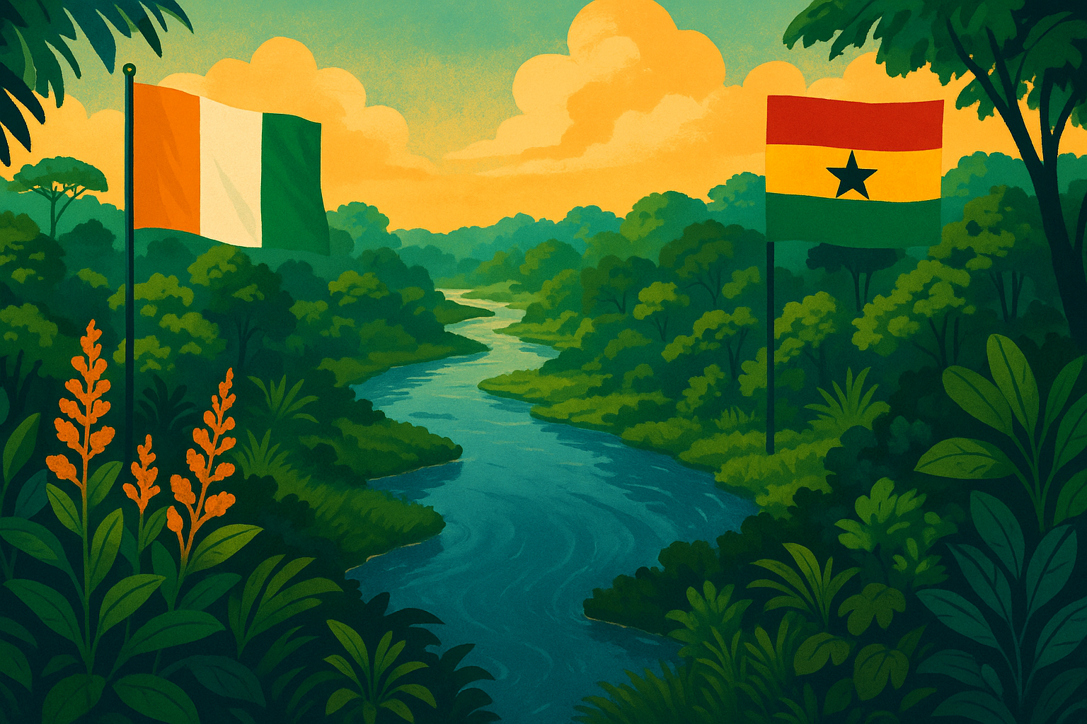
The Tano River, a significant waterway in West Africa, has played a pivotal and evolving role in defining the relationship between Ghana and Ivory Coast. From its origins as a cultural and economic artery for pre-colonial Akan polities, the river was transformed into a precisely delineated international boundary under European colonial rule. This report examines the historical trajectory of this natural border, highlighting the distinct imperial strategies of Britain and France, the instrumental role of explorers like Marcel Treich-Laplène, and the enduring geopolitical, socio-economic, and environmental implications of this imposed division. The analysis reveals that the border, far from being a static line, is a dynamic space shaped by historical legacies, resource discoveries, and the imperative for contemporary transboundary cooperation. The Tano River, once a symbol of colonial partition, is increasingly becoming a focal point for shared challenges and collaborative governance between the two sovereign nations.
1. Introduction: The Tano River as a Geopolitical Nexus
1.1 Geographical Characteristics and Significance of the Tano River
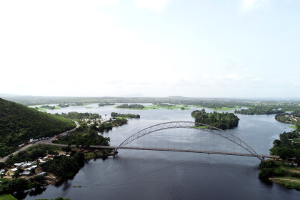
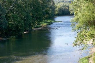
The Tano River, also identified as Tanoé, is a crucial hydrological feature in West Africa, originating near Techiman in western Ghana and extending approximately 400 kilometers (250 miles) southward to discharge into the Gulf of Guinea via the Aby Lagoon in Côte d’Ivoire. A distinctive characteristic of this river is that its lower course serves as a substantial segment of the international boundary separating Ghana and Côte d’Ivoire.
The Tano River basin is geographically expansive, encompassing an estimated area of 16,060 square kilometers. A significant majority of this basin, approximately 92.6% (14,875 km²), lies within Ghana, with a smaller portion, 7.4% (1,185 km²), extending into Côte d’Ivoire. This uneven distribution of the basin’s territory has fundamental implications for shared resource management and bilateral relations. The basin is recognized for its ecological and economic vitality, supporting millions of people through diverse activities such as agriculture, forestry, mining (including gold and bauxite), tourism, and fisheries. It provides essential ecosystem services, including water supply, biodiversity, and climate regulation for the region. The river’s navigability from its mouth extends for about 60 miles (95 km) to Tanoso, where further upstream travel is impeded by the Sutre Falls.
The designation of the Tano River’s lower course as an international boundary, rather than its entire length or the natural boundaries of its basin, suggests a deliberate colonial decision. Had the river been an organic, pre-existing border, one might anticipate a more balanced distribution of its basin across the two territories, or a closer alignment with established ethno-linguistic divisions. This selective application of a natural feature for demarcation underscores that the border was not a discovery but an imposition, driven by external political and strategic considerations of the colonial powers, rather than by existing indigenous territorial arrangements. This top-down imposition, which often disregarded pre-existing local social, economic, and political realities, laid the groundwork for long-term challenges in managing these inherited, often arbitrary, lines in the post-independence era.
1.2 Overview of Ghana-Ivory Coast Relations and the Border Context
The Ghana–Ivory Coast border spans 720 kilometers (447 miles), extending from the tripoint with Burkina Faso in the north to the Atlantic Ocean in the south. The Tano River’s contribution to this boundary is primarily in its lower reaches, where it flows into the Aby Lagoon and then along the southern shore of the adjoining Lake Tendo before reaching the Atlantic coast.
The relationship between Ghana and Ivory Coast has historically been characterized by periods of both cooperation and significant tension, particularly concerning border issues and the management of shared resources. The Tano River, as a shared geographical feature that physically divides the two nations along a segment of their border , has become a focal point for various bilateral issues. This includes disputes over maritime oil fields in the “Deepwater Tano Block” and contemporary concerns regarding river pollution stemming from illegal mining, known as “galamsey,” which affects both countries. Conversely, the river also serves as a catalyst for cooperation, evidenced by joint discussions on water resource management. This demonstrates that the Tano River, far from being a mere line, embodies the broader, often complex, and interdependent relationship between Ghana and Ivory Coast, reflecting both their shared challenges and their potential for collaboration. The physical existence of the Tano River as a shared border and resource directly leads to a range of shared challenges, including environmental degradation and resource competition. These challenges, in turn, necessitate bilateral diplomatic engagement and cooperation, illustrating how a geographical feature can become a central element in international relations. The colonial decision to use the river as a border, rather than a shared internal artery, laid the foundation for these specific post-independence issues.
2. Pre-Colonial Dynamics: Indigenous Societies and Territorial Fluidity
2.1 Major Akan Kingdoms and Their Influence in the Tano Basin
The pre-colonial landscape of the Tano River region was characterized by the vibrant presence and influence of various Akan kingdoms. The Akan people, a prominent Kwa ethno-linguistic group, are indigenous to present-day Ghana and parts of Ivory Coast and Togo, with their languages belonging to the Central Tano branch, signifying a deep historical and cultural interconnectedness across the modern border.
During the late 17th century, the powerful Asante Empire expanded its domain, prompting significant migrations of Akan peoples into the forest regions that now comprise Côte d’Ivoire. The Abron kingdom of Gyaman, a formidable state in the Ivorian forest, fell under Asante suzerainty in the 1730s and remained subject to it until 1875, illustrating the fluidity of pre-colonial territorial control across what would later become an international boundary. Similarly, the Anyi kingdoms of Indénié (Ndenye) and Sanwi emerged under comparable circumstances. A succession struggle in Kumasi, the Asante capital, in 1750 led Queen Abla Poku and her followers to migrate into north-central Côte d’Ivoire, where they established the Baule kingdom, a notable blend of Akan and local traditions.
Historically, the Aowin polity controlled territory west of the Bia River, extending across the Tano and Bia rivers into parts of Ivory Coast and south towards Nzema. The Kingdom of Sefwi, a confederation formed by migrant Akan groups in the 17th century, settled in lands previously held by the Aowin. Sefwi Wiawso, a component of this kingdom, allied with the rising Asante Empire and was granted control over Aowin territories west of the Tano River around 1715, further demonstrating the interconnectedness of these polities. The Tano Basin itself was a cradle for early Akan settlements, including Bono Manso and Begho, which developed into significant centers of trade and state formation between the 11th and 13th centuries. The Akan goldfields, particularly those encompassing Bono, were among the three principal gold-producing regions in West Africa.
The extensive presence and migrations of various Akan groups—including Asante, Abron, Anyi, Baoulé, Aowin, Sefwi, and Nzema—across the modern Ghana-Ivory Coast divide, with their political and economic spheres of influence often encompassing areas on both sides of the Tano River, strongly indicate that the river was not a rigid boundary in pre-colonial times. Instead, it functioned as a vital artery for movement, trade, and cultural diffusion. The shared linguistic heritage and the Tano Basin’s role as a core area for early Akan state formation reinforce this perspective. This historical reality reveals that the colonial imposition of a fixed border along the Tano River fundamentally disrupted established patterns of human interaction, trade networks, and political organization. It artificially severed communities and economic systems that had historically viewed the river as a shared resource and a pathway, rather than a barrier, laying the groundwork for future challenges in cross-border relations and community integration.
2.2 Traditional Perceptions and Uses of the Tano River by Local Communities
The Tano River holds profound spiritual and cultural significance for the Akan people. For instance, the Bono people traditionally believe that Taakora, regarded as the highest of their gods on Earth, resides at the river’s source. Ta Kora (Tano Kora/Akora), also known as Tando to the Fante, is revered as the Abosom (deity) of war and strife in Akan mythology and of Thunder and Lightning in Asante and Agni mythology. This deity is directly associated with and represented by the Tano River and a specific rock promontory, and is considered the supreme deity among the Obosom. The Atano (Water/Tano-Abosom) are believed to ‘descend’ from Ta Kora and the Tano River.
Beyond its spiritual role, the Tano is a vital river deity associated with water, rain, storms, justice, and fairness. It is crucial to the Akan people as a fundamental source of water, food, and life. Indigenous knowledge systems have historically guided the sustainable use and management of natural resources, including rivers, through established rules and belief systems. In the upper Tano River basin, deities were symbolically positioned along the river, and their oversight, managed by sub-chiefs, regulated its use, including taboos against certain activities like fishing in sacred areas.
Pre-colonial African societies, particularly the Akan, viewed the Tano River not merely as a geographical feature but as a sacred, living entity, a spiritual guardian, and a life-sustaining resource. Their resource management practices were deeply intertwined with these spiritual beliefs and governed by traditional laws and taboos. This contrasts sharply with the colonial powers’ primary perception of rivers as strategic lines for political demarcation, navigational routes for trade, and sites for resource extraction. This fundamental divergence in worldview meant that when colonial borders were drawn, indigenous spiritual connections, traditional land use patterns, and holistic resource management systems were largely disregarded or overridden. This clash of worldviews has had profound and lasting consequences. The imposition of a utilitarian, politically defined border over a sacred, communally managed river likely contributed to the erosion of traditional governance structures and sustainable practices. This historical disregard for indigenous relationships with the land and water can be seen as a root cause for contemporary environmental challenges, such as the widespread illegal mining (galamsey) that now severely pollutes the Tano River , as the sacredness of the river was undermined by external forces.
3. The Colonial Scramble and West African Partition
3.1 British and French Imperial Strategies in West Africa
European engagement with West Africa’s coast dates back to the 15th century, initially driven by trade in commodities such as gold, slaves, ivory, and pepper. The pursuit of gold was a primary catalyst for expanding European interest in the region. By the 19th century, Britain had emerged as the dominant European power on the Gold Coast, consolidating control over rival trading posts and formally establishing the Gold Coast colony in 1867. Their rule gradually extended inland, often encountering determined resistance from powerful indigenous kingdoms like the Asante.
The French, despite earlier coastal contacts, intensified their colonial project later in the 19th century, primarily focusing on the Senegal River area and its hinterland. Their expansion into the interior, spearheaded by military figures like General Louis Faidherbe, was characterized by the strategic signing of treaties with African leaders from a position of “superior firepower” to annex vast territories. By the early years of the 20th century, France had largely consolidated its colonial holdings in West Africa, which included the territory that would become Ivory Coast.
While both Britain and France were driven by similar imperial ambitions—resource extraction, trade control, and territorial expansion—their methods of colonial penetration and administration differed significantly. The British on the Gold Coast often reacted to local dynamics, such as the Asante wars and the need to protect coastal allies, and gradually extended their influence, often through indirect rule. The French, conversely, pursued a more direct, military-led expansion from a fixed base in Senegal, relying on superior firepower to impose treaties and establish control. This distinction in approach meant that their respective claims and subsequent negotiations over shared borders, including the Tano River, were shaped by different internal rationales and priorities, rather than a unified understanding of the local landscape or existing African polities. These contrasting imperial philosophies created distinct administrative and legal legacies on either side of the eventual border. The arbitrary nature of the borders, born from European power dynamics and competition rather than indigenous realities, meant that the resulting divisions were often ill-suited to the local context. This fundamental incompatibility between imposed colonial structures and pre-existing African societies would contribute to persistent challenges in governance, economic development, and cross-border relations in the post-independence era.
3.2 Contrasting Colonial Administrations: Gold Coast (British) vs. Côte d’Ivoire (French)
A key distinction in administrative approach was the British preference for utilizing local power holders, often referred to as indirect rule, in contrast to the French system, which largely bypassed traditional authorities. Instead, French territories were divided into administrative units (cercles) managed by French officials. French colonial administration was notably harsh, characterized by the implementation of forced labor (corvée) and imprisonment (indigenat) as means to maintain control and extract resources. Furthermore, French colonies were explicitly mandated to be financially self-sufficient, a policy that often led to severe exploitation. This suggests that enforcement was often brutal and resource-driven, rather than based on local consent or cooperation.
The legal systems established by the colonial powers left an enduring mark: Ghana (Gold Coast) adopted a common law system, while Ivory Coast (French Côte d’Ivoire) inherited a civil law system, directly reflecting their respective colonial masters. High settler mortality rates in both colonies are cited as indicators of the establishment of extractive institutions by the colonial powers, which are associated with “long-term pernicious effects” on development.
The physical line of the Tano River border was reinforced by a deeper, less visible, but equally impactful division: the contrasting administrative and legal systems imposed by Britain and France. Communities geographically close but on opposite sides of the Tano River developed under fundamentally different governance structures, legal frameworks, and economic imperatives. For example, Ghana’s post-independence economic trajectory, including its autonomous central bank, diverged significantly from Ivory Coast’s, which was tied to the CFA franc zone. This indicates that the border was not merely a territorial line but a demarcation of distinct institutional environments. These divergent colonial legacies continue to influence the national development paths, economic policies, and even the social fabric of Ghana and Ivory Coast. The differing regulatory environments and economic incentives created by these distinct colonial histories contribute to phenomena like informal cross-border trade , as individuals navigate the opportunities and constraints presented by two different systems. This “invisible” border thus perpetuates distinct challenges and opportunities for integration and cooperation in the post-colonial era.
4. Marcel Treich-Laplène: Pioneer of French Expansion and Border Precursors
4.1 Treich-Laplène’s Explorations and Treaty-Making in the Ivorian Interior
Marcel Treich-Laplène (1860-1890) is historically recognized as the “first European explorer of Côte d’Ivoire and its first colonial administrator”. His expeditions into the Ivorian interior, undertaken between 1887 and 1889 at the behest of private French merchant Arthur Verdier, were instrumental in securing numerous treaties and establishing French “protectorate” relationships with various indigenous groups. A significant outcome of his efforts was the signing of a Protectorate treaty with the Abron king of Bondoukou on November 13, 1888, marking a formal extension of French influence. France subsequently appointed him titular governor of the territory. However, his direct governance was short-lived, as Ivory Coast was formally declared a French colony in 1893, with Captain Binger assuming the governorship.
Treich-Laplène’s explorations and treaty-making were not simply acts of geographical discovery; they were strategic maneuvers within the broader context of the “Scramble for Africa”. By securing treaties and establishing “protectorate” relationships , he was actively laying the groundwork for French territorial claims. His rapid appointment as “titular governor” and the subsequent formalization of Ivory Coast as a French colony in 1893 underscore the direct link between his “explorations” and the political annexation of territory. His work served to legitimize, from a European perspective, French claims against rival European powers, particularly Britain. Treich-Laplène’s proactive treaty-making and exploration directly strengthened France’s bargaining position in subsequent Anglo-French border negotiations. His efforts provided the legal and territorial basis for French claims, thereby directly influencing where the eventual border, including the Tano River section, would be drawn, often disregarding existing indigenous polities and their fluid boundaries.
4.2 Early Anglo-French Engagements and the Emergence of Boundary Concepts
The late 19th century witnessed an acceleration of the “European rush to divide Africa,” intensifying the competition for territorial control. Throughout the 19th century, British and French imperial expansion in West Africa proceeded “hand-in-hand,” with both powers actively making contacts and solidifying their interests across the interior.
The emphasis on the “European rush to divide Africa” and the “hand-in-hand” progression of British and French imperialism highlights that the primary driver for border creation was the need for European powers to delineate their respective spheres of influence. This was done to prevent direct conflict between themselves and to formalize their claims on paper for international recognition. The borders were thus products of European diplomatic negotiations and power dynamics, rather than emerging from a deep understanding or respect for existing African political, social, or economic realities. Treich-Laplène’s work, while crucial for French claims, was ultimately a piece in this larger European geopolitical puzzle. This top-down, externally driven imposition of borders meant that the resulting lines, including the Tano River section, were often arbitrary and artificial. They frequently cut through established trade routes, bisected ethnic groups like the Akan, and ignored traditional territorial claims. This fundamental disjunction between the imposed colonial order and pre-existing African realities created inherent instabilities that would manifest as challenges in border management and regional integration for decades, even after independence.
5. Formalizing the Divide: Treaties and Demarcation of the Tano River Border
5.1 Key Anglo-French Agreements Defining the Border
The formal delimitation of the border between British and French territories commenced with an agreement on August 10, 1889, extending as far north as the 9th parallel north. This was followed by a treaty on June 26, 1891, which confirmed the existing border and stipulated that the Black Volta River would constitute the boundary in the far northern section. A more detailed boundary agreement, specifically covering the Atlantic-9th parallel section, was concluded on July 12, 1893. The northern Black Volta section was re-confirmed through an agreement on June 14, 1898. This 1898 convention further extended the boundary northward along the thalweg (deepest channel) of the Black Volta from the 9th to the 11th parallel. The border underwent more detailed demarcation on February 1, 1903, involving the physical placement of beacons and pillars on the ground. This demarcated border was formally approved by both governments in May 1905. Additional demarcation work was carried out in 1924.
The process of defining the Ghana-Ivory Coast border was not a singular event but a series of progressive agreements spanning decades (1889, 1891, 1893, 1898, 1903, 1905, 1924). This iterative approach, moving from broad delimitations to more detailed demarcations, reflects the evolving understanding of the terrain, the shifting priorities of the colonial powers, and the increasing need for precision as their administrative control deepened and resource interests became more defined. It was a continuous process of imposition and refinement rather than a one-time act of drawing a line. This incremental process underscores the inherent artificiality and ongoing negotiability of colonial borders. They were not “natural” lines discovered but rather political constructs that required repeated formalization and physical marking. This lack of organic development contributes to the fragility and potential for disputes even in the post-colonial era, as the lines were externally imposed rather than internally derived from local socio-political structures.
5.2 The Tano River’s Specific Role in the Delimitation Process
Within the overall Ghana-Ivory Coast border, the Tano River plays a specific role in its lower course. The border follows a broad arc of overland lines and streams before converging with the Tano River. It then tracks the Tano as it flows southwestward into the Aby Lagoon, and subsequently along the southern shore of the adjoining Lake Tendo, before veering south overland to the Atlantic coast. A notable detail in the delimitation is the evolution of how the river itself was defined as a boundary. The 1893 arrangement initially stipulated the French frontier following the
right bank of the Tanoe or Tendo River for a certain distance, while the British frontier followed the left bank. However, later agreements, particularly the 1903 demarcation, explicitly indicated the “thalweg” (the line of deepest flow) of the Tano as the boundary.
The shift from defining the border along the banks of the Tano River (1893 arrangement) to specifying the thalweg (deepest channel) as the boundary (1903 agreement) represents a significant legal and practical development in international boundary law. Defining the thalweg is a more sophisticated and internationally recognized method for riverine boundaries, as it implies a shared use and ownership of the river’s main channel, rather than granting one state exclusive control over the riverbed up to the opposite bank. This change suggests a move towards a more precise and potentially more equitable, from a legal standpoint, division of the river itself. This seemingly technical detail has profound implications for resource rights, navigation, and environmental management. By establishing the thalweg as the boundary, both states implicitly share the river’s main channel and its resources. This legal precedent sets the stage for future cooperation or disputes over water use, fishing rights, and pollution control, as seen in contemporary issues where the Tano River’s water quality is a shared concern. It highlights how specific legal definitions of natural features become critical in shaping post-colonial interstate relations.
Table 1: Key Anglo-French Border Delimitation Agreements (1889-1903)
| Date of Agreement | Parties Involved | Key Outcome/Provision | Specific Mention/Role of Tano River | Relevant Source(s) |
| August 10, 1889 | British & French | Initial border delimitation as far north as 9th parallel north. | Not explicitly detailed for Tano, but part of overall Atlantic-9th parallel section. | |
| June 26, 1891 | British & French | Confirmed existing border; Black Volta designated as border in far north. | Not explicitly detailed for Tano. | |
| July 12, 1893 | British & French | More detailed boundary agreement for Atlantic-9th parallel section. | French frontier followed right bank, British frontier followed left bank of Tanoe or Tendo River for 5 miles above Nougoua. | |
| June 14, 1898 | British & French | Re-confirmed northern Black Volta section; extended boundary to 11th parallel. | Not explicitly detailed for Tano. | |
| February 1, 1903 | British & French | Detailed demarcation with beacons and pillars on the ground. | Thalweg (deepest channel) of the Tano indicated as the boundary. | |
| May 1905 | British & French | Formal approval of the 1903 demarcated border by both governments. | Formalizes the Tano River’s thalweg as part of the approved boundary. |
5.3 Challenges in Colonial Border Enforcement and Administration
The establishment of colonial control and border enforcement in West Africa was not seamless. French expansion, for instance, encountered “strong and sustained resistance” from various African powers, including the Toucouleur Empire and Samori Touré, indicating significant challenges in fully imposing their authority even after signing treaties. The French administrative approach was characterized by its harshness, employing coercive measures such as forced labor (corvée) and imprisonment (indigenat) to maintain control and maximize resource extraction. Furthermore, colonies were expected to be financially self-sufficient, a policy that often led to exploitation. This suggests that enforcement was often brutal and resource-driven, rather than based on local consent or cooperation.
Despite formal border agreements and administrative structures, the reality on the ground was often different. The “ease with which informal operators can ship goods across borders” and the existence of “divergent economic policies” between neighboring colonial territories led to “widespread smuggling”. This demonstrates that economic realities and pre-existing networks often undermined colonial attempts at rigid border control. While colonial powers formally demarcated borders with treaties and physical markers , these borders were never truly impermeable or fully enforceable. African resistance demonstrates that local populations did not passively accept these divisions. More subtly, the persistence of “informal cross-border trade” driven by “divergent economic policies” indicates that economic forces and pre-existing social networks often transcended the imposed lines. This suggests that the colonial border, while legally defining sovereign territories, did not entirely erase or prevent the continuation of cross-border interactions. This historical permeability has significant implications for understanding the post-colonial landscape. It highlights that the border, despite its legal formality, has always been a dynamic space where local agency and economic realities interact with state control. This historical pattern of informal cross-border activity continues to shape contemporary livelihoods and poses challenges for formal governance, revenue collection, and regional economic integration in Ghana and Ivory Coast, as formal trade mechanisms struggle to compete with established informal networks.
6. Post-Independence: The Enduring Legacy of a Colonial Border
6.1 Transition to Sovereign States and the Inherited Frontier
The Gold Coast achieved full independence from Britain, becoming Ghana, in 1957, marking a pivotal moment as the first sub-Saharan African country to gain independence. Three years later, France granted independence to Ivory Coast in 1960. With independence, the mutual frontier that had been meticulously defined by Anglo-French colonial agreements automatically transformed into an international border between two sovereign states.
The transition was not without challenges; historical accounts indicate that “colonial boundary issues worsened under Kwame Nkrumah, Ghana’s first president,” necessitating the establishment of a boundary re-demarcation commission to address emerging disputes. Despite this, border issues persisted, leading to the creation of another such commission in 1968. The newly independent nations of Ghana and Ivory Coast inherited borders that were drawn by external colonial powers primarily for their own strategic and economic interests, often with little regard for pre-existing local realities or ethnic distributions. This meant that the very lines delineating their newfound sovereignty were artificial constructs, leading to immediate and “worsened” boundary issues under Ghana’s first president. The necessity of establishing re-demarcation commissions so soon after independence strongly indicates that the colonial “formalization” was either incomplete, problematic, or simply not accepted as legitimate by the new African states. This inherited artificiality established a precedent for ongoing border disputes and complex management challenges in the post-colonial era. It diverted valuable resources and diplomatic efforts that could have been channeled into national development. Furthermore, it perpetuated the division of historically interconnected communities, forcing them to adapt to an externally imposed political reality that often ran counter to their traditional patterns of interaction and resource use.
6.2 Evolution of Ghana-Ivory Coast Relations and Border Management Post-1960
The 20th century saw a fluctuating relationship between Ghana and Ivory Coast, marked by periods of both cooperation and tension. In the early 1980s, relations deteriorated when Ghana accused Ivory Coast of harboring Ghanaian dissidents and political agitators. While relations improved after 1988, they were severely strained again in late 1993 and early 1994 due to incidents that led to the evacuation of over 10,000 Ghanaians from Ivory Coast.
A significant shift in border dynamics occurred in 2010 when Ivory Coast petitioned the United Nations to complete the demarcation of its maritime boundary with Ghana, following the discovery of oil in the Deepwater Tano Block. Ghana responded by establishing its own Boundary Commission. This maritime dispute escalated, leading Ghana to initiate arbitral proceedings against Ivory Coast under the United Nations Convention on the Law of the Sea (UNCLOS) in 2014. The International Tribunal for the Law of the Sea (ITLOS) ultimately ruled in Ghana’s favor in 2017, affirming Ghana’s maritime boundary and concluding that Ghana had not violated Ivory Coast’s rights. The ruling established a “strict equidistance line” as the boundary. Looking forward, Ghana and Côte d’Ivoire are committed to finalizing their land boundary reaffirmation by 2025, a process influenced by the ITLOS maritime boundary decision, with plans for joint maritime patrols and continued land demarcation efforts.
While initial post-independence border challenges focused on the inherited land boundaries , the discovery of substantial hydrocarbon reserves in the Gulf of Guinea, specifically in the Deepwater Tano Block , fundamentally altered the nature and intensity of border disputes. This resource-driven interest directly led to the highly contentious maritime boundary dispute, necessitating formal international arbitration through ITLOS. This demonstrates a clear causal link between new economic opportunities and the re-emergence and redefinition of border-related tensions. The discovery of valuable offshore oil and gas reserves directly triggered heightened competition and legal disputes over maritime boundaries. This, in turn, necessitated the involvement of international legal bodies like ITLOS to resolve the conflict, illustrating how significant economic interests can transform dormant or less pressing border issues into high-stakes international legal battles. This also highlights how the colonial legacy of loosely defined maritime claims, in contrast to the more detailed land borders, became a flashpoint in the modern era of resource exploration.
7. Contemporary Dynamics: Shared Resources, Challenges, and Cooperation
7.1 Socio-Economic Activities and Livelihoods in the Border Region
The Tano Basin is a vibrant economic hub, supporting a diverse range of socio-economic activities. Agriculture is the predominant occupation, engaging over 27% of the population (rising to 47% in rural areas), with cocoa being the primary cash crop. Other significant agricultural products include oil palm, rubber, coffee, copra, plantain, cassava, and coconut. The region is rich in mineral resources, particularly gold, which is extensively mined. Oil and gas exploration in the lower Tano Basin, commencing in 2012, further contributes to the national economies and offers potential for regional industrial growth. Forestry, including logging and timber processing, is also a major industry, supplemented by non-timber forest products. Urban centers within the basin, such as Techiman and Sunyani, serve as significant attraction hubs for internal migrants seeking economic opportunities and development.
Elubo, a Ghanaian town situated near the border, exemplifies the economic activities sustained by the frontier. Its economy is largely based on agriculture, trade, and commerce, with many residents relying on the traffic generated by the border crossing for their livelihoods. Informal cross-border trade (ICBT) is a pervasive and significant economic activity between Ghana and Ivory Coast. It thrives due to divergent economic policies between the neighboring countries and the relative ease of movement of goods and people across the border, despite formal regulations. The volumes of ICBT underscore its importance to the regional economy.
While the Tano River border is a formally demarcated international boundary, the evidence reveals a vibrant, often informal, economic interdependence between communities on both sides. The existence of significant informal cross-border trade, driven by differing national economic policies , suggests that the border, rather than being a strict barrier, also creates unique economic opportunities and serves as a conduit for goods and people. This indicates that local populations have adapted to and leveraged the imposed political division to maintain historical economic and social connections. This dynamic highlights the resilience and adaptability of local communities in the face of artificial political divisions. However, it also presents challenges for formal governance, economic planning, and revenue collection, as a substantial portion of economic activity operates outside official channels. It underscores the need for policies that acknowledge and integrate informal economies into broader regional development strategies, rather than simply suppressing them, to maximize mutual benefit and formalize cross-border cooperation.
Table 2: Socio-Economic Profile of the Tano Basin Border Region
| Category | Description/Details | Significance/Impact on Border Region | Relevant Source(s) |
| Demographics | Estimated population: 1,969,825 (2021 Census). 54% urban, 46% rural. Average density: 130 persons/km², aligning with national average. | Supports millions of livelihoods, contributes to regional population dynamics, internal migration to urban centers like Techiman and Sunyani for economic opportunities. | |
| Primary Economic Sectors | Agriculture (primary occupation for >27% overall, 47% rural); Cocoa is dominant cash crop (70-100% income for households). Other crops: oil palm, rubber, coffee, copra, plantain, cassava, coconut. | Provides fundamental livelihoods, forms the backbone of the local economy, and is a key driver of land use. | |
| Key Resources & Industries | Mineral resources (gold extensively mined in Kenyase, Bibiani, Sefwi-Surano). Oil & gas exploration (lower Tano Basin since 2012). Logging & timber processing. Non-Timber Forest Products (up to 35% of farmer income). | Drives significant economic activity, contributes to national economies, but also leads to environmental challenges (e.g., illegal mining pollution). Offers potential for regional industrial growth. | |
| Urban Economies | Diversified activities: trading, crafts, machine operation, small-scale industries (carpentry, block making, soap manufacturing, metalwork). Major market towns: Techiman, Sunyani, Goaso, Sefwi Wiawso. | Centers for economic growth and migration, providing diverse employment opportunities beyond agriculture. | |
| Cross-Border Trade | Informal Cross-Border Trade (ICBT) is pervasive due to divergent economic policies and ease of movement. Elubo (Ghana) is a major border crossing, supporting livelihoods through trade and traffic. | Creates an informal economic bridge despite formal divisions, highlights economic interdependence, but also poses challenges for formal governance and revenue collection. | |
| Environmental Challenges | Widespread illegal mining (galamsey) is a significant source of water pollution, rendering the Tano River “useless” for domestic consumption in downstream areas. Sedimentation and habitat degradation. | Shared environmental liability, directly impacting downstream communities (e.g., in Ivory Coast), necessitating transboundary governance and cooperation to address pollution. |
7.2 Environmental Concerns: Pollution and Resource Management in the Tano Basin
A critical environmental challenge in the Tano Basin is the widespread illegal mining, locally known as “galamsey,” which is a significant source of water pollution. The severity of this issue is underscored by the Ivorian government’s “bitter” complaints about the pollution of the Tano River, noting that illegal mining activities have rendered the river “useless” for domestic consumption and severely jeopardized aquatic life within its territory. An incident in January 2020, where a truck carrying sulfuric acid plunged into the Tano River, led to public health warnings about water contamination, highlighting the vulnerability of the river to industrial accidents.
Recognizing the transboundary nature of these issues, Ghana and Côte d’Ivoire have engaged in high-level discussions focused on water resources and the urgent need to address pollution in shared rivers like the Bia and Tano. Ghana has initiated efforts, including forming a task force, to tackle the challenges facing its water bodies. It is important to note that the Tano River basin is predominantly within Ghana (93%), with only 7% in Ivory Coast, meaning pollution originating upstream in Ghana directly impacts downstream Ivorian communities.
Despite the Tano River serving as an international border, it functions as a single, interconnected hydrological system. Pollution from illegal mining activities, predominantly occurring in the larger Ghanaian portion of the basin , directly flows downstream, severely impacting Ivorian communities and their access to clean water. This demonstrates that environmental problems inherently transcend political boundaries. The explicit complaints from Ivory Coast and the subsequent joint discussions on water resource preservation signify a critical recognition by both nations that unilateral national action is insufficient to address these shared ecological threats. Upstream human activities, particularly illegal mining (galamsey) in Ghana, lead to severe water pollution that crosses the international border, directly impacting downstream communities and ecosystems in Ivory Coast. This shared environmental degradation necessitates and drives bilateral cooperation and shared responsibility for effective environmental management, forcing the nations to collaborate on issues that transcend their inherited political divisions.
7.3 Cross-Border Trade, Migration, and Cooperation Initiatives
In the decades following independence, Ghana and Ivory Coast undertook joint re-demarcation efforts on their shared land border in the late 1960s and early 1970s, indicating early recognition of the need for collaborative border management. More recently, following the ITLOS ruling on their maritime boundary dispute, both countries are committed to finalizing their land boundary reaffirmation by 2025, with plans for joint maritime patrols and continued land demarcation. High-level meetings have specifically focused on transboundary water systems, with both nations expressing a strong desire to protect shared resources like the Tano River from pollution. The observance of “Africa Border Day,” promoted by the African Union, underscores a broader continental initiative to recognize the significance of international borders while fostering regional integration and unity.
While informal cross-border trade (ICBT) faces challenges such as border delays and harassment from customs officials, there is optimism that initiatives like the African Continental Free Trade Area (AfCFTA) can facilitate formal trade and minimize illegal cross-border movements, thereby improving livelihoods. Challenges to effective cross-border cooperation include broader regional issues such as security threats (e.g., terrorism), political instability, and economic crises. However, these challenges also present opportunities for the mutualization of basic services, more efficient exploitation of common resources, and enhanced peacebuilding efforts within border regions.
Historically, the Tano River border was imposed as a clear division by colonial powers. However, contemporary challenges—ranging from environmental degradation and resource management to economic development and regional security —are increasingly compelling Ghana and Ivory Coast to view this border not merely as a dividing line but as a shared zone requiring active cooperation. The ongoing joint re-demarcation efforts , bilateral discussions on shared water resources , and the aspirations for facilitated trade under AfCFTA all indicate a pragmatic shift towards collaborative governance of the border region for mutual benefit. This evolving paradigm reflects a growing maturity in post-colonial statecraft, where the artificiality of inherited borders is acknowledged, and efforts are made to transcend these divisions through practical collaboration and regional integration. The Tano River, once a stark symbol of division, is now becoming a focal point for a more cooperative and integrated future between Ghana and Ivory Coast, demonstrating that shared challenges can drive deeper bilateral engagement.
8. Conclusion: A Historical Border’s Present and Future
The Tano River’s history as a border between Ghana and Ivory Coast is a compelling narrative of transformation. It evolved from a vital artery connecting pre-colonial Akan polities, facilitating movement, trade, and cultural exchange, into a precisely defined international boundary imposed by European colonial powers. This demarcation, primarily driven by external geopolitical interests and divergent administrative philosophies of Britain and France, fundamentally reshaped the region’s human and physical geography.
The legacy of this colonial imposition is profound and enduring. The artificiality of the border, which often bisected ethnic groups and disregarded traditional land-use patterns, led to immediate post-independence challenges in boundary management and continues to influence the geopolitical, socio-economic, and environmental dynamics of the border region. The differing institutional frameworks inherited from colonial rule have created distinct national trajectories, contributing to both opportunities and complexities in cross-border interactions, including the prevalence of informal trade.
However, the contemporary relationship between Ghana and Ivory Coast, particularly concerning the Tano River, demonstrates an evolving paradigm. Shared challenges, notably environmental degradation from illegal mining and the imperative of managing transboundary water resources, are increasingly compelling both nations to move beyond simply managing a dividing line. The discovery of offshore hydrocarbon reserves further underscored the need for precise boundary definitions and led to significant international legal arbitration, highlighting how resource interests can redefine border-related tensions.
The ongoing joint initiatives, such as land boundary reaffirmation and discussions on water resource preservation, signal a pragmatic shift towards active cooperation and regional integration. The Tano River, once a stark symbol of colonial division, is now emerging as a crucial focal point for a more collaborative and interdependent future between Ghana and Ghana and Ivory Coast. This path of shared responsibility and mutual benefit represents a mature approach to navigating the complex legacies of history and building a more integrated future in West Africa.