


I. Introduction to the Tano River Glossary
This document presents a comprehensive glossary of scientific terms essential for understanding the Tano River, its vast basin, and the intricate ecosystems it supports. The primary objective is to provide precise, scientifically accurate definitions, enriched with specific contextual information and empirical data pertaining to the Tano River Basin, which spans both Ghana and Côte d’Ivoire. The scope of this glossary is broad, encompassing critical aspects of hydrology, geomorphology, basin characteristics, the diverse fauna and flora, complex ecological processes, and the environmental challenges, alongside ongoing conservation initiatives.
To facilitate ease of navigation and comprehension, terms are systematically organized into thematic sections. Each entry is structured to present a concise scientific definition, followed by detailed elaboration that integrates specific examples or observed data points directly from the Tano River Basin, with appropriate citation of the source material. This methodical approach ensures that the glossary serves as both a general scientific reference and a highly localized resource, highlighting the unique attributes of the Tano River system.
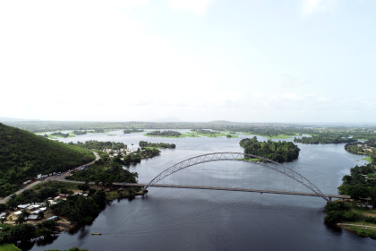
The Tano River itself is a significant transboundary river system. It originates in Ghana and flows approximately 400 kilometers southwestward, eventually discharging into the complex Aby Lagoon system, which is shared with Côte d’Ivoire. The total catchment area of the Tano Basin is estimated to be between 15,000 and 16,060 square kilometers, with the vast majority (approximately 93%) situated within Ghana and the remaining 7.4% extending into Côte d’Ivoire. This basin is not merely a geographical feature; it represents an ecologically and economically vital region. It sustains millions of people through a diverse array of activities, including agriculture, forestry, mining, tourism, and fisheries. Beyond its economic contributions, the basin’s rich terrestrial and aquatic ecosystems provide indispensable services, such as a consistent water supply, maintenance of biodiversity, and crucial climate regulation. Furthermore, the Tano River holds profound cultural and spiritual significance for local communities, particularly the Akan and Ashanti people, who revere it as a sacred entity intrinsically linked to fertility, agricultural prosperity, and the sustenance of life itself.
II. River Hydrology and Geomorphology Terms
This section delineates terms fundamental to understanding the physical properties of water movement within the Tano River system, alongside the processes that shape its channels and associated landforms.
Acre-foot (af): A volumetric unit representing the quantity of water required to cover one acre of land to a depth of one foot. This is equivalent to 43,560 cubic feet, 1,233.5 cubic meters, or approximately 325,851 gallons. This standard unit is crucial for quantifying large volumes of water, making it highly relevant for comprehensive water resource management and planning within the Tano Basin.
Alluvium: A geological term referring to detrital deposits, typically composed of clay, gravel, silt, and sand, that are transported and subsequently laid down by flowing water. These deposits commonly accumulate on riverbeds, floodplains, and alluvial fans, particularly during periods of high flow or flood events. In the Tano Basin, geological records indicate significant deposition from ancient fluvial and lacustrine environments during the Cretaceous era, which resulted in the formation of thick clastic sequences that underpin much of the current landscape.
Bank-full Discharge: The specific stream discharge at which the water level first reaches the top of the natural banks of a river channel, just before spilling onto the floodplain. This hydrological event typically occurs, on average, once every 1 to 2 years and is recognized as the flow condition responsible for the most significant sediment transport over time within a river system. For rivers like the Tano, bankfull events are instrumental in maintaining high-quality aquatic habitats by facilitating the scouring of fine sediments from deeper pools and the deposition of coarser bedload materials in shallower riffle areas.
Braided Channel: A type of river channel characterized by a network of multiple, interweaving, and often shallow channels that successively diverge and converge. This morphology commonly develops in river systems where the sediment load carried by the stream is too large to be efficiently transported by a single, stable channel. While specific instances of braided channels within the Tano River are not detailed, understanding this geomorphological feature is vital for analyzing river morphology, particularly in regions experiencing high sediment loads, which can be a concern in the Tano due to human-induced erosion.
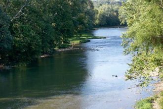
Channel: An open conduit that conveys water, which can be either naturally formed or artificially constructed. In the context of a river, it refers to the distinct route or course through which the water flows, bounded by its bed (bottom) and banks (sides). The Tano River, serving as the primary watercourse of its basin, extends approximately 400 kilometers in length, forming an extensive and dynamic channel system.
Confluence: The geographical point at which two or more streams or rivers merge or flow together. The Tano River system is characterized by numerous significant tributaries, including the Abu, Amama, Bo, Disue, Soro, Atronie, Sabom, Gaw, Kwasa, Sumre, and Totua, each contributing to the main river’s flow and forming distinct confluences along its course.
Delta: A low-lying, flat landform created at the mouth of a river where its flow slows down significantly as it enters a larger, relatively still body of water, such as a lake, sea, or ocean. This reduction in velocity causes the river to deposit its sediment load, typically sand, silt, and clay, often resulting in the river splitting into multiple distributary channels. The Tano River ultimately discharges into the Aby Lagoon complex, which straddles the border between Ghana and Côte d’Ivoire, forming a complex and ecologically significant deltaic system.
Discharge: The volume of water that flows through a specific cross-section of a river or stream per unit of time. It is a fundamental measure of river flow, commonly expressed in cubic feet per second (cfs) or cubic meters per second (cms). Discharge is a primary variable that dictates the physical form of a stream channel and its capacity to transport sediment. Periods of high discharge, particularly during the rainy seasons in the Tano Basin, play a crucial role in influencing the transport and ultimate fate of pollutants, such as
Escherichia coli pathogens, within the river system.
Drainage Basin (Catchment/Watershed): A geographical area of land from which all surface water runoff, resulting from precipitation or snowmelt, converges and drains into a common outflow point, such as a river, lake, or ocean, via a network of streams and tributaries. The Tano Basin exemplifies a transboundary river basin, shared between Ghana and Côte d’Ivoire, encompassing an approximate total area of 16,060 square kilometers. The basin’s varied topography, ranging from 0 to 700 meters above mean sea level, significantly influences its water flow patterns and overall drainage characteristics.
Erosion: The natural process by which rock, soil, and other Earth materials are worn away, detached, and transported from one location to another. This process is driven by various biological, chemical, or mechanical forces, including the abrasive action of flowing water, the movement of ice, or the force of wind. In the Tano River, sediment transport and erosion constitute significant hydrological processes, which are notably influenced and often exacerbated by human activities such as illegal mining and extensive land use changes. Bank erosion, in particular, poses a concern, especially in river sections downstream of impoundments.
Fluvial Geomorphology: A specialized field within geomorphology that focuses on the study of the development and evolution of landforms within river valleys and channels. It specifically investigates the dynamic interplay between the powerful forces of moving water and the physical characteristics of the materials that constitute the streambed and banks. The Tano Basin’s geological framework, which includes the Birimian system and various sedimentary rock formations, plays a pivotal role in shaping its distinct fluvial geomorphology.
Floodplain: Low-lying, relatively flat land areas that adjoin lakes, wetlands, and rivers, and are naturally susceptible to inundation by water during flood events. These areas are often characterized by the deposition of sediments carried by the floodwaters. The dynamic nature of meanders within the Tano River means they are constantly shifting laterally, and over extended geological periods, this movement contributes to the widening and shaping of the adjacent floodplain.
Gradient (Slope): A measure of the incline or steepness of a stream channel, typically expressed as the rate of vertical drop over a given horizontal distance. The Tano River exhibits considerable topographical variation along its course. Upstream regions are characterized by highlands with average elevations around 540 meters, while the middle sections descend to approximately 200 meters. The southern areas are notably flatter, ranging from 0 to 15 meters, with an average elevation of 50 meters, reflecting a significant change in gradient from source to mouth.
Headwaters: The source area of a river or stream, representing the furthest upstream points from which a river originates. This region is often characterized by the river actively carving a deeper channel through a process known as headward erosion. The Tano River commences its journey from the Boyem Mountain Ranges, situated near Techiman in Ghana, specifically within a forested area in Pooyem. Several designated forest reserves within the basin, including Boin Tano, Tano Suraw, Tano Suhien, and Disue Forest Reserves, are specifically established to protect these critical river headwaters.
Meanders: A series of characteristic looping bends or curves that develop in a stream channel. These sinuous patterns are formed through a continuous process of differential erosion, which is more pronounced on the outer bank (creating a river cliff), and simultaneous deposition of sediment on the inner bank (forming a point bar). The Tano River is described as “meandering elegantly through the lush landscapes of Ghana,” indicating its naturally sinuous and winding course.
Mouth: The terminal point of a river, where its waters discharge into another larger body of water, such as another river, a lake, a sea, or an ocean. The Tano River ultimately flows into the Aby Lagoon complex, which then connects to and discharges into the Atlantic Ocean.
Oxbow Lake: A crescent-shaped or horseshoe-shaped lake that forms when a meander bend in a river is cut off from the main river channel. This separation typically occurs during flood events when the river finds a new, straighter course, leaving the old bend isolated. Given the prominent meanders observed in the Tano River, the potential for oxbow lake formation exists over geological timescales.
Sediment Transport: The dynamic process by which solid particulate material, or sediment, is carried by flowing water. This process encompasses various modes, including bed material load, where heavier sediments roll, bounce, or slide along the streambed, and suspended load, where finer sediments are held aloft and carried within the water column by turbulence. Sediment transport is a critical hydrological process in the Tano River, directly influencing the stability and morphology of its channel. Excessive sediment input, often resulting from soil erosion (e.g., from agricultural lands), can lead to increased deposition within the channel, forming features like riffles, bars, or islands. Conversely, a significant reduction in sediment supply, such as that caused by dams trapping sediment, can lead to downstream channel widening and downcutting. Furthermore, sediment transport plays a role in the distribution and fate of pollutants, including heavy metals like mercury, within the river system.
The interconnectedness of hydrology, geomorphology, and human impact: The physical characteristics of the Tano River, such as its varying topography and sinuous meanders, are profoundly shaped by fundamental hydrological and geomorphological processes, including discharge, sediment transport, erosion, and floodplain dynamics. However, the influence of human activities significantly alters these natural processes. For instance, activities like illegal mining and agriculture introduce excessive sediment into the river, exacerbating erosion. This increased sediment load directly impacts the river’s channel stability, leading to either deposition within the channel or, in cases where upstream dams trap sediment, downstream widening and downcutting. This demonstrates a clear feedback loop: human activities modify the river’s physical structure, which in turn compromises its capacity to support healthy ecosystems and provide essential services to communities.
Transboundary nature as a geomorphological and hydrological challenge: The Tano River’s designation as a transboundary river basin, shared by Ghana and Côte d’Ivoire, inherently links the hydrological and geomorphological processes across international borders. The flow of water and the transport of sediment, for example, do not adhere to political boundaries. Consequently, any geomorphological changes, such as increased erosion or deposition, or hydrological alterations, like shifts in discharge or water quality degradation, originating in one country (e.g., Ghana) will inevitably affect the river’s physical state and water quality in the downstream country (Côte d’Ivoire). This necessitates international cooperation and the implementation of an Integrated Water Resources Management Plan to effectively address shared challenges like pollution and water resource allocation, as the physical dynamics of the river system transcend national jurisdictions.
III. Tano River Basin: Geographical and Geological Terms
This section provides definitions for terms related to the physical landscape, underlying geological formations, and specific characteristics of the Tano River Basin.
Birimian Formation: A significant geological series primarily composed of metamorphosed and folded rocks, including slates, phyllites, greywackes, tuffs, and minor lava flows. These rocks are characterized by strong folding, foliation, and jointing, which are features that facilitate water infiltration and movement of groundwater. Within the Tano Basin, the landscape is extensively underlain by the Birimian system, which accounts for a substantial portion of the basin’s geological composition (31.9% Birimian Sediments and 25.5% Birimian Volcanics). This formation plays a crucial role in shaping the region’s geological structure and significantly influences the occurrence and movement of groundwater.
Cretaceous Era: A major geological period spanning from approximately 145 to 66 million years ago. This era was marked by profound tectonic activity, including extensive continental rifting, and significant depositional processes that shaped Earth’s landforms and sedimentary basins. The formation and lithic fill of the Tano Basin are deeply rooted in the tectonic activities that occurred during the Cretaceous era. Specifically, the continental rifting between the African and South American plates during this period led to the creation of the West African Transform Margin, and the Tano Basin became a focal point for the deposition of fluvial and lacustrine clastic sediments.
Depocenter: A localized area within a sedimentary basin where the maximum thickness of a particular stratigraphic unit or sequence has accumulated. This accumulation is typically driven by sustained subsidence of the Earth’s crust in that area, coupled with continuous sediment deposition. The structural configuration of the Tano Basin, which resulted from ancient rifting events, gave rise to two major depocenters. These areas played a critical role in controlling the accumulation and distribution of the lithic fill (rock layers) within the basin.
Elevation: The vertical distance or height of a geographical location above a fixed reference point, which is conventionally taken as mean sea level. The Tano Basin exhibits a diverse topography with significant variations in elevation. Upstream areas, particularly near the Boyem Mountain Ranges, have average elevations around 540 meters above sea level. The middle sections of the basin gradually drop to approximately 200 meters, while the southern areas are considerably flatter, ranging between 0 and 15 meters, with an average elevation of 50 meters. The overall topography of the entire basin spans a range from 0 to 700 meters above mean sea level.
Geological Formation: A recognizable body of rock that possesses a consistent set of physical characteristics, such as its lithology (rock type), and can be mapped as a distinct unit on the Earth’s surface or in the subsurface. The Tano Basin is underlain by several main geological formations, which dictate its structural and compositional characteristics. These include Granite (Granitoids), constituting 38.1% of the basin; Birimian Sediments, at 31.9%; Birimian Volcanics, at 25.5%; Eocene & Cretaceous Sedimentary Rocks; the Upper Voltaian (Kwahu Group), covering 1.8%; and Tarkwaian Rocks, which are the least dominant at 0.6%.
Granitoids: A broad classification of intrusive igneous rocks, primarily composed of quartz and feldspar, typically characterized by a coarse-grained texture. Within the Tano Basin, Granite (Granitoids) represents the most dominant geological formation, underlying approximately 38.1% of the total basin area.
Hydrocarbon Resources: Naturally occurring organic compounds, primarily composed of hydrogen and carbon atoms, found within geological formations beneath the Earth’s surface. These resources, such as crude oil and natural gas, can be extracted and utilized as fuels. The Tano Basin has been recognized for its significant potential for hydrocarbon resources since as early as 1896, with historical oil seepages attracting early geological exploration efforts. The basin contains crucial source rocks, including Upper Albian, Cenomanian, and Turonian marine shales, and reservoir rocks, primarily Upper Cretaceous sandstones, which have facilitated the generation and accumulation of oil and gas. This geological setting has led to major discoveries, such as the Jubilee and TEN fields.
Tarkwaian Formation: A geological rock formation characterized by slightly metamorphosed and folded rocks that exhibit some open joint systems. These structural features can support limited groundwater storage and facilitate its movement within the rock. Tarkwaian rocks are present within the Tano Basin, although they are less extensive, accounting for only 0.6% of the basin’s geological composition. Despite their limited distribution, they contribute to the overall hydrogeological characteristics of the basin.
Transboundary River Basin: A geographical area drained by a river system where the river and its tributaries cross or form part of the international political boundaries between two or more countries. The Tano Basin is a clear example of a transboundary river basin, as it is shared between Ghana and Côte d’Ivoire. This shared nature underscores the imperative for cooperative management strategies between the two nations.
Unconformity: A break or gap in the geological rock record, signifying a period during which either erosion occurred, removing previously deposited rock layers, or no new sediment deposition took place. Unconformities often indicate significant geological events, such as episodes of tectonic uplift. The stratigraphy of the Tano Basin includes “undifferentiated stratigraphic gaps, as either hiatuses or unconformities.” A notable example is a significant uplift and erosion event that occurred during the middle Albian times, which profoundly influenced the topography of the Tano Basin and played a crucial role in the formation of productive hydrocarbon fields like Jubilee.
Upper Voltaian (Kwahu Group): Identified as the thickest and coarsest geological formation found in the northern part of the Tano Basin. Its specific structure and composition are significant factors influencing the occurrence and availability of groundwater in that particular section of the basin.
West African Transform Margin (WATM): A major hydrocarbon-bearing geological province situated along the coast of West Africa. This margin was formed as a direct result of the Atlantic rift system, which initiated in the Late Jurassic period with the break-up and subsequent drifting apart of the South American and African paleocontinents. The Tano Basin is geographically located within Ghana’s extensive WATM and is predominantly composed of crystalline igneous and metamorphic rocks, making it a key region for ongoing oil and gas exploration.
Geological structure as a determinant of resource potential and environmental vulnerability: The Tano Basin’s underlying geological formations, such as the Birimian system and Granitoids, are intrinsically linked to its rich mineral and hydrocarbon resources. The Birimian system, for instance, is associated with significant gold deposits, while the Cretaceous basin formations are known for their hydrocarbon potential. The very geological characteristics that make the basin resource-rich, such as the folded, foliated, and jointed nature of Birimian rocks, also promote water infiltration and groundwater movement. This dual nature means that the geology not only dictates the availability of groundwater, which is increasingly vital for municipal, agricultural, and industrial water supplies , but also renders these water sources vulnerable to contamination from resource extraction activities, particularly illegal gold mining. This highlights a critical intersection where geological potential drives economic activity, but simultaneously introduces significant environmental risks, complicating the sustainable management of water resources.
Topography and climate’s influence on basin function and human livelihoods: The Tano Basin’s diverse topography, ranging from elevated highlands to flat southern plains, combined with its wet semi-equatorial climate characterized by double rainfall maxima, profoundly shapes its hydrological function. While the double rainfall maxima generally ensure ample water availability, the basin also experiences prolonged dry seasons. This variability in rainfall, coupled with the varied topography, directly influences surface water flow and groundwater recharge. During prolonged dry seasons, farming, which heavily relies on rainfall, is negatively impacted, leading to an increased dependence on groundwater and river water for irrigation. This dynamic illustrates how the basin’s physical geography and climatic patterns directly dictate agricultural practices and water resource demands. The reliance on groundwater during dry periods, in turn, exposes communities to potential geological or anthropogenic contamination, demonstrating how climate variability exacerbates existing water management challenges tied to the basin’s intrinsic physical characteristics.
The following table provides a concise overview of the major geological formations within the Tano Basin, presenting their areal distribution, key characteristics, and their significance. This structured presentation offers a quick reference for understanding the basin’s geological foundation, which is crucial for comprehending its resource potential and hydrogeological behavior.
Table 4: Major Geological Formations of the Tano Basin
| Formation Name | Areal Distribution (%) | Key Characteristics/Composition | Role/Significance |
| Granite (Granitoids) | 38.1% | Crystalline igneous and metamorphic rocks | Dominant formation, influences regional geology |
| Birimian Sediments | 31.9% | Slates, phyllites, greywackes, tuffs, minor lava flows; strongly folded, foliated, jointed | Key to geological structure, promotes water infiltration, associated with gold deposits |
| Birimian Volcanics | 25.5% | Metamorphosed volcanic rocks | Contributes to geological structure, influences water movement |
| Eocene & Cretaceous Sedimentary Rocks | Not specified | Sedimentary rocks | Part of the basin’s depositional history |
| Upper Voltaian (Kwahu Group) | 1.8% | Thickest and coarsest formation in northern basin | Influences groundwater occurrence in northern section |
| Tarkwaian Rocks | 0.6% | Slightly metamorphosed and folded rocks with open joint systems | Supports limited groundwater storage and movement |
Export to Sheets
Source:
IV. Aquatic and Terrestrial Fauna Terms of the Tano River Basin
This section provides scientific and common names of key animal species found within or in close proximity to the Tano River, along with their relevant ecological classifications and behaviors.
Actinopterygii: A diverse class of ray-finned fishes, distinguished by their fins, which are supported by bony rays. This class encompasses the vast majority of living fish species. Many of the fish species inhabiting the Tano River, including
Tylochromis jentinki and various members of the Mormyroidea superfamily, belong to this widespread class.
Amphibia: A class of vertebrate animals typically characterized by their cold-blooded nature, moist skin, and a life cycle that involves metamorphosis from an aquatic larval stage (e.g., tadpole) to a terrestrial or semi-aquatic adult form. The Boin Tano Forest Reserve, an integral part of the Tano Basin, is recognized for its rich amphibian diversity. Notable species include the African common toad (
Amietophrynus), the African foam-nest tree frog (Chiromantis), and various species of river frogs belonging to the genus Phrynobatrachus.
Anadromous Fish: Pertaining to fish species that exhibit a specific migratory life cycle, spending a significant portion of their adult lives in saltwater environments (the sea or ocean) but returning to freshwater streams and rivers to spawn. While specific anadromous species confirmed for the Tano River are not explicitly detailed in the provided information, the river’s direct connection to the Aby Lagoon and subsequently to the Atlantic Ocean suggests the potential for such life cycles within its ecosystem.
Animalia: The biological kingdom that encompasses all living or extinct animals. This kingdom is characterized by multicellularity, heterotrophic nutrition (obtaining nutrients by consuming other organisms), and typically, mobility. All faunal species discussed in the context of the Tano Basin, whether aquatic or terrestrial, are classified within this fundamental biological kingdom.
Benthic: An ecological descriptor referring to organisms that live on, in, or near the substrate (bottom) of a body of water, such as a river, lake, or ocean. These organisms are commonly referred to as bottom-dwelling. A study conducted on the Tano River identified a significant diversity of 111 benthic diatom species, underscoring the importance of these bottom-dwelling microbial communities in the river’s ecology.
Catadromous Fish: Pertaining to fish species that exhibit a migratory life cycle opposite to anadromous fish. These fish spend a substantial part of their lives in freshwater environments but migrate to the ocean to spawn. Similar to anadromous species, the Tano River’s connection to the sea suggests the potential presence of catadromous species, such as certain types of eels.
Cichlidae: A large and diverse family of ray-finned fish, predominantly found in freshwater environments. Cichlids are renowned for their remarkable diversity in morphology, behavior, and ecological adaptations, often exhibiting complex reproductive strategies.
Tylochromis jentinki, a notable fish species identified in the Tano River, is a member of this extensive family.
Critically Endangered Species: A conservation status assigned to species by organizations like the IUCN (International Union for Conservation of Nature) when they are facing an extremely high risk of extinction in the wild. This designation signifies an urgent need for conservation intervention. The Tano Basin is a vital habitat for several critically endangered species, including Miss Waldron’s Red Colobus (
Piliocolobus badius waldronae), the Roloway guenon (Cercopithecus roloway), the White-thighed colobus (Colobus vellerosus), and the slender-snouted crocodile (Mecistops cataphractus).
Elephant-nose Fishes (Mormyridae): A family of freshwater fish belonging to the superfamily Mormyroidea, endemic to Africa. These fish are particularly distinctive for their unique ability to generate and detect weak electric fields, which they utilize for various purposes, including orientation, reproduction, foraging, and communication. Many species within this family also possess a characteristic prominent, flexible, fleshy elongation of the mouth, resembling an elephant’s trunk.
Mormyrus rume, a species belonging to the Mormyridae family, has been identified in the Tano River, and studies have specifically assessed the stress levels experienced by this species due to environmental pollution.
Mammalia: A class of vertebrate animals characterized by the presence of mammary glands (for milk production), hair or fur covering their bodies, and the development of a neocortex region in their brains. The Tano Basin supports significant populations of diverse mammal species. These include large iconic animals like African bush elephants (
Loxodonta), various primate species (e.g., chimpanzees, different types of colobus monkeys), and unique animals such as pangolins.
Mormyroidea (Mormyriformes): A superfamily of freshwater fishes exclusively found in Africa, classified within the order Osteoglossiformes. This group is particularly notable for their specialized electroreception capabilities and their ability to produce electric organ discharges. The superfamily comprises two families: Gymnarchidae and Mormyridae. This diverse superfamily includes numerous fish species that are observed in tropical African river systems, including those found within the Tano River.
Phylum Chordata: A major phylum within the Kingdom Animalia, characterized by the presence of a notochord (a flexible rod supporting the body), a dorsal hollow nerve cord, pharyngeal slits (gill slits), and a post-anal tail at some stage of their development. This phylum includes all vertebrates. All fish, amphibians, and mammals inhabiting the Tano Basin are classified within this phylum.
Rodentia: The largest order of mammals, distinguished by a single pair of continuously growing, chisel-like incisors in both their upper and lower jaws, which they use for gnawing. Various rodent species, such as the African brush-tailed porcupine (
Atherurus) and different species of swamp rats (Malacomys), are documented as inhabitants of the Boin Tano Forest Reserve within the Tano Basin.
Tylochromis jentinki: A specific species of fish belonging to the Cichlidae family. This species is found in coastal river systems extending from Gambia eastward to the Tano River in Ghana, reaching a maximum standard length of 27 centimeters. The presence of
Tylochromis jentinki confirms its status as a native fish inhabitant of the Tano River, contributing to the river’s unique ichthyofauna.
Vulnerable Species: A conservation status assigned to species that are considered to be facing a high risk of extinction in the wild. This designation indicates a need for conservation measures to prevent their decline. The Tano Basin provides habitat for several vulnerable species, including the Olive colobus (
Procolobus verus) and the West African dwarf crocodile.
Biodiversity hotspot under threat – A conservation imperative: The Tano River and its basin are recognized as a significant biological reservoir, often described as a “haven for birdwatchers and wildlife enthusiasts” due to its “rich biodiversity”. This region supports a “diverse array of flora and fauna” , including a “significant population of forest elephants”. The Boin Tano Forest Reserve, located within the basin, is particularly rich in both floral and faunal species, hosting 162 bird species and numerous amphibians and mammals. Critically Endangered and Vulnerable species, such as Miss Waldron’s Red Colobus, the slender-snouted crocodile, and the African white-bellied pangolin, further underscore the basin’s ecological importance.
However, this rich biodiversity faces severe and escalating threats driven by pervasive human activities. These include unsustainable forestry practices, the conversion of natural habitats to oil palm plantations, extensive hunting for bushmeat, and widespread illegal mining. Additionally, climate change poses a growing challenge to these ecosystems. The conversion of “over 80% of the riparian vegetation” in certain areas into agricultural land exemplifies the extent of habitat destruction. The direct consequence of these anthropogenic pressures is a profound loss and degradation of habitat, leading to the endangerment or critical endangerment of numerous species. For example, logging and the expansion of oil palm plantations directly threaten the last remaining individuals of Miss Waldron’s Red Colobus. This situation presents a critical conservation challenge where the immediate economic needs of human populations are in direct conflict with the long-term preservation of biodiversity. This necessitates urgent, integrated conservation strategies that not only protect species and habitats but also address the livelihoods of local communities. The deep cultural and spiritual significance of the river, where fish are revered as “children of the river deity Ta Kora” , could potentially serve as a powerful leverage point for fostering community-led conservation initiatives.
Bioaccumulation of pollutants as a direct threat to aquatic fauna and human health: The Tano River is significantly impacted by pollution from “trace metals,” including mercury, lead, copper, iron, cadmium, zinc, arsenic, and chromium. These pollutants primarily originate from “illegal mining activity” and agricultural practices within the basin. Scientific studies have specifically assessed the concentrations of these heavy metals in various fish species inhabiting the Tano River, such as
Clarias gariepinus, Sarotherodon galilaeus, Mormyrus rume, Oreochromis niloticus, and Ctenopoma kingsleyae.
The concepts of “bioconcentration factors (BCFs)” and “bioaccumulation factors (BAFs)” are crucial here. BCFs measure the uptake of a substance from water, while BAFs account for accumulation from both water and food sources. High values for these factors in Tano River fish and even in crops like cassava indicate enhanced bioavailability and significant accumulation of these pollutants within biological tissues. Critically, concentrations of chromium, arsenic, and mercury in fish samples were found to be “higher than the acceptable levels of fish muscles” for human consumption. This direct accumulation leads to “possible noncarcinogenic and carcinogenic health risks” for human consumers who rely on these fish as a food source. This demonstrates a direct and alarming pathway from environmental degradation, particularly from upstream human activities like mining and agriculture, to significant public health risks for both aquatic organisms and the human populations dependent on the Tano River for food and water. This underscores the urgent need for stringent pollution control and continuous monitoring, especially given the socio-economic reliance of local communities on the river’s resources.
The following table provides a summary of notable fauna species identified within the Tano River Basin, including their scientific and common names, taxonomic classification, and, where available, their conservation status. This organized presentation highlights the rich biodiversity of the basin and draws attention to species of conservation concern.
Table 2: Notable Fauna Species of the Tano River Basin
| Common Name | Scientific Name | Taxonomic Class/Order/Family | Conservation Status | Tano Basin Context |
| African Bush Elephant | Loxodonta spp. | Mammalia / Proboscidea / Elephantidae | Vulnerable (VU) | Significant population in the basin |
| African Common Toad | Amietophrynus spp. | Amphibia / Anura / Bufonidae | Least Concern (LC) | Found in Boin Tano Forest Reserve |
| African Slender-snouted Crocodile | Mecistops cataphractus | Reptilia / Crocodilia / Crocodylidae | Critically Endangered (CR) | Found in Tanoé-Ehy Forest, Tano Basin |
| African White-bellied Pangolin | Manis tetradactyla | Mammalia / Pholidota / Manidae | Near Threatened (NT) | Found in Boin Tano Forest Reserve; Vulnerable |
| Chimpanzee | Pan spp. | Mammalia / Primates / Hominidae | Endangered (EN) | Found in Boin Tano Forest Reserve |
| Miss Waldron’s Red Colobus | Piliocolobus badius waldronae | Mammalia / Primates / Cercopithecidae | Critically Endangered (CR) | Last individuals believed to live in forest between Tano River and Ehy Lagoon |
| Mormyrus rume | Mormyrus rume | Actinopterygii / Osteoglossiformes / Mormyridae | Not specified | Fish species found in Tano River, assessed for stress due to pollution |
| Olive Colobus | Procolobus verus | Mammalia / Primates / Cercopithecidae | Vulnerable (VU) | Found in Tanoé-Ehy Forest |
| Roloway Guenon | Cercopithecus roloway | Mammalia / Primates / Cercopithecidae | Critically Endangered (CR) | Found in Tanoé-Ehy Forest |
| Tylochromis jentinki | Tylochromis jentinki | Actinopterygii / Cichliformes / Cichlidae | Least Concern (LC) | Fish species found in Tano River |
| West African Dwarf Crocodile | Osteolaemus tetraspis | Reptilia / Crocodilia / Crocodylidae | Vulnerable (VU) | Found in Tano River riparian ecosystem |
| White-thighed Colobus | Colobus vellerosus | Mammalia / Primates / Cercopithecidae | Critically Endangered (CR) | Found in Tanoé-Ehy Forest |
Source:
V. Aquatic and Riparian Flora Terms of the Tano River Basin
This section defines scientific and common names of key plant species, encompassing both native and invasive flora, found within or along the Tano River and its basin.
Acacia (Akasaa): A polyphyletic genus of shrubs and trees belonging to the Fabaceae (legume) family, encompassing over 1,300 species globally. Many species are characterized by thorns and pod-bearing fruits. Within the Tano Basin, “Akasaa” is identified as a tree species present in the forest reserves, contributing to the local arboreal diversity.
Aquatic Plants: Plants that have evolved specialized adaptations to thrive in aquatic environments. These adaptations allow them to live either fully submerged beneath the water surface, floating on the surface, or partially emergent from the water. The Tano River and its associated lagoon complex face significant ecological challenges due to the proliferation of various “water weeds,” notably invasive species such as water hyacinth, water lettuce, hippo grass, and water ferns.
Bulrushes (Scirpus spp.): Grass-like wetland plants belonging to the Sedge family (Cyperaceae). These plants typically grow in moist environments such as meadows, ponds, and streams, particularly in areas with standing water. Bulrushes can be successfully established in low-energy stream areas, including backwaters and protected corners, suggesting their potential presence in calmer sections of the Tano River.
Cassia (Cassia fistula): A flowering plant classified within the Fabaceae family, commonly known as the golden shower tree. The term “Cassia” is listed among the tree species found in the Bosomkese and Apaape Forest Reserves, which are located within the broader Tano Basin.
Cattails (Typha spp.): Distinctive grass-like wetland plants characterized by their cylindrical flower spikes. They typically inhabit marshes, streams, and ponds, thriving in areas with standing water. Cattails are known to establish well in the toe zones of riparian areas, indicating their potential presence along the banks of the Tano River.
Ceiba (Ceiba pentandra): A prominent tropical tree species belonging to the Malvaceae family. Native to Mexico, Central America, and parts of South America, it has been widely introduced and cultivated in other tropical regions, including Africa, where it is commonly known as the Kapok tree. “Ceiba” is specifically mentioned as one of the tree species found within the Bosomkese and Apaape Forest Reserves in the Tano Basin.
Forest Ochrosols: A type of soil commonly found in forest zones, characterized by good internal drainage and a relatively high content of essential nutrients. These soils are often alkaline in nature and possess a clayey texture, which contributes to their significant capacity for retaining water, making them highly suitable for plant growth. The soils within the Tano Basin, situated in a moist semi-deciduous forest zone, are predominantly composed of forest ochrosols and rubrisol-ochrosols intergrades. This soil composition makes the region particularly ideal for the cultivation of both forest crops and various food crops.
Mahogany (Swietenia spp.): A genus of valuable timber trees belonging to the Meliaceae family. This genus includes commercially significant species such as Swietenia mahagoni (West Indies mahogany) and Swietenia macrophylla (Honduran mahogany), both highly prized for their wood. “Mahogany” is explicitly listed among the tree species found in the Bosomkese and Apaape Forest Reserves within the Tano Basin, highlighting its presence and potential economic importance in the region.
Milicia excelsa (Odum): A prominent tree species within the Moraceae family, widely distributed across tropical Central Africa. It is highly valued for its timber and is known by several common names, including African teak and iroko. “Odum” is specifically identified as one of the tree species found in the Bosomkese and Apaape Forest Reserves within the Tano Basin, indicating its ecological and economic significance.
Pistia stratiotes (Water Lettuce): A free-floating, stoloniferous, and perennial monocotyledonous aquatic plant. It is widely recognized as a common and often problematic aquatic weed throughout tropical and subtropical freshwater systems globally. Within the Tano River and its associated Abby-Tano Lagoon complex, water lettuce has been identified as an invasive species, contributing to the proliferation of water weeds.
Riparian Zone: A crucial transitional area of land and its associated vegetation that directly borders a body of water, such as a river, stream, or wetland. This zone exhibits distinct marginal effects and possesses unique ecological functions, acting as an interface between aquatic and terrestrial ecosystems. A significant concern in the Tano Basin is that “over 80% of the riparian vegetation” along a 50-kilometer stretch of the Tano River’s upstream section has been converted into agricultural land, indicating severe degradation. These zones are ecologically vital for safeguarding biological habitats, preserving biodiversity, mitigating soil erosion, stabilizing riverbanks, and enhancing the overall quality of river water.
Rubrisol-Ochrosols Intergrades: A classification of soils that display characteristics intermediate between rubrisols (typically red, clayey soils) and ochrosols (well-drained, nutrient-rich forest soils). These intergrade soils combine features of both types. These intergrade soils are present in the Tano Basin, and their specific properties contribute to the region’s agricultural productivity, supporting various crops.
Semi-deciduous Dense Forests: Forest ecosystems characterized by trees that shed their leaves seasonally, but not all at once, resulting in a less pronounced and often staggered defoliation during the dry season compared to fully deciduous forests. The terrestrial landscape of the Tano Basin includes extensive areas of semi-deciduous dense forests, which are crucial for maintaining regional biodiversity and contributing to climate regulation. However, these forests have undergone significant conversion to more open forest types, human settlements, and agricultural cropland over recent decades.
Water Hyacinth (Eichhornia crassipes): A non-native, perennial aquatic herb widely recognized as one of the world’s most problematic invasive weeds. It is known for its exceptionally rapid growth rate, forming dense, floating mats that can cover extensive water surfaces. Water hyacinth poses a major ecological and socio-economic challenge in the Tano/Abby/Ehy lagoon complex and along a 25-kilometer stretch of the Tano River. It was introduced from a canal in Côte d’Ivoire and has since caused significant problems by physically blocking access routes for fishing and farming activities, leading to reduced incomes and the destruction of agricultural produce for local communities.
Invasive aquatic plants as a multi-faceted ecological and socio-economic threat: The Tano River and its associated lagoon complex are severely impacted by the “proliferation of water weeds,” particularly “water hyacinth” (Eichhornia crassipes) and “water lettuce” (Pistia stratiotes). Ecologically, these invasive species form dense mats that can “kill native submerged plants and reduce biodiversity” by blocking sunlight penetration and depleting dissolved oxygen in the water. From a socio-economic perspective, these dense mats physically “block access routes” for “farmers, fishermen, [and] boat operators” , resulting in the “destruction of farm produce,” “increased travel time,” “reduced profit,” and overall “economic hardship” for riparian communities. The introduction of these non-native species, such as water hyacinth from a canal in Côte d’Ivoire , has created a severe negative externality, directly impacting both the livelihoods of local populations and the health of the aquatic ecosystem. This situation highlights the complex interplay between ecological integrity and human well-being, where an environmental problem, seemingly natural in its manifestation, has profound human-induced origins and impacts. Addressing this requires integrated management strategies that combine ecological restoration efforts with robust community engagement and socio-economic support.
Riparian vegetation loss as a driver of basin degradation: The Tano Basin is characterized by “semi-deciduous dense forests” and a significant “forest cover” that historically represented the second highest land use pattern. However, there has been a substantial “conversion of the greater part of dense forest to open forest, and subsequently to settlement and cropland”. Alarmingly, “over 80% of the riparian vegetation” along a 50-kilometer stretch of the upstream Tano River has been converted into farms. Riparian zones are ecologically crucial; they “safeguard biological habitat, preserv[e] biodiversity, reduc[e] soil erosion, stabiliz[e] riverbanks, and improv[e] river water quality”. Native vegetation, such as cottonwoods and willows, forms the base of the aquatic food web by providing food for aquatic insects. The extensive conversion of this critical riparian vegetation to agricultural land directly undermines these essential ecosystem functions. The loss of vegetative cover leads to increased “soil erosion” , diminished bank stability, and reduced habitat for both terrestrial and aquatic species. This erosion, in turn, contributes to increased “sediment transport” and “siltation” in the river , exacerbating existing water quality issues. This degradation of riparian flora is not merely a localized issue but a systemic problem that compromises the entire river ecosystem’s health and resilience. It establishes a positive feedback loop where deforestation and agricultural expansion lead to increased erosion and pollution, further degrading the river and diminishing its capacity to provide essential services, thereby impacting the very livelihoods that contributed to the degradation.
The following table presents a selection of notable flora species found within the Tano River Basin, including their common and scientific names, their classification (e.g., tree, aquatic weed, riparian shrub), and their key characteristics or ecological/economic significance. This table serves to illustrate the botanical diversity of the basin and highlight species that are either ecologically vital or pose significant environmental challenges.
Table 3: Notable Flora Species of the Tano River Basin
| Common Name | Scientific Name | Type | Key Characteristics/Significance |
| Acacia (Akasaa) | Acacia spp. | Tree/Shrub | Polyphyletic genus, many thorny and pod-bearing; found in forest reserves |
| Bulrushes | Scirpus spp. | Wetland Grass-like Plant | Sedge family, grows in standing water; suitable for low-energy stream areas |
| Cassia | Cassia fistula | Tree | Flowering plant, also known as golden shower tree; found in forest reserves |
| Cattails | Typha spp. | Wetland Grass-like Plant | Grows in marshes and ponds with standing water; suitable for riparian toe zones |
| Ceiba | Ceiba pentandra | Tree | Tropical tree, Kapok tree; found in forest reserves |
| Mahogany | Swietenia spp. | Tree | Valuable timber tree; found in forest reserves |
| Odum | Milicia excelsa | Tree | African teak, iroko; valuable timber tree; found in forest reserves |
| Water Hyacinth | Eichhornia crassipes | Invasive Aquatic Herb | Non-native, forms dense floating mats, major challenge in Tano/Aby/Ehy lagoon complex, blocks access |
| Water Lettuce | Pistia stratiotes | Invasive Aquatic Plant | Free-floating, stoloniferous, common aquatic weed; present in Tano River complex |
Source:
VI. Riverine Ecology and Ecosystem Dynamics Terms
This section defines terms related to the intricate interactions between organisms and their environment, fundamental ecological processes, and the overall functioning of the Tano River ecosystem.
Algae: Microscopic, photosynthetic organisms that thrive in sunlit water bodies rich in nutrients. Algae play a crucial role in aquatic ecosystems by adding oxygen to the water through photosynthesis and forming a foundational component of the food chain. Studies on the Tano River have classified its water’s trophic status as oligotrophic to mesotrophic, a classification that directly relates to the level of algal productivity and nutrient availability within the system.
Allochthonous Carbon: Organic carbon that originates from outside an aquatic ecosystem, typically supplied from the surrounding terrestrial environment (e.g., leaf litter, soil organic matter). It represents an external source of energy and nutrients for the aquatic food web. The metabolic activity within river ecosystems, such as the Tano River, is dependent on a balance between both autochthonous (internally produced) and allochthonous carbon sources.
Anoxia: An extreme environmental condition characterized by the complete absence of dissolved oxygen within a water body. While not explicitly reported as a widespread condition in the Tano River, anoxic zones can develop as a consequence of eutrophication, a process linked to excessive nutrient inputs, which is a potential risk in rivers experiencing pollution from agricultural and domestic sources.
Aquatic Habitat: The specific physical environment that exists within water bodies and provides the necessary conditions for a particular organism or community of organisms to live and thrive. The Tano Basin encompasses diverse aquatic ecosystems, which are vital for providing essential services such as water supply and supporting a rich array of biodiversity.
Autochthonous Carbon: Organic carbon that is produced within an aquatic ecosystem itself, primarily through the process of primary production by autotrophs (e.g., algae, aquatic plants) via photosynthesis. The balance between autochthonous and allochthonous carbon inputs significantly influences the structure and energy flow of the food web and the overall metabolic processes within the Tano River ecosystem.
Biodiversity: The comprehensive variety of life within a given community or ecosystem, encompassing the number of different species, their genetic variation, and the distribution of these species across different habitats. The Tano River flows through lush forests, creating a “haven for birdwatchers and wildlife enthusiasts” due to its “rich biodiversity”. The Tano Basin is home to a wide range of terrestrial and aquatic ecosystems, which collectively provide vital ecosystem services, including the maintenance of this inherent biodiversity.
Biotic Interactions: The complex relationships and reciprocal influences that occur among living organisms within an ecosystem. These interactions can include competition for resources, predation (predator-prey relationships), symbiosis (mutually beneficial relationships), and the disruptive impacts of invasive species. The invasion of water hyacinth in the Tano River, for example, profoundly impacts biotic interactions by physically blocking access for fishing and farming, thereby disrupting natural food webs and altering the availability and quality of habitat for native species.
Decomposers: Organisms, primarily bacteria and fungi, that play a critical role in ecosystems by breaking down dead organic matter (plant and animal remains) into simpler inorganic forms. This process regenerates nutrients, making them available for uptake by primary producers (plants) and thus facilitating nutrient cycling. Decomposers are essential for the regeneration of inorganic nutrients, such as phosphorus and nitrogen, within the Tano River ecosystem, directly influencing the availability of these elements for primary production.
Dissolved Oxygen (DO): The concentration of molecular oxygen gas that is dissolved in water. Dissolved oxygen is a fundamental water quality parameter and is indispensable for the respiration and survival of most aquatic organisms, including fish and invertebrates. Measured DO levels in the Tano River have ranged from 4.88 to 8.02 milligrams per liter, generally indicating healthy oxygenation. However, conditions such as eutrophication, if severe, can lead to significant depletion of DO.
Ecosystem Services: The diverse benefits that human populations derive, directly or indirectly, from healthy functioning ecosystems. These services include, but are not limited to, the provision of clean water, food production, climate regulation, maintenance of biodiversity, and environmental purification. The rich terrestrial and aquatic ecosystems of the Tano Basin offer essential services, including providing water supply for over 50,000 people, supporting extensive agricultural activities, and serving as critical habitat for numerous species of conservation concern. These services are fundamentally linked to the functional diversity of the organisms within the ecosystem.
Eutrophication: An ecological process characterized by the excessive enrichment of a body of water with nutrients, primarily nitrogen and phosphorus. This nutrient overload stimulates an overgrowth of algae and other aquatic plants. When these plants die and decompose, the process consumes large amounts of dissolved oxygen, potentially leading to hypoxic or anoxic conditions and negatively impacting aquatic life. The Tano River is susceptible to eutrophication due to significant nutrient inputs originating from agricultural runoff (e.g., fertilizers) and the discharge of domestic wastewater.
Food Web: A conceptual model that illustrates the complex, interwoven pathways of energy flow and nutrient transfer among all the organisms within an ecosystem. It integrates multiple food chains, depicting who eats whom and the intricate dependencies that exist. The Tano River’s food web includes a variety of aquatic life, notably fish, which are culturally revered as “children of the river deity Ta Kora”. This food web is fundamentally supported by native riparian vegetation, which provides essential food sources for aquatic insects, forming the base of many trophic links. Disruptions, such as pollution or the introduction of invasive species, can significantly alter and destabilize this intricate web.
Functional Diversity: A measure of the range and value of functional traits present within a biological community. These traits represent the characteristics of organisms that influence ecosystem processes and the provision of ecosystem services. The functional diversity of organisms in freshwater ecosystems like the Tano River is intrinsically linked to the array and quality of ecosystem services they provide. A reduction in species from the same functional group can lead to a decrease in functional redundancy, potentially compromising the ecosystem’s ability to maintain its functions under stress.
Limiting Nutrient: A specific nutrient that, despite being present in relatively small quantities, constrains or limits the overall biological production (e.g., growth of algae or plants) within an ecosystem. Even small increases in the availability of this nutrient can lead to disproportionately larger changes in biological productivity. Understanding the identity and dynamics of limiting nutrients (e.g., phosphorus, nitrogen) is crucial for effective management of eutrophication and primary productivity in the Tano River, especially given the inputs from agricultural runoff.
Limnology: The scientific discipline dedicated to the study of inland aquatic ecosystems. This comprehensive field examines the biological, chemical, physical, and geological characteristics of both freshwater and saline, natural and human-made bodies of water, including lakes, reservoirs, ponds, rivers, streams, wetlands, and groundwater. Limnological studies conducted on the Tano River have provided valuable insights into its ecological characteristics, including assessments of water quality parameters, trophic status, and the identification of diverse benthic diatom communities.
Lotic: An ecological term used to describe moving or flowing water environments, such as rivers and streams. The Tano River is a quintessential lotic system, and its ecological characteristics are profoundly shaped by dynamic factors including current velocity, discharge rates, and the transport of sediment.
Nutrient Cycling: The biogeochemical process by which essential elements, such as phosphorus and nitrogen, are continuously transported, transformed, utilized by living organisms (biota), and subsequently regenerated within a river system. This process is often conceptualized as “spiralling” due to the constant downstream movement of water and dissolved substances. The Tano River experiences significant nutrient inputs from anthropogenic sources, including improper disposal of domestic wastewater and agricultural runoff, which directly influence the concentrations and dynamic cycling of nutrients within its waters.
Primary Production (Productivity): The fundamental ecological process by which organic matter is synthesized from inorganic carbon sources, primarily through photosynthesis carried out by autotrophs (e.g., plants, algae). Gross primary productivity (GPP) refers to the total amount of organic matter produced, while net primary productivity (NPP) represents the amount remaining after accounting for the energy consumed by the organisms themselves through respiration. The productivity of macrophytes in rivers like the Tano is influenced by a variety of interacting factors, including light penetration, current velocity, availability of suitable substrate, nutrient concentrations, and water turbidity. The observed trophic status of the Tano River (oligotrophic to mesotrophic) provides an indication of its overall level of primary production.
Trophic Status: A classification system used to categorize a water body’s biological productivity, based on the concentrations of key nutrients (e.g., phosphorus, nitrogen) and the amount of organic matter present. Categories include oligotrophic (low productivity, clear water), mesotrophic (moderate productivity), and eutrophic (high productivity, often turbid water with algal blooms). Sampling sites along the Tano River have been classified as oligotrophic to mesotrophic in terms of trophic status, suggesting moderate levels of nutrients and productivity. However, localized pollution events can lead to increased nutrient loads and shifts towards more eutrophic conditions.
The dual nature of anthropogenic inputs on Tano River’s ecosystem dynamics: The Tano River receives various “anthropogenic inputs” from sources such as “improper disposal of domestic wastewater,” “washing laundry,” “open defecation,” and “polluted agricultural runoff”. These inputs introduce both “microbial contamination” (e.g.,
Escherichia coli) and elevated “nutrient concentrations” (e.g., nitrates, ammonium, phosphates) into the river. While an increase in nutrient levels might, at first glance, appear to boost “primary production” by stimulating the growth of algae and aquatic plants, this effect is often detrimental. Excessive growth can lead to “eutrophication,” which, upon the decomposition of plant matter, depletes “dissolved oxygen” , potentially creating “anoxia”. Simultaneously, these inputs introduce microbial pathogens and promote the proliferation of invasive species like water hyacinth. This creates a complex scenario where the river’s “trophic status” might shift towards mesotrophic or even eutrophic, but the overall ecological health declines due to oxygen depletion, physical blockages, and the presence of harmful microorganisms. This demonstrates that increased “productivity” in a polluted system does not equate to a healthy or functional ecosystem, necessitating a holistic approach to water quality management that considers all impacts.
The interplay of flow regimes and pollution in shaping ecosystem health: The Tano Basin experiences distinct seasonal variations, including “double rainfall maxima” and “prolonged dry seasons,” which result in significant fluctuations in “flow regimes” within the river. These natural hydrological dynamics profoundly interact with the distribution and impact of pollutants. For instance, “heavy metal concentrations in water-carrying lakes generally decreased during the dry season” , while “non-point sources became the predominant contributors during periods of maximum discharge due to runoff from land”. Furthermore, turbidity was “relatively higher in the upstream sections where the Tano River enters the lagoon,” attributed to localized anthropogenic inputs and sediments. This indicates that seasonal variations in flow directly influence the “fate and transport” of pollutants. During high flow periods, runoff increases the contribution from non-point sources, but simultaneously, the increased water volume can dilute point sources. Conversely, during low flow (dry season), while runoff might decrease, reduced dilution can lead to higher concentrations or increased bioavailability of existing pollutants, particularly in more static water bodies. This complex interplay means that environmental monitoring and management strategies must dynamically account for these seasonal variations to accurately assess ecological risk and implement effective interventions, rather than relying on static measurements. It also highlights that pollution impacts are not uniform across the basin or throughout the year.
VII. Environmental Challenges, Pollution, and Conservation Terms
This section defines terms related to the various human impacts, types of pollution, key water quality parameters, and the ongoing conservation efforts within the Tano River Basin.
Anthropogenic Activities: Actions or influences originating from human beings, particularly in reference to their impact on the natural environment. In the Tano River Basin, anthropogenic activities such as extensive farming, daily washing activities, discharge of industrial effluents, widespread illegal mining, and improper domestic waste disposal collectively pose severe threats to the river’s ecological health and the well-being of human communities dependent on it.
Artisanal Mining (Illegal Mining/Galamsey): Small-scale mining operations, often informal and unregulated, that frequently employ environmentally damaging methods, including the use of highly toxic substances like mercury and cyanide, to extract gold and other minerals. Illegal gold mining is a pervasive issue in the Tano Basin and represents a primary source of trace metal pollution (e.g., mercury, lead, copper, iron, cadmium, zinc, arsenic, chromium) in the river’s water and sediments, posing significant health risks to both aquatic life and human populations.
Bioaccumulation Factors (BAFs): A quantitative measure of the total accumulation of a substance (e.g., a pollutant) in an organism from all environmental sources, including both direct uptake from water and ingestion through food chains. It represents the ratio of the concentration of a substance in an organism to its concentration in the surrounding environment. BAFs for mercury in fish and for various heavy metals in cassava within the Tano Basin indicate enhanced bioavailability and significant accumulation of these pollutants in biological tissues, particularly linked to artisanal and small-scale gold mining (ASGM) activities.
Bioconcentration Factors (BCFs): A specific measure of the accumulation of a substance in an organism solely from its surrounding water, relative to the substance’s concentration in that water. It quantifies the direct uptake from the aquatic medium. High BCFs observed for certain heavy metals in Tano River fish indicate a direct and substantial uptake of these pollutants from the water, contributing directly to the health risks posed to human consumers of these fish.
Buffer Zone Policy: A regulatory or management policy that designates a specific area of land immediately adjacent to a sensitive ecological feature, such as a river, wetland, or forest. Within this buffer zone, development or certain human activities are restricted or prohibited to protect the ecological feature from adverse impacts, such as pollution or habitat degradation. The enforcement of robust buffer zone policies along the Tano River is strongly recommended as a critical measure to mitigate pollution originating from various human activities, particularly illegal mining and agricultural practices.
Conductivity: A physical property of water that measures its ability to conduct an electrical current. This property is directly indicative of the total concentration of dissolved inorganic ions (salts) present in the water. Conductivity levels in the Tano River have been measured ranging from 131.33 to 249.35 microsiemens per centimeter (µs/cm⁻¹). Elevated conductivity levels observed in groundwater in the northern part of the basin suggest its unsuitability for both drinking and irrigation purposes.
Disability-Adjusted Life Years (DALY): A comprehensive measure of overall disease burden, widely used in public health. It quantifies the number of healthy years of life lost due to illness, disability, or premature death. Studies have shown that the disease burden arising from exposure to Tano River and spring water sources, primarily due to microbial contamination, was found to be above the World Health Organization (WHO) reference tolerable risk level of 1 × 10⁻⁶ DALYs per person per year.
Dissolved Organic Carbon (DOC): The fraction of organic carbon compounds that are dissolved in water and can pass through a fine filter (typically 0.45 micrometers). DOC is a significant component of the global carbon cycle in aquatic systems and plays a crucial role in nutrient cycling, light attenuation, and the complexation and transport of pollutants. While specific measurements for the Tano River were not provided, DOC is an important parameter given the substantial organic matter inputs from agriculture and domestic waste in the basin.
Escherichia coli (E. coli): A common bacterium that naturally inhabits the intestines of warm-blooded animals, including humans. Its presence in water is widely used as a key indicator of fecal contamination, signaling potential health risks from waterborne pathogens. High concentrations of
E. coli (reaching up to 2.39 log cfu/100 ml during the rainy season) represent a significant public health problem in the Tano River Basin. These concentrations are primarily attributed to human feces and livestock manure, posing a direct threat to human health.
Heavy Metals (Trace Metals): A group of metallic elements characterized by their high atomic weight and density. These elements can be highly toxic even at low concentrations and tend to accumulate in the environment (e.g., sediments) and within biological tissues, posing long-term ecological and health risks. The Tano River is contaminated with various heavy metals, including mercury (Hg), cadmium (Cd), zinc (Zn), lead (Pb), arsenic (As), copper (Cu), iron (Fe), and chromium (Cr), with primary sources identified as illegal gold mining and agricultural activities.
Integrated Water Resources Management (IWRM) Plan: A holistic and participatory process that promotes the coordinated development and management of water, land, and related resources. The objective is to maximize economic and social welfare in an equitable manner, without compromising the sustainability of vital ecosystems. An IWRM Plan has been specifically developed for the Tano Basin to address complex challenges such as the proliferation of invasive water weeds and widespread pollution.
pH: A logarithmic scale (ranging from 0 to 14) that quantifies the acidity or alkalinity of water. A pH of 7 indicates neutrality, values below 7 indicate acidity, and values above 7 indicate alkalinity. pH levels in the Tano River have been recorded between 7.01 and 8.02, indicating slightly alkaline to neutral conditions, which generally fall within the World Health Organization (WHO) guidelines for drinking water.
Point Source Pollution: Pollution that originates from a single, identifiable, and localized source, such as a discharge pipe from an industrial facility, a municipal sewage treatment plant, or a specific mining operation outflow. In the Tano River Basin, a significant proportion (44%) of
E. coli concentrations are attributed to point sources, primarily stemming from direct discharges of human feces and livestock manure.
Non-point Source Pollution: Pollution that arises from diffuse sources over a broad area, rather than from a single identifiable point. Examples include agricultural runoff carrying fertilizers and pesticides, urban stormwater runoff, and atmospheric deposition. Non-point sources contribute approximately 22% of
E. coli concentrations in the Tano River. Their contribution becomes particularly predominant during periods of maximum river discharge, driven by increased runoff from land surfaces.
Runoff: The portion of precipitation (rainfall or snowmelt) that flows over the ground surface, rather than infiltrating into the soil or evaporating, eventually reaching a waterway such as a stream or river. Polluted agricultural runoff is a major contributor to fecal contamination and nutrient loading in the Tano River, carrying contaminants from farmlands into the aquatic system.
Siltation: The process characterized by an increased concentration and/or deposition of water-borne silt particles within a body of water. This phenomenon often results from accelerated soil erosion in the watershed and subsequent sediment transport into the river. Siltation is a direct consequence of increased sediment load in the Tano River, a problem exacerbated by widespread land degradation and mining activities within its basin.
Total Dissolved Solids (TDS): A measure of the total concentration of all inorganic and organic substances that are dissolved in water, expressed typically in milligrams per liter (mg/l). TDS levels in the Tano River have been recorded ranging from 91.93 to 162.01 mg/l. Elevated TDS levels in groundwater, particularly in the northern part of the basin, can render it unsuitable for both drinking and irrigation purposes.
Turbidity: A measure of the cloudiness or haziness of water, caused by the presence of suspended particulate matter that scatters light. High turbidity indicates a greater amount of suspended solids. Turbidity levels in the Tano River have ranged from 2.98 to 182.33 NTU (Nephelometric Turbidity Units). Notably, higher turbidity levels were observed in upstream sections where the river enters the lagoon, a condition attributed to localized anthropogenic inputs and the transport of sediments.
Water Quality Index (WQI): A simplified numerical expression that integrates multiple water quality variables into a single value. This index provides a comprehensive assessment of water quality, often compared against established guideline values to determine suitability for various uses. The WQI serves as a valuable tool for evaluating the suitability of Tano River water for different purposes, such as drinking and irrigation, providing a holistic view of its overall health.
The complex web of pollution sources and their cumulative impact: The Tano River faces a multifaceted pollution challenge originating from a diverse array of human activities. These include “illegal mining” operations, which introduce toxic heavy metals like mercury and cyanide ; “domestic waste,” “washing laundry,” and “open defecation,” leading to microbial contamination and nutrient loading ; and “agricultural runoff,” which contributes fertilizers, pesticides, nutrients, and trace metals. These diverse pollutants collectively contribute to “undrinkable water,” “harm to aquatic life,” and significant “health risks” for human populations, including mercury poisoning and various waterborne diseases. Furthermore, these impacts extend to “reduced crop yield” and “economic hardship” for communities reliant on the river.
The absence of adequate “sewage treatment facilities” and poor “waste management systems” from mining operations , combined with widespread informal activities like illegal mining and agriculture, create a synergistic pollution burden. This means the river is not merely affected by a single pollutant but by a complex mixture of contaminants, making remediation efforts significantly more challenging and the resulting impacts more severe. The Tano River serves as a compelling case study of a “multiple stressor” environment , where various human activities independently and cumulatively degrade the ecosystem. This necessitates a multi-pronged, integrated management approach that addresses all major pollution sources simultaneously, rather than tackling them in isolation, to achieve meaningful environmental and public health improvements. The challenge is further compounded by underlying socio-economic factors, such as a lack of alternative livelihoods, which often drive these environmentally damaging activities.
The critical role of conservation efforts in mitigating degradation and sustaining livelihoods: Despite the severe degradation experienced by the Tano River, there are ongoing and proposed conservation efforts that offer a pathway towards recovery and sustainable co-existence. These initiatives include the development of an “Integrated Water Resources Management Plan” , recommendations for the rigorous enforcement of “buffer zone policies” , active programs aimed at “restoring degraded areas” through replanting riparian vegetation , and robust community engagement initiatives. The primary objectives of these efforts are to “sustain rural livelihoods” and “promote conservation of rich biodiversity” , while also working to “safeguard public health” and “sustain agricultural productivity”. The deep cultural significance of the river is also being strategically leveraged to foster broader support for conservation.
Proactive management and meaningful community involvement, encompassing training, capacity building, and the provision of alternative livelihoods, are crucial steps in reversing the negative trends caused by human activities. For instance, implementing effective wastewater and manure treatment systems can significantly reduce Escherichia coli concentrations in the river. Similarly, restoring riparian vegetation directly improves water quality, enhances habitat, and stabilizes riverbanks. This demonstrates that the narrative can shift from merely identifying problems to highlighting the potential for ecological recovery and the establishment of sustainable human-environment interactions. The long-term health and viability of the Tano River fundamentally depend on the effectiveness of these integrated conservation and management strategies. This underscores that environmental protection is not solely about preserving nature in isolation but is intrinsically linked to securing human well-being and fostering long-term economic stability.
The following table presents key water quality parameters observed in the Tano River, along with their measured ranges. This quantitative data is essential for assessing the river’s health and identifying specific areas of concern, particularly when compared against international guidelines.
Table 1: Key Water Quality Parameters and Observed Ranges in the Tano River
| Parameter | Unit | Observed Range/Value | Comparison to WHO/International Guidelines | Source |
| Temperature | °C | 22.0-30.0 | Generally within acceptable ranges for aquatic life and human contact | |
| Velocity | m/s | 0.28-0.79 | Reflects flow dynamics, influences sediment transport | |
| Turbidity | NTU | 2.98-182.33 | Higher levels in upstream sections (anthropogenic inputs, sediments) | |
| pH | – | 7.01-8.02 | Slightly alkaline to neutral, generally within WHO guidelines | |
| Total Dissolved Solids (TDS) | mg/l | 91.93-162.01 | High levels in northern groundwater can be unsuitable for drinking/irrigation | |
| Conductivity | µs/cm⁻¹ | 131.33-249.35 | High levels in northern groundwater can be unsuitable for drinking/irrigation | |
| Dissolved Oxygen (DO) | mg/l | 4.88-8.02 | Generally healthy oxygenation, but susceptible to eutrophication | |
| Biochemical Oxygen Demand (BOD5) | mg/l | 0.27-3.47 | Indicates organic pollution levels | |
| Nitrate (NO₃⁻) | mg/l | 0.29-1.29 | Nutrient, influenced by agricultural runoff/wastewater | |
| Ammonium (NH₄⁺) | mg/l | 0.09-0.61 | Nutrient, influenced by domestic wastewater | |
| Cadmium (Cd) | mg/kg dw (sediment) | Not specified | Below FAO limits in fish muscles | |
| Lead (Pb) | mg/kg dw (sediment) | Not specified | Below FAO limits in fish muscles | |
| Copper (Cu) | mg/kg dw (sediment) | Not specified | Present in fish, but not exceeding acceptable levels | |
| Iron (Fe) | mg/kg dw (sediment) | Not specified | Concentrations in fish not explicitly compared to limits | |
| Zinc (Zn) | mg/kg dw (sediment) | Not specified | Below FAO limits in fish muscles | |
| Arsenic (As) | mg/kg (fish muscle) | 1.01-3.00 | Higher than acceptable levels in fish muscles; carcinogenic risk | |
| Chromium (Cr) | mg/kg (fish muscle) | 16.10-57.9 | Higher than acceptable levels in fish muscles; health risk | |
| Mercury (Hg) | µg/L (water), mg/kg (fish muscle) | 0.06-4.49 (water), 0.58-2.52 (fish) | Higher than acceptable levels in fish muscles; health risk | |
| Escherichia coli (E. coli) | log cfu/100 ml | Up to 2.39 (rainy season) | High, indicates fecal contamination; disease burden above WHO tolerable risk | |
| Total Coliforms | log CFU/100 mL | 3.63-4.57 (intake to point-of-use) | Significant difference between intake and point-of-use | |
| Fecal Coliforms | log CFU/100 mL | 1.38-2.83 (intake to point-of-use) | Significant difference between intake and point-of-use |
Source:
VIII. Conclusions
The Tano River, a vital transboundary system shared by Ghana and Côte d’Ivoire, is a complex interplay of natural hydrological and geomorphological processes, rich biodiversity, and profound cultural significance. Its physical characteristics, shaped by varied topography, climatic patterns, and ancient geological formations like the Birimian system, underpin its capacity to provide essential ecosystem services, including water supply and agricultural support for millions. The basin’s geological structure, while providing valuable mineral and hydrocarbon resources, also dictates its hydrogeological vulnerabilities, particularly concerning groundwater availability and susceptibility to contamination.
However, the Tano River ecosystem is under considerable anthropogenic pressure, leading to significant environmental degradation. Illegal mining activities are a primary source of heavy metal pollution, contaminating both water and aquatic fauna, posing direct health risks to human consumers. Furthermore, improper domestic waste disposal and agricultural runoff contribute substantial microbial contamination and nutrient loading, leading to water quality issues such as high E. coli levels and the potential for eutrophication. The proliferation of invasive aquatic flora, notably water hyacinth, exacerbates these challenges by physically impeding access for local livelihoods and disrupting native biodiversity. The extensive conversion of critical riparian vegetation for agriculture further destabilizes riverbanks, increases erosion, and diminishes the ecosystem’s natural buffering capacity.
The dynamic interplay between the river’s flow regimes and these diverse pollution sources creates complex spatial and temporal patterns of contamination, demanding adaptive monitoring and management strategies. Despite these challenges, ongoing conservation efforts, including the development of an Integrated Water Resources Management Plan, the promotion of buffer zone policies, and community-led restoration initiatives, offer a pathway toward mitigating degradation. The cultural reverence for the Tano River provides a unique foundation for fostering community engagement in these efforts.
Ultimately, the long-term health and sustainability of the Tano River ecosystem, and by extension, the well-being of the communities it supports, hinge on a comprehensive, integrated approach. This approach must address the synergistic impacts of multiple stressors, reconcile economic development with environmental protection, and translate scientific understanding into actionable policies and community-level interventions. Continued scientific study, coupled with collaborative management across national and local scales, will be critical to safeguarding this invaluable natural resource.