
Executive Summary
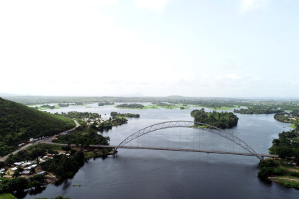
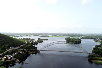
The Tano River, also known as the Tanoé River, stands as a pivotal transboundary watercourse in West Africa, primarily originating and flowing through Ghana before its lower course delineates a portion of the international boundary with Côte d’Ivoire, ultimately discharging into the Aby Lagoon and the Atlantic Ocean. This report systematically details the river’s major tributaries, basin characteristics, ecological significance, and the profound environmental and socio-economic challenges it currently faces.
Key findings reveal a well-developed drainage network supported by nine principal tributaries, which are integral to the Tano’s hydrological dynamics. The basin, while naturally rich in biodiversity, including habitats for critically endangered species, is under severe pressure. Widespread illegal mining activities, coupled with agricultural runoff and the proliferation of invasive water hyacinth, have led to significant heavy metal contamination and a drastic reduction in water quality. This degradation directly impacts the socio-economic fabric of local communities, who depend on the river for domestic water supply, agriculture, and fishing. Despite these challenges, the basin holds considerable potential for small hydropower development, offering a pathway towards sustainable energy. Addressing the multifaceted issues necessitates an integrated water resource management approach that accounts for existing degradation, climate change impacts, and the complex interplay of human activities.
1. Introduction to the Tano River System
1.1. Geographical Context and Course of the Tano River
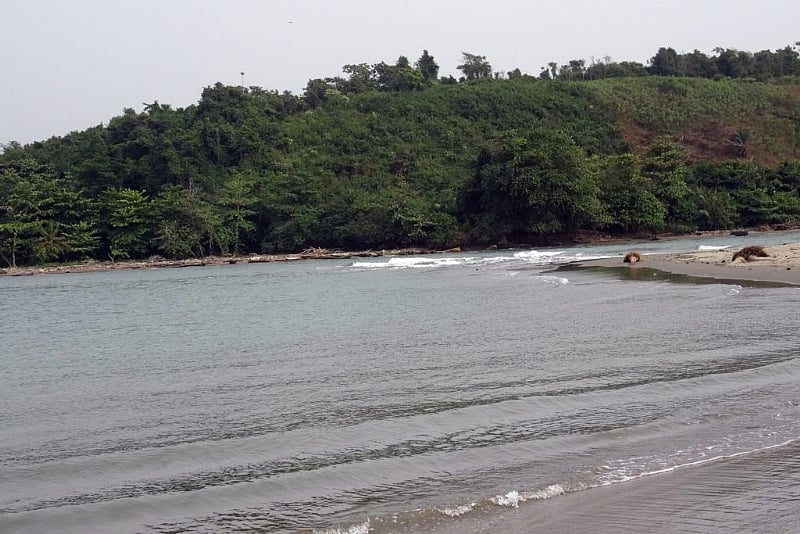
The Tano River, or Rivière Tanoé as it is known in French, is a significant water body in Ghana, stretching approximately 400 kilometers (250 miles) from its source. It originates from Traa, a suburb of Techiman, the capital town of the Bono East Region in Ghana. The river then flows southward, traversing through the Ehy Lagoon and Tendo Lagoon, before finally reaching the Aby Lagoon in Ivory Coast, where it empties into the Atlantic Ocean. The final few kilometers of the Tano River’s course define a segment of the international land boundary between Ghana and Ivory Coast.
The Tano River basin is a transboundary system, shared between Ghana and Côte d’Ivoire. Its total area is approximately 16,060 square kilometers, with the vast majority—about 93% or 15,000 square kilometers—situated within Ghana, and the remaining 7% (1,185 square kilometers) extending into Côte d’Ivoire. The river’s precise origin is located within the Boyem Mountain Ranges near Techiman.
The transboundary nature of the Tano River system, with its course spanning two nations and its mouth located in Côte d’Ivoire, presents inherent complexities for water resource management and pollution control. Decisions and environmental conditions within the larger Ghanaian portion of the basin directly influence water quality and availability for communities and ecosystems downstream in Côte d’Ivoire. This geographical reality underscores the necessity of robust bilateral cooperation and the implementation of integrated water resource management plans that transcend national jurisdictions. Such collaborative efforts are essential to ensure the river’s health and its sustainable utilization for all riparian states, as unilateral actions are insufficient for long-term ecological and socio-economic stability.
Furthermore, the Tano River’s source in the Boyem Mountain Ranges near Techiman holds more than just geographical significance. For the indigenous Bono people, this origin point is deeply sacred, believed to be the dwelling place of Taakora, their highest deity. This spiritual reverence for the river’s source offers a powerful cultural leverage point for conservation initiatives. Protecting this area thus becomes not only an ecological imperative but also a cultural and spiritual one, potentially fostering stronger local engagement and traditional governance in conservation efforts. Conversely, any degradation at the source would have profound cultural as well as environmental repercussions, undermining traditional beliefs and practices.
1.2. Cultural Significance and Local Beliefs
In Akan mythology, the Tano River transcends its physical form to be revered as a sacred river deity, personified and worshipped for its profound spiritual and cultural importance. It plays a central role in the Akan people’s understanding of nature and spirituality. The river’s deep, clear waters are often symbolized by the color blue in traditional ceremonies, representing purity and life, and mirroring the essence of the Tano deity. Indigenous knowledge systems in the upper basin reinforce this reverence, holding the Tano River as a sacred entity and, in some areas, prohibiting fishing to preserve its sanctity. Historically, traditional practices involved the establishment of deities along the river, with their use regulated by local sub-chiefs, demonstrating a form of indigenous water resource management.
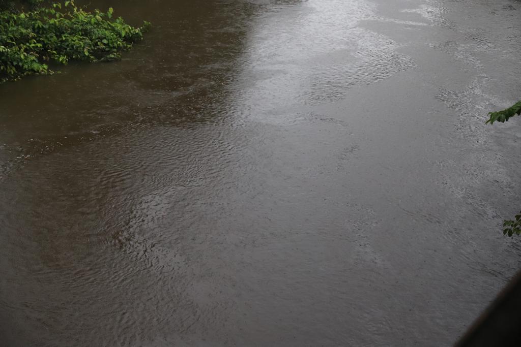
However, a significant disparity exists between these deeply held cultural values of environmental stewardship and the current state of the river. Contemporary reports vividly describe the Tano River as having turned a “murky brown” due to severe pollution, primarily from illegal mining activities. This stark contrast suggests that external pressures, particularly the economic incentives driving illegal mining, have either overwhelmed or eroded the effectiveness of traditional governance and spiritual deterrents. This breakdown highlights a critical need to re-empower traditional leaders and integrate indigenous knowledge and practices into formal water management plans. Bridging this gap could foster more sustainable practices, leveraging the cultural and spiritual connection to the river for its long-term preservation.
1.3. Purpose and Scope of the Report
The primary objective of this report is to provide a comprehensive analysis of the Tano River tributaries. This includes detailing their geographical context, hydrological characteristics, ecological significance, and the various human and environmental factors that impact them within the broader Tano River basin. The scope of this report is designed to inform academic research, environmental policy development, and ongoing conservation efforts by presenting a holistic and evidence-based understanding of this vital West African river system.
2. Major Tributaries of the Tano River
2.1. Identification and Geographical Distribution of Key Tributaries
The Tano River system is sustained by an intricate network of tributaries that contribute significantly to its flow. Early documentation from the Water Resources Commission of Ghana identified main tributaries such as the Abu, Amama, Bo, Disue, Soro, Atronie, Sabom, Gaw, Kwasa, Sumre, and Totua. More recent and detailed information, also from the Water Resources Commission, provides a refined list of nine major tributaries along with their specific catchment areas. These include the Boin, Disue, Amama, Abu, Gaw, Suraw, Samre, Totua, and Disri. The Tano River basin is characterized by a well-developed drainage network, contributing to an overall drainage density of 0.032 km²/km.
For an expert-level analysis, it is crucial to prioritize the most detailed and authoritative data available. The Water Resources Commission’s more recent data, which includes specific catchment areas for each major tributary, offers a more rigorous hydrological assessment compared to earlier lists. This precision allows for a more accurate understanding of each tributary’s contribution to the Tano River’s flow and overall basin dynamics. Such detailed information is essential for developing targeted water management and conservation efforts, as it enables stakeholders to identify the most hydrologically significant sub-basins for intervention. The slight discrepancies between available lists also highlight the dynamic nature of hydrological data and the importance of relying on the most current and robust sources for informed decision-making.
2.2. Catchment Areas and Relative Contribution to the Tano River Flow
The total catchment area of the Tano River System is approximately 15,000 km² , or more precisely, 16,060 km² as per recent data. A substantial portion, about 93% (or 15,000 km²), is located within Ghana, with the remaining 7% (1,185 km²) extending into Côte d’Ivoire. The contributions of individual tributaries vary, with some playing a disproportionately large role in the overall basin hydrology.
Among the major tributaries, the Disue River boasts the largest catchment area at 1,715 km², with 1,709 km² of that area lying within Ghana. The Abu River follows closely with a catchment area of 1,650 km². Other significant contributors include the Gaw River (984 km²), Amama River (958 km²), Boin River (821 km², with 655 km² in Ghana), Suraw River (640 km²), Samre River (487 km²), Totua River (440 km²), and Disri River (370 km²).
The substantial catchment areas of rivers like the Disue and Abu, each exceeding 1,600 km², indicate that these tributaries contribute a significant proportion of the water and sediment load to the main Tano River. This hydrological dominance implies that any environmental changes or pollution sources within the Disue and Abu sub-basins would have a disproportionately large impact on the overall health, flow regime, and water quality of the Tano River. This highlights the strategic importance of concentrating monitoring, conservation, and pollution control efforts on these major tributaries to achieve basin-wide improvements. For example, if illegal mining activities are prevalent in these larger sub-basins, their cumulative impact on the main river’s turbidity and chemical composition would be greatly amplified, necessitating targeted interventions in these specific areas.
Table 1: Major Tributaries of the Tano River
| Tributary Name | Total Catchment Area (km²) | Catchment Area within Ghana (km²) |
| Disue | 1,715 | 1,709 |
| Abu | 1,650 | Not specified |
| Gaw | 984 | Not specified |
| Amama | 958 | Not specified |
| Boin | 821 | 655 |
| Suraw | 640 | Not specified |
| Samre | 487 | Not specified |
| Totua | 440 | Not specified |
| Disri | 370 | Not specified |
Export to Sheets
Source: Water Resources Commission of Ghana
3. Hydrological and Geological Characteristics of the Tano River Basin
3.1. Basin Topography, Climate, and Rainfall Patterns
The Tano Basin is geographically located in southwestern Ghana, spanning between Latitudes 5° N and 7° 40′ N, and Longitudes 2° 00′ W and 3° 15′ W. The topography across the basin varies considerably. Upstream areas, particularly near the Boyem Mountain Ranges where the Tano River originates, are characterized by highlands with average elevations around 540 meters above sea level. Moving downstream, the middle sections of the basin typically exhibit elevations of 200-300 meters, while the southern areas are significantly flatter, ranging between 0 and 15 meters, with an average elevation of 50 meters above sea level.
Climatically, the Tano Basin falls partly under the wet semi-equatorial zone and partly under the south-western equatorial climatic zone of Ghana. This results in a distinctive pattern of double rainfall maxima throughout the year. The total annual rainfall generally decreases spatially, ranging from approximately 1,800 mm/year on the southwest coast to about 1,000 mm/year in the northern parts of the basin. The bimodal rainfall pattern is characteristic of the southern regions, while the northern areas experience a mono-modal rainfall regime.
The significant elevation gradient, transitioning from highlands in the north to low-lying areas in the south, has a direct influence on the river’s flow dynamics. Steeper gradients in the upper and middle reaches result in faster water flow and increased erosive power. This topographical characteristic, when combined with observed pollution from mining activities in the midstream areas, creates an efficient mechanism for the rapid transport of contaminants. Consequently, pollution originating upstream can be quickly carried downstream, impacting a wider range of communities and ecosystems, including the lagoons at the river’s mouth. This illustrates the profound interconnectedness of the basin and the far-reaching consequences of localized environmental degradation, emphasizing that pollution in one area has ripple effects throughout the entire system.
3.2. Drainage Network and Patterns
The Tano River basin features a well-developed drainage network, encompassing the main Tano River and its nine major tributaries. This interconnected system results in a drainage density of 0.032 km²/km. The specific pattern formed by tributaries within a drainage basin is largely determined by the underlying rock type and the structural geology, including folds, fractures, and faults within the bedrock. Dendritic drainage patterns, which resemble the intricate branching structure of a tree, are the most common type globally. They typically form in regions with relatively uniform geology, such as areas dominated by granite, gneiss, volcanic rock, or unfurled sedimentary material. The formation of these patterns is primarily governed by the forces of gravity, erosion, and the prevailing topography.
Given the Tano Basin’s dominant geological composition, which includes Granitoids (38.1%), Birimian Sediments (31.9%), and Birimian Volcanics (25.5%) , it is highly probable that the Tano River basin exhibits a dendritic drainage pattern. This geological predisposition for a dendritic network, while efficient in collecting water from a broad area, also carries significant implications for basin-wide pollution. Specifically, pollutants introduced anywhere within this extensive, branching network of tributaries will be effectively channeled and concentrated into the main Tano River. This characteristic exacerbates the challenge of managing diffuse pollution sources across the entire basin, as contaminants can easily spread throughout the interconnected system, making comprehensive pollution control efforts more complex and critically important.
3.3. Dominant Geological Formations and their Influence on Water Resources
The geological composition of the Tano Basin is diverse, with several dominant formations influencing its hydrology and resource endowment. Granite (Granitoids) constitutes the largest proportion at 38.1%, followed by Birimian Sediments at 31.9%, and Birimian Volcanics at 25.5%. Other formations include Eocene & Cretaceous Sedimentary Rocks, Upper Voltaian (Kwahu Group) at 1.8%, and Tarkwaian Rocks, which are the least dominant at 0.6%. The Birimian series rocks are notably strongly folded, foliated, and jointed, characteristics that facilitate water infiltration and groundwater movement. Tarkwaian rocks, though less extensive, are slightly metamorphosed and folded, possessing open joint systems that can support limited groundwater storage. In the northern part of the basin, the Upper Voltaian formation is recognized as the thickest and coarsest, directly influencing the occurrence of groundwater in that region. Along the coastal areas, the geology transitions to Cretaceous and Eocene sedimentary rocks, which feature a variety of rock types, including sand, clay, fossiliferous sandy limestone, marl, sandstone, siltstone, mudstone, and shale basal conglomerates. Some limestone layers within this sequence are believed to hold oil and gas potential, adding economic interest to this part of the basin. Overall, the basin is described as being endowed with significant mineral, oil, and gas resources. Both surface water and groundwater serve as major sources of domestic water supply for the region.
The basin’s inherent geological wealth, particularly its endowment with minerals, oil, and gas resources , and the presence of Birimian and Tarkwaian formations known to host significant mineral deposits , directly correlates with intensive mining activities, both legal and illegal. These activities are explicitly identified as primary sources of severe water quality degradation, leading to increased turbidity, heavy metal contamination, and incidents like acid spills. This establishes a clear cause-and-effect relationship where the basin’s geological endowment, while an economic asset, simultaneously creates an inherent vulnerability for its water resources. The pursuit of these valuable resources leads to practices that directly compromise the environmental health of the river system, creating a fundamental conflict between economic development and ecological sustainability. This situation points to a critical need for robust regulatory frameworks and sustainable extraction practices that prioritize environmental protection.
Furthermore, the strong hydraulic connection between surface water bodies, such as rivers and streams, and the underlying aquifers is a critical hydrological feature. The dominant Birimian rocks, for instance, promote water infiltration and groundwater movement. Groundwater is a major source of domestic water supply , and hydrological studies confirm that surface water contributes to groundwater recharge in the Lower Tano River Basin. This groundwater is characterized as “young” with modern recharge. Crucially, elevated concentrations of trace elements have been detected in both surface water and groundwater, rendering some groundwater samples unsuitable for drinking. This interconnectedness means that pollution originating in the river, for example, from mining or agricultural runoff, can rapidly infiltrate and contaminate vital groundwater resources. This poses a significant and often long-term public health risk, as groundwater contamination is typically more challenging and costly to remediate than surface water. The “young” nature of the groundwater further confirms that recent surface pollution is actively impacting deeper water sources, highlighting the urgent need for comprehensive pollution prevention across the entire hydrological system to safeguard drinking water supplies.
4. Ecological Features and Biodiversity
4.1. Terrestrial and Aquatic Flora and Fauna
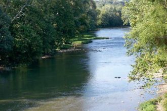
The Tano River meanders through lush landscapes and verdant forests, supporting a rich and diverse array of flora and fauna. This makes the basin a significant haven for birdwatchers and wildlife enthusiasts. The terrestrial landscape of the basin is characterized by semi-deciduous dense forests, dry dense forests, and clear forests, interspersed with extensive farmlands and degraded lands. In southern Ghana, where a substantial portion of the Tano basin lies, the evergreen and semi-deciduous forests host economically important tree species such as mahogany, odum, and ebony, alongside oil palms and mangroves.
A critically important ecological feature is the forest located between the Tano River and Ehy Lagoon, which is believed to be the habitat for the last few individuals of Miss Waldron’s Red Colobus (Piliocolobus badius waldronae), one of the world’s most threatened primates. However, as of mid-2008, this specific forest area was slated for logging by Unilever, with the explicit aim of replacing it with oil palm plantations. This situation represents a direct and acute conflict between the preservation of global biodiversity and large-scale industrial agricultural expansion. The conversion of natural forest to monoculture plantations would inevitably lead to severe habitat loss and fragmentation, pushing this already highly threatened primate closer to extinction. This highlights a critical need for stringent environmental impact assessments, strategic land-use planning that prioritizes conservation in biodiversity hotspots, and potentially, international intervention to protect such irreplaceable natural assets.
Beyond direct water pollution, the ecological health of the Tano Basin is also threatened by extensive, systemic habitat destruction and fragmentation across the landscape. Significant land use and land cover changes are occurring, specifically the conversion of dense forest to open forest, cropland, and human settlements. This widespread deforestation and land degradation also contribute to reduced land productivity. This broader transformation impacts terrestrial biodiversity, alters hydrological cycles (e.g., increased runoff, reduced infiltration, exacerbating flooding or drought), and contributes to non-point source pollution. This creates a complex, interconnected web of environmental challenges that demands integrated land and water management solutions, recognizing that the health of the river is intrinsically linked to the health of its surrounding terrestrial ecosystems.
Table 2: Key Ecological Features and Notable Biodiversity in the Tano River Basin
| Feature/Species Category | Specific Examples/Description | Significance/Threats | Source Snippet |
| Terrestrial Flora | Semi-deciduous dense, dry, and clear forests | Regulate freshwater supply, filtration, water quality; habitat | |
| Mahogany, Odum, Ebony, Oil Palms, Mangroves | Economically important timber and agricultural species | ||
| Terrestrial Fauna | Miss Waldron’s Red Colobus (Piliocolobus badius waldronae) | One of the world’s most threatened primates; habitat in forest between Tano River and Ehy Lagoon | |
| Diverse bird species | Haven for birdwatchers and wildlife enthusiasts | ||
| Aquatic Life | Diverse aquatic flora and fauna | Supports ecosystem health and local livelihoods | |
| Freshwater fish fauna (28 families, 73 genera, 157 species; 81 food importance) | Crucial protein source for local communities | ||
| Major Threats | Logging for oil palm plantations | Direct habitat loss for endangered species, e.g., Miss Waldron’s Red Colobus | |
| Heavy metal pollution in fish | Severe health risks (carcinogenic) to human consumers, fish stress | ||
| Illegal mining activities | Reduces fish populations, impedes movement | ||
| Land use/cover change (deforestation) | Habitat destruction, altered hydrology, non-point pollution |
4.2. Designated Forest Reserves and their Role in Basin Protection
Several forest reserves have been strategically established within the Tano Basin to protect critical river headwaters. These include the Boin Tano Forest Reserve, which protects the River Boin; the Tano Suraw Forest Reserve, for the River Suraw; the Tano Suhien Forest Reserve, for the River Suhien; and the Disue Forest Reserve, for the River Disue. These forest ecosystems are recognized for their critical role in regulating freshwater supply by supporting natural flow, filtration processes, and maintaining water quality. Additionally, the Tano South District contains two other significant forest reserves: the Bosomkese Forest Reserve, covering 138.41 square kilometers, and the Apaape Forest Reserve, spanning 19.04 square kilometers.
The explicit designation of forest reserves at river headwaters underscores a clear understanding that protecting these source areas is paramount for the health of the entire river system. These ecosystems are vital for natural water filtration and flow regulation. This demonstrates a proactive, “source-to-sea” approach to water management, where maintaining the integrity of the river’s origin is seen as foundational for ensuring downstream water quality and quantity. However, the effectiveness of these reserves is contingent upon rigorous enforcement against external threats like illegal mining and encroachment. If pollution or deforestation occurs immediately outside these protected zones, or if enforcement within them is weak, their intended benefits for the wider basin will be severely compromised. This highlights the ongoing need for buffer zone protection and effective monitoring around these critical areas to ensure their continued ecological function.
4.3. Aquatic Life and Fish Species
The Tano River is recognized for its diverse aquatic flora and fauna, contributing to the rich biodiversity of the region. Ghana’s freshwater fish fauna is extensive, comprising 28 families, 73 genera, and 157 species, with 81 species holding significant importance as food sources.
However, the Tano River basin is severely impacted by heavy metal pollution, which poses a significant threat to its fish populations. Studies have detected alarming levels of Chromium (Cr), Arsenic (As), and Mercury (Hg) in the muscles of fish sampled from the Tano River. These concentrations have been found to exceed international acceptable limits established by organizations such as the Food and Agriculture Organization (FAO/WHO) and the United States Food and Drug Administration (USFDA). The consumption of these contaminated fish poses significant noncarcinogenic and carcinogenic health risks to humans, with potential long-term health problems including kidney, liver, and skin cancers. Furthermore, some fish species, such as
Mormyrus rume and Sarotherodon galilaeus, have exhibited poor to moderate health conditions, indicating the severe stress they experience from the polluted environment.
A stark illustration of this threat occurred in January 2020, when a truck carrying sulfuric acid plunged into the river, resulting in the immediate death of many fish and other aquatic species. This incident prompted an urgent public health warning advising residents not to drink the river water. Beyond such acute events, ongoing illegal mining activities have been observed to impede fish movement and contribute to overall reductions in fish populations. This situation establishes a clear and alarming cause-and-effect chain: unchecked anthropogenic pollution, particularly from illegal mining, leads to heavy metal contamination of water and the aquatic food chain. This results in severe health risks for human consumers and the collapse of local fisheries, directly threatening the food security and livelihoods of communities dependent on the river. The public health advisories and the implicit warnings against eating contaminated fish underscore the immediate crisis. This situation demands urgent, stringent pollution control, remediation efforts, and the provision of alternative safe food and water sources to protect human well-being and restore ecological integrity.
5. Environmental Issues and Anthropogenic Impacts
5.1. Water Quality Degradation and Pollution Sources
The Tano River, once known for its clear waters, has undergone a dramatic transformation, visibly turning a murky brown. Measurements indicate that its turbidity levels are more than 100 times higher than the accepted standard for drinking water. The primary cause of this severe pollution is identified as irresponsible mining, locally known as “galamsey”. Specific entities, such as Akonta Mining Limited, have been implicated, with investigative teams documenting mining operations occurring directly on the riverbed at four key pollution points. This practice is a clear violation of the mandated 50-meter buffer zone regulation intended to protect water bodies. Mining residue and waste from these sites are observed flowing directly into the river.
Beyond mining, a confluence of other significant pollution sources contributes to the river’s degradation. These include industrial effluent discharges, atmospheric deposition, agricultural runoffs containing trace metals, pesticides, insecticides, and weedicides, as well as impacts from urbanization and commercial activities. A notable incident in January 2020 involved a truck carrying sulfuric acid plunging into the river, leading to widespread contamination and an advisory for residents not to drink the water. Although the river was reportedly restored to its natural state afterward, such events highlight the vulnerability of the system to acute pollution. Furthermore, microbial contamination from raw urban and rural effluent, direct runoff discharge, and open defecation significantly contribute to water quality issues, exacerbated by a pervasive lack of sewage treatment facilities.
Despite the existence of environmental regulations, such as the 50-meter buffer zone for mining, and the presence of governmental bodies like the Water Resources Commission with mandates for monitoring and enforcement , illegal mining activities continue to operate with apparent impunity, causing severe pollution. The government’s acknowledgment of a need to “renew its fight against irresponsible mining” implies a history of inadequate enforcement. This situation highlights a profound gap between environmental policy formulation and its effective implementation on the ground. The persistence of destructive practices suggests that the economic drivers for illegal mining are powerful enough to circumvent or overwhelm existing regulatory frameworks, possibly due to insufficient resources for enforcement, corruption, or a lack of sustained political will. This systemic weakness allows chronic environmental degradation to persist, undermining public health and ecological integrity.
The Tano River is not subjected to a single source of pollution but to a confluence of stressors: heavy metals and turbidity from mining, chemical spills, trace metals and pesticides from agriculture, and microbial contamination from domestic waste. This multifaceted pollution creates a complex environmental challenge where the cumulative impact is likely greater than the sum of its individual parts. Remediation efforts cannot be isolated to addressing a single source but must adopt an integrated approach that considers industrial, agricultural, and domestic waste management simultaneously. For instance, the reported “restoration” of the river after the sulfuric acid spill might only address acute, visible contamination, leaving chronic, less obvious pollutants like heavy metals from mining to persist and accumulate. This indicates a critical need for continuous, comprehensive monitoring and long-term remediation strategies to ensure genuine ecological recovery.
5.2. Heavy Metal Contamination and Associated Health Risks
The Tano Basin is characterized by appreciable levels of various trace metals, including Chromium (Cr), Arsenic (As), Mercury (Hg), Lead (Pb), Cadmium (Cd), and Zinc (Zn), which have been consistently reported throughout its waters. A particularly alarming finding is that the levels of Cr, As, and Hg detected in the muscles of fish sampled from the Tano River significantly exceed international acceptable limits established by organizations such as the Food and Agriculture Organization (FAO/WHO) and the United States Food and Drug Administration (USFDA).
The consumption of these contaminated fish poses significant noncarcinogenic and carcinogenic health risks to humans, with potential long-term health problems including kidney, liver, and skin cancers. Furthermore, the health of some fish species within the river, such as
Mormyrus rume and Sarotherodon galilaeus, has been assessed as poor to moderate, indicating the severe stress they endure from the polluted environment.
Fish from the Tano River serve as a crucial protein source for local communities. However, the heavy contamination of these fish with metals at levels deemed unsafe for consumption, posing significant carcinogenic risks, transforms this environmental problem into a profound public health crisis. The contamination of a staple food source means that communities relying on the river are subjected to chronic exposure to harmful substances, leading to potentially serious long-term health issues. This necessitates immediate and robust public health interventions, including widespread awareness campaigns, the provision of safe alternative food sources, and aggressive, sustained pollution abatement measures. The economic and social costs of this health crisis, encompassing healthcare burdens and loss of productivity, are likely substantial and long-lasting, demanding urgent attention from public health authorities and environmental regulators.
5.3. Land Use and Land Cover Change
Within the Tano basin, arable lands constitute the highest percentage of the total landmass, closely followed by forest cover, which occupies approximately 50% of the total landmass. However, a significant historical trend of land use and land cover (LULC) change has been observed between 1986 and 2020. This period is primarily characterized by the conversion of dense forest to open forest, and subsequently to settlement and cropland. During this timeframe, cropland increased at an average rate of 24.8 km²/year, and human settlement expanded at 1.5 km²/year. Conversely, dense forest experienced a drastic decrease at an alarming rate of 298.4 km²/year, and open forest declined at 173.9 km²/year. These LULC changes are recognized as significant contributors to carbon emissions, thereby exacerbating climate change and global warming. Furthermore, widespread land degradation and physical processes like water erosion contribute to a decline in overall land productivity.
The Tano Basin is experiencing rapid and extensive deforestation, with dense forest cover decreasing at an alarming rate of nearly 300 km²/year. This is largely driven by agricultural expansion and human settlement. Forest ecosystems are crucial for regulating freshwater supply, natural flow, and water quality through filtration. This rapid land cover change has profound and cascading negative impacts across the ecosystem. It directly contributes to water quality degradation by increasing sediment load and reducing natural filtration. It exacerbates climate change through significant carbon emissions. It also leads to widespread habitat loss and fragmentation, threatening biodiversity, including critically endangered species like Miss Waldron’s Red Colobus. Moreover, these changes can alter local hydrological cycles, potentially increasing runoff and flood risk while simultaneously reducing groundwater recharge. This situation highlights an unsustainable development trajectory where short-term gains from agriculture and settlement are undermining the long-term ecological and hydrological resilience of the basin, necessitating a fundamental shift towards more sustainable land management practices.
5.4. Impact of Invasive Species: The Water Hyacinth Menace
The proliferation of water hyacinth, an highly invasive aquatic species, poses a major challenge within the Tano/Abby/Ehy lagoon complex and extends along a 25-kilometer stretch of the Tano River. The rate of its spread on the Tano River was estimated at 12 hectares per annum. This invasive plant was introduced from Le Canal d’Assinie, a canal in Côte d’Ivoire that connects to the Abby-Tano Lagoon, illustrating how species can easily cross international borders through interconnected waterways.
Water hyacinth forms dense mats that physically block waterways, severely disrupting essential human activities such as fishing and farming. This blockage increases travel time for farmers to access their lands, leads to the destruction of farm produce, and consequently reduces farmers’ income. Ecologically, the dense mats reduce oxygen levels in the water, suffocate native aquatic vegetation by blocking sunlight, and generally degrade overall water quality. The severity of the invasion has been such that some farmers have even resorted to abandoning their farms due to the insurmountable challenges posed by the water hyacinth.
The transboundary origin of water hyacinth, introduced from Côte d’Ivoire and rapidly spreading within the Tano Basin in Ghana, highlights how environmental problems, particularly biological invasions, do not respect national borders. An introduction in one country can have severe, far-reaching consequences in a neighboring country due to shared water systems. This underscores the critical need for regional environmental cooperation, coordinated early detection, and rapid response mechanisms, as well as preventative measures against invasive species across shared basins. The significant economic impact on farming, fishing, and transportation further emphasizes the urgency of collaborative, transboundary solutions to mitigate the spread and effects of this pervasive invasive species.
6. Human Activities and Community Dependence
6.1. Socio-Economic Activities within the Basin
The Tano River Basin is a cornerstone for the socio-economic activities of its resident communities, serving as a major source of domestic water supply, drawing from both surface and groundwater resources. Beyond household use, its waters are extensively utilized for industrial processes, mining operations, and agricultural irrigation. Communities situated in the midstream areas of the basin are heavily involved in commercial and subsistence farming, cultivating a variety of crops such as maize, cocoa, and various vegetables, and also engage in fish farming.
The broader Ankobra–Tano Basin holds significant economic importance due to its rich natural resources. It is a key area for mining activities, including the extraction of gold and bauxite, and supports a thriving timber industry. Additionally, the basin is productive in cash crops such as copra, palm oil, and rubber. Furthermore, the middle and lower Tano basins have been subject to intense exploration for oil and natural gas since the mid-1980s, indicating a potential for future development in the energy sector.
This diverse range of socio-economic activities, particularly the pursuit of wealth from extractive industries, creates an inherent and escalating conflict over resource allocation and use. The Tano River basin is a critical source of water for human consumption, food production (agriculture, fish farming), and supports a range of industries. However, mining is identified as a primary source of severe water pollution , directly impacting water quality for drinking and agricultural use. This exemplifies a “resource curse” scenario where economic gains from one sector undermine the sustainability and well-being of other vital sectors and the resident population. This situation necessitates integrated land and water use planning that prioritizes long-term human health and ecological sustainability over short-term industrial profits.
6.2. Challenges Faced by Local Communities
Communities relying on the Tano River for their water supply, including Sunyani, Abesim, Techiman, Tanoso, Chiraa, Duayaw Nkwanta, and Bechem, have been directly impacted by its degradation. Following a sulfuric acid spill in January 2020, residents were explicitly advised not to drink the river water due to contamination. Pollution stemming from irresponsible mining activities has caused the river to turn a murky brown, with extremely high turbidity levels, rendering it unsuitable for drinking and posing significant health risks. Furthermore, the heavy metal contamination detected in fish from the river poses severe health risks, including carcinogenic effects, to consumers.
The widespread invasion of water hyacinth has compounded these challenges, physically blocking waterways and significantly affecting fishing and farming activities. This invasive plant increases travel time for farmers to access their lands, leads to the destruction of farm produce, and consequently reduces their income. The severity of the water hyacinth invasion has even led some farmers to abandon their farms entirely. These multifaceted environmental problems place immense pressure on the livelihoods and well-being of the communities dependent on the Tano River.
7. Water Management and Conservation Efforts
7.1. Existing Management Frameworks and Institutions
Ghana has established formal frameworks for water resource management, primarily through the Water Resources Commission (WRC). The WRC operates under Act 522, deriving its authority from Article 269 of Ghana’s Constitution. Its functions include issuing water use permits, developing comprehensive water resource management plans, monitoring water quality, promoting public awareness about water conservation, and issuing enforcement notices to address violations. An Integrated Water Resources Management Plan has specifically been drawn up for the Tano Basin to address its unique challenges.
In parallel to these formal structures, traditional governance systems also play a role. Indigenous knowledge systems in the upper basin hold the Tano River as a sacred entity, leading to practices such as prohibitions on fishing in certain areas. Historically, deities were mounted along the river, and sub-chiefs were responsible for regulating its use, demonstrating a form of indigenous water resource management.
However, a disparity exists between the mandates of formal institutions and their on-ground effectiveness. While the Water Resources Commission has clear responsibilities, it faces significant challenges in fully implementing its mandates, particularly in combating pervasive issues like illegal mining. Similarly, while traditional systems offer valuable, culturally embedded approaches to conservation, they often lack the formal legislative support necessary for widespread enforcement. This situation highlights a critical need for better integration and collaboration between formal governmental bodies and traditional governance structures. Providing legislative backing to indigenous knowledge and practices could significantly enhance the effectiveness of water resource management and foster greater community ownership and compliance.
7.2. Water Management Projects and Initiatives
Several projects and initiatives are underway or have been identified to manage the Tano River’s water resources and promote sustainable development. The Tono irrigation scheme, located in the Upper East Region of Ghana, is a notable example. This scheme utilizes the Tono River as its water source, with 2,490 hectares of land developed primarily for rice cultivation, managed by the Irrigation Company of Upper Region (ICOUR) and the Water Users Association (WUA). Ghana’s overall irrigation potential is estimated to range between 0.36 and 2.9 million hectares.
Furthermore, the Tano River Basin (TRB) holds significant potential for small hydropower (SHP) development. A study identified twenty-four potential sites along the Tano River, with three sites (HP9, HP11, and HP14) being particularly promising due to their high Net Present Values (NPVs) and potential for significant CO2 emissions savings. The development of these sites could contribute substantially to Ghana’s renewable energy goals and rural electrification. Hydrological models, such as the Soil and Water Assessment Tool (SWAT) and HEC-HMS, are being utilized for water resource management, including flood forecasting, reservoir operation, and assessing water quality, aiding in optimizing water use efficiency.
The potential for small hydropower development in the Tano Basin presents a promising avenue for sustainable energy, offering both economic benefits and significant CO2 emissions savings. This opportunity for clean energy generation must be carefully balanced with the existing environmental degradation and the projected impacts of climate change on the basin’s water resources. While hydropower offers a sustainable energy solution, its implementation must be meticulously planned to avoid exacerbating current ecological challenges, such as altered flow regimes or further habitat fragmentation. This necessitates comprehensive environmental impact assessments and the integration of hydropower development into a broader, holistic water management strategy that prioritizes the overall health and resilience of the Tano River ecosystem.
7.3. Challenges in Water Resource Management
Despite existing frameworks and initiatives, the Tano River basin faces numerous and compounding challenges in water resource management. A major ecological challenge is the widespread proliferation of water weeds, particularly water hyacinth, in the Tano/Abby/Ehy lagoon complex and along a 25-kilometer stretch of the Tano River. This invasive species is spreading at an estimated rate of 12 hectares per annum , physically obstructing waterways and impacting livelihoods.
Beyond biological invasions, Ghana’s freshwater resources, including the Tano River, are under increasing pressure from rapid population growth, accelerating urbanization, and the pervasive effects of climate change. The situation is further complicated by chronic issues such as widespread pollution, unchecked illegal mining activities, and inadequate infrastructure for water supply and sanitation across the basin. Climate change projections indicate a future decrease in mean annual streamflow for the Tano Basin, with a more pronounced reduction (37.5%) under the RCP8.5 scenario compared to the RCP4.5 scenario (19.9%). Analysis of drought patterns using indices like the Standardized Precipitation Index (SPI) and Reconnaissance Drought Index (RDI) shows an increasing trend in drought severity, which has negative implications for agricultural production and drinking water supply, as the basin relies heavily on surface water for these purposes.
Compounding these environmental threats are significant governance challenges. Managing freshwater resources in Ghana is characterized by conflicts and power struggles between various stakeholders, including government agencies, local communities, and private interests. Traditional institutions, despite their historical role in water management, often lack the formal bye-laws or legislative instruments necessary to support the enforcement of indigenous knowledge and practices.
The projected impacts of climate change, particularly reduced streamflow and increased frequency of droughts, are poised to exacerbate existing anthropogenic pressures such as pollution and over-extraction. This creates a compounding threat to water security within the Tano Basin. The diminished water availability from climate change will intensify competition for the already degraded and polluted water resources, potentially leading to more severe ecological and socio-economic consequences. This complex interplay underscores the urgent need for proactive adaptation strategies that integrate climate resilience into all aspects of water management.
The pervasive conflicts between stakeholders and the lack of legislative support for traditional knowledge in water governance represent significant systemic weaknesses. These governance gaps hinder the effective implementation of management plans and perpetuate unsustainable practices. A truly integrated, multi-stakeholder approach is therefore essential, one that fosters genuine collaboration, resolves conflicts, and provides robust legislative backing for all effective management strategies, including those rooted in indigenous practices. Without addressing these fundamental governance deficiencies, the long-term sustainability of the Tano River system remains precarious.
8. Conclusions and Recommendations
The Tano River system, a vital transboundary watercourse in West Africa, is characterized by an extensive network of tributaries that are fundamental to its hydrological function and the ecological health of its basin. While historically revered for its purity and supporting diverse ecosystems and human livelihoods, the river is currently under severe environmental duress. The primary drivers of this degradation are widespread illegal mining activities, rapid land use and land cover changes (particularly deforestation for agriculture and settlement), and the unchecked proliferation of invasive water hyacinth. These pressures have led to alarming levels of water quality degradation, including high turbidity and heavy metal contamination, which in turn pose significant public health risks through contaminated drinking water and fish. The socio-economic well-being of communities dependent on the river for domestic water, agriculture, and fishing is directly and severely impacted.
Despite existing formal and traditional management frameworks, their effectiveness is often undermined by systemic regulatory failures, enforcement deficiencies, governance gaps, and the compounding effects of climate change. The basin’s inherent geological wealth, while offering economic opportunities, also creates a fundamental conflict with environmental sustainability. Addressing these multifaceted challenges requires a comprehensive and integrated approach that transcends traditional sectoral boundaries and national borders.
Based on this analysis, the following recommendations are put forth to foster the sustainable management and restoration of the Tano River Basin:
- Strengthen Enforcement Against Illegal Mining: Implement robust and sustained monitoring, surveillance, and enforcement of existing mining regulations, particularly the 50-meter buffer zone policy. This necessitates increased resources for regulatory bodies and a zero-tolerance approach to illegal operations to curb the primary source of water pollution and habitat destruction.
- Implement Integrated Water Resource Management (IWRM): Develop and rigorously implement a truly integrated water resource management plan that addresses pollution from all sources—mining, agricultural runoff, industrial effluent, and domestic waste—and considers the interconnectedness of both surface and groundwater resources. This plan should encompass pollution prevention, control, and remediation strategies across the entire basin.
- Enhance Transboundary Cooperation: Foster and strengthen collaborative mechanisms between Ghana and Côte d’Ivoire for joint monitoring, data sharing, coordinated pollution control, and integrated management of shared water resources, including invasive species control. This is crucial for addressing the transboundary nature of environmental challenges.
- Prioritize Public Health Interventions: Launch widespread public awareness campaigns regarding water and fish contamination risks. Simultaneously, ensure the provision of safe, alternative drinking water sources and support for alternative, safe food sources for communities whose livelihoods and health are compromised by the river’s pollution.
- Promote Sustainable Land Use Planning and Forest Protection: Enforce existing forest protection laws and implement sustainable land use planning to curb deforestation and land degradation. This includes promoting sustainable agricultural practices that minimize runoff and erosion, and integrating land-use changes into water management strategies to protect headwaters and reduce sediment load.
- Empower Traditional Governance Systems: Formally recognize and integrate indigenous knowledge and traditional leaders into modern water management structures. Provide legislative backing and resources to traditional institutions to enhance their capacity for local water resource governance and enforcement, bridging the gap between traditional stewardship and formal management.
- Develop Climate Change Adaptation Strategies: Incorporate climate change projections, such as decreasing streamflow and increasing drought frequency, into long-term water management plans. This should include strategies for water conservation, efficient water use in agriculture, and the development of drought-resilient infrastructure and practices.
- Implement Comprehensive Invasive Species Control: Develop and execute a multi-pronged strategy for water hyacinth control, combining mechanical removal, biological control methods, and, where appropriate, targeted chemical treatments. Focus should also be placed on preventing the further spread of this invasive species from its points of origin.
By addressing these critical areas with concerted effort and integrated strategies, the Tano River Basin can move towards a more sustainable future, safeguarding its ecological integrity and supporting the well-being of its dependent communities.