

I. Introduction: Reading Earth’s Storybook
Rivers: Dynamic Sculptors of Our Landscape
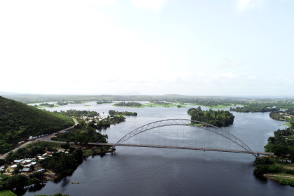
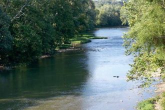
Rivers are far more than mere channels for water; they are powerful, persistent sculptors of the Earth’s surface, constantly carving valleys, transporting vast quantities of sediment, and shaping the very landscapes we inhabit. From the narrow, deeply incised gorges of Utah’s canyon country to the expansive, fertile floodplains of coastal regions, the diverse forms of river valleys are a testament to the continuous interplay between local geological conditions and global forces. The relentless flow of water, over immense spans of time, provides a dynamic record of our planet’s ever-changing face.
The Earth’s “History Book”: What the Rocks Tell Us
Geologists approach the Earth’s rock layers as a colossal history book, with each stratum representing a distinct chapter in our planet’s saga. Sedimentary rocks, in particular, are invaluable archives, preserving detailed information about the ancient environments in which they formed. The size and type of sediment within these layers, for instance, can reveal whether a region was once a shallow sea, a vast desert, or a meandering river floodplain. By meticulously studying these layered records, scientists can reconstruct the prevailing conditions, climatic patterns, and biological activity that characterized Earth’s past.
The Mystery of the Missing Pages: Introducing Unconformities
However, like any ancient text, Earth’s history book is not always complete. There are often “missing pages” or “missing chapters” within this geological record, representing significant intervals of time for which no rock layers were preserved, or existing layers were subsequently removed. These crucial breaks are known as geological unconformities. Far from being mere voids, unconformities are fundamental geological features that provide profound information about Earth’s history. They mark periods where continuous sediment deposition ceased, often due to powerful erosional events or prolonged periods of non-deposition, before renewed sedimentation began. The very presence of such a gap, and the nature of the contact between the older and younger rocks, offers invaluable clues to the dramatic geological events that transpired during the unrecorded interval. This means that geologists do not simply note what is absent; they actively interpret
why it is absent, transforming a perceived lack of information into a rich source of understanding about past Earth processes.
II. Unconformities: Gaps in the Geological Record
What is an Unconformity?
An unconformity is a buried surface that separates two rock masses or strata of different ages, indicating a significant interruption in the geological record. This interruption, often referred to as a “hiatus,” signifies a period when either no sediments were deposited, or previously deposited rocks were eroded away, before younger layers accumulated on top. The rocks above an unconformity are invariably younger than those beneath it, unless the entire sequence has been overturned by extreme tectonic forces. These surfaces are critical for delineating Earth’s history, effectively dividing a region’s geological timeline into chapters of continuous deposition punctuated by these profound breaks.
The Role of Erosion in Creating Unconformities
Erosion stands as the primary architect of unconformities. When landmasses are uplifted or global sea levels fall, previously submerged or stable rock formations become exposed to the relentless forces of weathering and erosion. Wind, water, and ice tirelessly break down and transport rock material, effectively “erasing” vast stretches of geological time from the local record. This erosional phase is often followed by a period of subsidence or rising sea levels, which allows new sediments to be deposited on the eroded surface, thus creating the distinct boundary of an unconformity. The extent and type of erosion involved can provide critical information about the intensity and nature of these past geological processes, including the formation of ancient mountains and valleys.
Types of Unconformities: Different Kinds of Gaps
Geologists classify unconformities into several types based on the angular relationship and rock types across the break, each revealing a unique sequence of events in Earth’s history. Recognizing these variations requires careful observation and specialized knowledge, as some are far more evident than others.
- Angular Unconformity: This is perhaps the most visually striking type, characterized by horizontally parallel younger sedimentary layers deposited on top of older layers that have been tilted or folded and then eroded. The angular discordance between the two sets of strata clearly indicates a complex history: initial deposition of the older rocks, followed by significant tectonic activity that deformed and uplifted them, a prolonged period of erosion that planed down the tilted layers, and finally, renewed deposition of flat-lying sediments. James Hutton’s Unconformity at Siccar Point in Scotland is a classic example, demonstrating deep time and recurrent geological cycles.
- Disconformity: A disconformity occurs between parallel layers of sedimentary rocks, representing a period of erosion or non-deposition without significant tilting of the underlying strata. While the layers above and below are parallel, the contact surface itself is often irregular, sometimes containing fragments of the older rock within the younger layers. These unconformities are typically harder to spot in the field than angular unconformities, often requiring close examination for features like ancient weathering surfaces or specific inclusions. Their presence indicates a pause in sedimentation, perhaps due to a temporary drop in sea level exposing the land to erosion, followed by a return to depositional conditions.
- Nonconformity: This type of unconformity is found where younger sedimentary rocks are deposited directly on top of much older, eroded igneous or metamorphic rocks. The stark difference in rock type across the boundary signifies a period of profound erosion that stripped away vast amounts of overlying material, exposing the Earth’s crystalline basement, before new sedimentary layers began to accumulate. The Great Unconformity in the Grand Canyon, where Paleozoic sedimentary rocks overlie ancient igneous and metamorphic basement, is a prime example of a nonconformity.
- Paraconformity: The most subtle and challenging unconformity to identify, a paraconformity involves parallel sedimentary layers with no obvious erosional break between them. The only indication of a missing time interval is typically through fossil evidence, which shows a gap in the expected sequence of life forms, or through precise radiometric dating that reveals a significant age difference between adjacent layers. This type highlights the meticulous nature of geological investigation, where the absence of visible disruption does not preclude a substantial passage of unrecorded time.
The varying visibility and complexity of these unconformity types underscore a crucial aspect of geological study: interpreting Earth’s past is not always a straightforward visual exercise. While angular unconformities dramatically display past tectonic forces and erosion, the more subtle disconformities and paraconformities demand a keen eye for minute details, such as weathering patterns, inclusions, or the careful analysis of fossil records and radiometric dates. This requires geologists to act as meticulous detectives, piecing together clues that are not immediately obvious to the untrained observer, thus revealing the intricate and often hidden passages of time in the rock record.
Furthermore, these different types of unconformities serve as powerful diagnostic tools, indicating major shifts in Earth’s dynamic systems. For instance, angular unconformities and nonconformities are strong indicators of significant tectonic activity, such as mountain building and regional uplift, which deform and expose rocks to erosion. Conversely, disconformities and paraconformities are frequently linked to fluctuations in global sea level, where periods of falling sea level expose land to erosion, followed by rising sea levels that permit renewed deposition. Understanding these geological boundaries, therefore, moves beyond simply identifying a gap; it allows scientists to infer the powerful underlying processes—tectonics, climate, and eustasy—that have shaped our planet over eons.
Table 1: Types of Unconformities and What They Reveal
| Type of Unconformity | Description (Arrangement of Layers, Nature of Contact) | Key Events Indicated | Visual Cue / Ease of Recognition |
| Angular Unconformity | Younger horizontal sedimentary layers overlie older, tilted or folded sedimentary layers. | Deposition, intense deformation (folding/tilting), uplift, significant erosion, renewed deposition. | Clear angular discordance between rock units; relatively easy to spot. |
| Disconformity | Parallel sedimentary layers separated by an irregular erosional surface. | Pause in deposition or period of erosion without significant tilting. | Parallel bedding planes but an irregular, wavy contact; often subtle and harder to identify. |
| Nonconformity | Younger sedimentary layers deposited on older, eroded igneous or metamorphic rocks. | Deep erosion exposing Earth’s crystalline basement, followed by sedimentation. | Abrupt contact between very different rock types (layered sedimentary vs. crystalline); often distinct. |
| Paraconformity | Parallel sedimentary layers with no obvious erosional break, but a time gap is inferred. | Prolonged period of non-deposition or subtle erosion; time inferred from missing fossils or dating. | No visible discordance or irregular contact; most difficult to recognize, requires detailed analysis (e.g., fossil evidence). |
III. Rivers as Geologic Detectives: Unconformities and Fluvial History
Exposing the Past: How Rivers Reveal Unconformities
While unconformities are formed by a variety of geological processes, rivers play an indispensable role in exposing these ancient features, particularly in the formation of deep canyons and valleys. The relentless erosional power of a river, acting like a giant natural saw, cuts down through successive rock layers, laying bare the complex stratigraphy and revealing the buried surfaces of unconformities. The Grand Canyon, for example, is a testament to this process, where the Colorado River’s incision has unveiled a geological history spanning billions of years, prominently displaying multiple unconformities. This process of exposure allows geologists to directly observe and study these vital breaks in the rock record, providing tangible evidence of Earth’s dynamic past.
Decoding Ancient River Systems
Unconformities are not merely features exposed by rivers; they are also invaluable records of ancient river activity and the paleogeographic environments through which these rivers flowed. The information contained within and around these unconformable surfaces allows geologists to reconstruct long-vanished river systems and understand the forces that shaped them.
Clues to Paleochannels and Drainage Patterns
The geometry of unconformity surfaces and the characteristics of the sediments immediately overlying them can provide direct evidence of the paths of ancient rivers, known as paleochannels, and the broader networks of their drainage systems. For instance, the presence of “fluvial ridges”—remnants of ancient channel deposits—can reveal the planimetric patterns of paleochannel networks, offering insights into ancient sediment dispersal systems. By studying the orientations, cross-sectional profiles, and sedimentology of these features, geologists can deduce the paleohydrology and style of precursor streams at specific moments in deep time. The topography of an unconformity surface itself can significantly control where and how overlying sediments, including those deposited by ancient rivers, accumulated, thus influencing the preservation of the past drainage systems. Reconstructing these ancient source-to-sink systems, including the trends of paleo-drainage systems, is a key focus in Earth sciences, though it presents considerable challenges due to the modifications and overprinting by subsequent geological events. The information gleaned from these features allows for a more complete understanding of how ancient landscapes evolved.
Evidence of Tectonic Uplift and Subsidence
Unconformities are powerful indicators of past tectonic activity, and their presence in river valleys frequently signals periods of significant uplift or subsidence that directly influenced river behavior. When a region undergoes tectonic uplift, deposition often ceases, and erosion intensifies, leading to the formation of unconformities, particularly angular unconformities and nonconformities. Mountains rise, rocks deform, and erosion dominates for millions of years. Rivers respond to such uplift by increasing their incision rates, cutting deeply into the rising landmass. Conversely, periods of regional subsidence can lead to the accumulation of thick sedimentary sequences, sometimes burying older erosional surfaces. Rivers are remarkably sensitive to even subtle changes in land slope caused by tectonic tilting, which can alter their courses, patterns of sediment deposition (aggradation), or erosion (degradation). Differential incision rates observed across major structural boundaries, for example, clearly point to ongoing tectonic uplift driving river carving. This intricate relationship highlights that the shape and behavior of river systems are not static but are dynamically adjusted to the Earth’s underlying tectonic forces.
Indicators of Past Sea-Level Changes
Fluctuations in global sea level, known as eustasy, are another major driver in the formation of unconformities and the evolution of river systems. When sea levels drop, vast areas of previously submerged land become exposed to subaerial erosion, leading to the creation of disconformities and paraconformities. Rivers flowing across these newly exposed landscapes adjust their base levels, often leading to increased incision closer to the new, lower sea level. As sea levels subsequently rise, these eroded surfaces are once again submerged, and new sediments are deposited on top, marking the unconformity. Thus, the presence and nature of unconformities within river valleys can provide compelling evidence of ancient marine transgressions and regressions, offering a window into past global climate and oceanographic conditions.
Measuring River Incision Rates
Unconformities, especially those associated with datable volcanic layers like basaltic lava flows, serve as invaluable time markers for quantifying how quickly rivers have cut down through bedrock over geological timescales. By determining the absolute ages of rocks directly above and below an unconformity, and measuring the vertical distance between them, geologists can calculate long-term river incision rates, often expressed in meters per million years. Such measurements have revealed that river incision rates can vary significantly in space and time, influenced by factors such as precipitation rates and tectonic uplift. These quantitative data are crucial for understanding the geomorphic evolution of landscapes and the interplay between climate, tectonics, and erosion.
River Capture Events
Unconformities can also provide evidence of dramatic geological “heists” known as river capture or stream piracy. This geomorphological phenomenon occurs when one river system diverts the flow or headwaters of a neighboring stream, often due to headward erosion, tectonic earth movements, or natural damming. The abandonment of an older river course and the establishment of a new one can be marked by specific erosional surfaces or changes in sediment characteristics across an unconformity. For example, the abandonment of Unaweep Canyon by the Gunnison River, which subsequently joined the Colorado River, involved rapid incision through erodible rock, a process that would leave tell-tale signs in the geological record. These events fundamentally reshape drainage patterns and leave their imprint on the landscape, with unconformities serving as key markers of these past reconfigurations.
The study of unconformities in river valleys reveals a profound understanding: river evolution is the outcome of a complex, dynamic interplay of multiple Earth forces. It is not simply about a river carving a path, but about how climate, tectonics, rock type, and sea level constantly interact to shape the river’s form and behavior. This interconnectedness means that unconformities are not just static boundaries; they are active proxies for paleogeography. The characteristics of the rocks above and below these gaps, including their lithology, fossil content, and orientation, provide critical information for reconstructing ancient environments, climates, and the very layout of continents and oceans. Even the “missing” time represented by an unconformity can be inferred by examining the geological context, allowing geologists to piece together a comprehensive picture of Earth’s ancient geography and the ecosystems that thrived within it.
Table 2: Major Geological Events Revealed by Unconformities in River Valleys
| Type of Event | How Unconformity Appears | Clues in Surrounding Rocks | River Response |
| Tectonic Uplift/Folding | Angular unconformity (tilted layers below horizontal layers); nonconformity (sedimentary on igneous/metamorphic). | Tilted or folded older strata; presence of igneous/metamorphic basement; evidence of faulting. | Deep incision, increased river gradient, changes in river course (deflection or superposition), potentially rapid downcutting. |
| Sea-Level Fall | Disconformity (parallel layers with irregular erosional surface); paraconformity (parallel layers with missing time). | Features of subaerial erosion (channels, paleosols); specific sediment types (e.g., non-marine gravels) above the unconformity. | Adjustment of base level, increased erosion/incision in newly exposed areas, potential for valley deepening. |
| Intense Erosion | Any unconformity type, but particularly disconformities with significant topographic relief. | Missing rock layers; presence of weathered surfaces or inclusions of older rock in younger layers. | Significant removal of material, formation of wide valleys or plains, changes in sediment transport. |
| River Capture | Unconformity surface marking an abandoned paleovalley or a new, incised channel connecting two drainage basins. | Evidence of former river course (paleochannels, old terraces); abrupt changes in sediment provenance; distinct incision rates. | Diversion of flow, accelerated incision in the capturing stream, abandonment of original stream course (wind gaps). |
IV. Case Study: The Grand Canyon – A Masterpiece of Missing Time
The Grand Canyon: A Natural Laboratory for Unconformities
The Grand Canyon stands as one of the world’s most spectacular geological showcases, a natural laboratory where the Earth’s deep history is laid bare. Its immense scale and the clear exposure of its rock layers, carved by the Colorado River, make it an unparalleled site for studying geological unconformities. Despite its seemingly complete vertical mile of rock, the Grand Canyon actually contains more “missing” time in its unconformities than time preserved in its rock layers. This makes it a critical location for understanding these profound breaks in the geological record.
The “Great Unconformity”: Billions of Years Lost and Found
At the heart of the Grand Canyon’s geological narrative lies the renowned “Great Unconformity.” First recognized by John Wesley Powell in 1869, this feature represents an astonishing gap of up to 1.2 to 1.3 billion years of Earth’s history in certain locations. What appears as a single, dramatic boundary is, in fact, a composite feature, comprising multiple erosional surfaces. For instance, it includes a nonconformity where 1.25-billion-year-old Unkar Group rocks rest on 1.75-billion-year-old igneous and metamorphic Vishnu Basement rocks, representing a 500-million-year gap. Further up, an angular unconformity separates the tilted Grand Canyon Supergroup from the younger, horizontal Paleozoic layers, spanning up to 750 million years of missing record. This layered nature of the Great Unconformity highlights that major geological breaks are often the result of several superimposed erosional events, each contributing to the overall loss of rock record over vast timescales.
The precise cause of this immense missing time has been a subject of ongoing scientific discussion for over a century. Two prominent hypotheses contend for its origin: one attributes it primarily to widespread continental erosion caused by global glaciation during the “Snowball Earth” events (around 720 to 635 million years ago), while the other suggests it was driven by plate tectonic reorganization, such as the assembly and breakup of supercontinents. Recent research, utilizing advanced thermochronological tools, has provided evidence that significant erosion predated the Snowball Earth events in some areas, supporting a tectonic origin related to supercontinent cycles. However, the complexity of Earth’s ancient systems means that this discussion continues, with new data continually refining our understanding of this profound geological mystery.
How the Colorado River’s Incision Exposed Earth’s Deep Past
While the rocks of the Grand Canyon are ancient, the canyon itself is a geologically young feature, having been carved primarily over the last 5 to 6 million years. This relatively recent incision by the Colorado River, triggered by the regional uplift of the Colorado Plateau and the opening of the Gulf of California (which provided a lower base level for the river), was the critical event that exposed the deep, ancient unconformities to view. The river’s powerful downcutting action acted as a geological excavator, slicing through billions of years of rock layers and revealing the hidden boundaries that tell the story of Earth’s past. This direct link between the river’s erosional power and the exposure of these ancient features underscores how modern geological processes continue to unveil the planet’s deep history.
The Colorado River’s incision history is not merely a passive revelation of existing geology; it is intimately intertwined with the regional uplift and the evolution of the entire drainage system. The uplift of the Colorado Plateau created the necessary elevation for the river to cut downwards with such force. Furthermore, the formation of the ancestral Colorado River involved the capture of older drainage systems, leading to a more integrated and powerful river capable of carving such a monumental canyon. Studies of river incision rates in the broader Rocky Mountain region, including the Colorado River and its tributaries, show that these rates reflect differential uplift and ongoing neotectonic events. This demonstrates that the river itself is a dynamic recorder of large-scale tectonic forces, its very form and erosional power shaped by the same geological processes that created the unconformities it now exposes.
What the Grand Canyon’s Unconformities Tell Us About its Ancient History
The unconformities within the Grand Canyon provide a wealth of specific information about the region’s ancient past:
- The Great Nonconformity: This contact, found at the base of the Tonto Group where it overlies the Vishnu Basement Rocks, represents a period of colossal erosion. It indicates that ancient mountains, formed from the Vishnu Basement rocks, were uplifted and then planed down to a nearly smooth surface over hundreds of millions of years.
- The Great Angular Unconformity: Located between the tilted Grand Canyon Supergroup and the overlying horizontal Paleozoic Layers, this unconformity reveals a dramatic sequence of events. It signifies that the Supergroup rocks were deposited, then subjected to intense tilting and faulting, followed by extensive erosion, before the younger Paleozoic sediments were laid down in a relatively flat orientation.
- Disconformities within the Paleozoic Layers: Even within the seemingly continuous Paleozoic rock sequence, geologists identify numerous disconformities. These subtle breaks indicate multiple periods when the region experienced pauses in sedimentation or episodes of erosion, often linked to fluctuations in ancient sea levels, before deposition resumed.
- The Modern Erosion Surface: The very top of the Grand Canyon, the current land surface, is itself an active unconformity. It represents millions of years of ongoing erosion since the most recent rock layers were deposited, highlighting that geological processes continue to shape the landscape even today.
By studying these unconformities, geologists can deduce significant events that occurred during the “missing” time intervals, reconstructing the ancient environments and forces that shaped this iconic landscape. The Grand Canyon thus serves as a powerful testament to the iterative and complex nature of geological processes, where layers of erosion and deposition are superimposed over vast stretches of time.
V. Conclusion: Unconformities – Windows to a Dynamic Earth
Summarizing the Profound Understandings Gained from Studying Unconformities
Unconformities, often perceived as mere gaps in the geological record, are in fact vital natural clues that unlock the profound secrets of Earth’s dynamic past. They are not simply missing data, but tangible evidence of immense spans of time, powerful geological forces, and dramatic environmental transformations. By meticulously analyzing the type and extent of these breaks, geologists can infer the specific processes—such as intense erosion, tectonic uplift, or shifts in sea level—that shaped a region over millions, or even billions, of years. The study of unconformities transforms the abstract concept of deep time into a concrete, interpretable narrative, allowing us to reconstruct ancient landscapes and understand the evolution of our planet.
The Ongoing Dance of Erosion, Deposition, and Tectonic Forces
The processes responsible for creating unconformities—erosion, deposition, uplift, and subsidence—are not relics of a distant past but are active forces continuously shaping our planet today. Rivers, in particular, serve as powerful agents of change, perpetually reshaping their valleys through ongoing erosion and sediment transport. The Grand Canyon, for example, is a living testament to this continuous geological activity; its formation is a relatively recent event compared to the ancient rocks it exposes, and the Colorado River continues to modify it today. This ongoing geological “dance” ensures that Earth’s surface remains in a state of constant flux, with new unconformities forming and ancient ones being exposed.
The Enduring Legacy of Rivers in Shaping Our Planet’s Past and Present
Rivers stand as indispensable geological historians, both as active sculptors of the landscape and as revealers of its hidden past. Their erosional power not only carves the valleys and canyons that expose unconformities but also responds directly to the very tectonic forces and sea-level changes that create these breaks. The intricate relationship between river evolution and unconformities provides a powerful framework for understanding the long-term history of drainage systems, including changes in their courses, incision rates, and responses to regional uplift. By applying observations of modern river dynamics to interpret ancient geological features, and conversely, using the ancient rock record to understand the long-term evolution of Earth systems, geologists continually refine our comprehension of the planet’s past and present. Unconformities, therefore, are not just geological curiosities; they are fundamental keys to unlocking the complex and captivating story of Earth’s dynamic surface.