

I. Executive Summary
The Tano River, also known as the Tanoé River, is a vital transboundary watercourse spanning approximately 400 kilometers (250 miles) across Ghana and Ivory Coast, ultimately discharging into the Aby Lagoon complex and the Atlantic Ocean. This report provides a comprehensive assessment of the cities and villages situated along its course, highlighting their socio-economic landscapes, cultural ties, environmental challenges, and ongoing conservation efforts.
The communities within the Tano River basin predominantly rely on agriculture and fishing for their livelihoods. However, this critical dependency is increasingly threatened by severe environmental degradation, notably from illegal mining (galamsey) activities, the proliferation of invasive water hyacinth, and widespread deforestation. These stressors not only compromise the river’s ecological health but also directly impact public health and the economic stability of riparian populations. Despite these formidable challenges, the Tano River holds profound cultural and spiritual significance for indigenous communities, which continues to influence local environmental stewardship. Various conservation and infrastructure development initiatives are underway, though their effectiveness is often challenged by the scale of environmental threats and the need for more integrated, transboundary cooperation. The findings underscore the urgent need for coordinated, holistic strategies that balance economic development with environmental protection and enhance community well-being across the entire basin.
II. Introduction
Purpose and Scope of the Report
This report offers an in-depth socio-economic and environmental assessment of key cities and villages located along the Tano River in Ghana and Ivory Coast. Its primary objective is to synthesize available data to provide a comprehensive understanding of the intricate interdependencies between these communities and the river. By doing so, it aims to inform future development planning, environmental conservation strategies, and policy formulation within this critical West African transboundary basin. The analysis focuses on population dynamics, dominant economic activities, cultural and historical connections to the river, prevalent environmental challenges, and existing conservation and public service initiatives.
Geographical and Hydrological Overview of the Tano River and its Basin
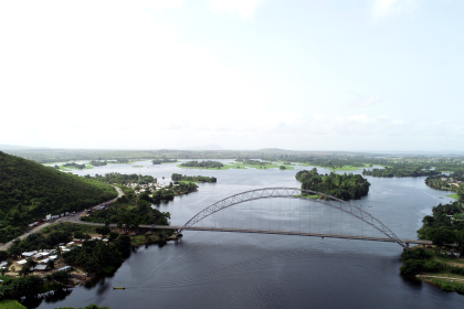
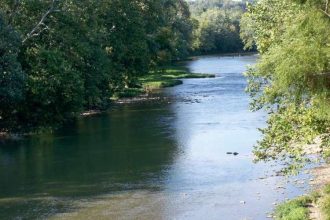
The Tano River, or Rivière Tanoé, is a significant West African river system originating from a town called Traa, a suburb of Techiman, in the Bono East Region of Ghana. It flows approximately 400 kilometers (250 miles) southwest, traversing through Ghana and Ivory Coast, before ultimately discharging into the Ehy, Tendo, and Aby Lagoons, and finally into the Atlantic Ocean. A notable feature of its course is that its lower reaches form the international land boundary between Ghana and Ivory Coast for several kilometers.
The Tano Basin spans a total area of approximately 16,060 square kilometers, with the vast majority, about 93%, located within Ghana, and the remaining 7.4% (1,185 km²) extending into Ivory Coast. Geographically, the basin lies between latitudes 5°00′ N and 7°40′ N and longitudes 1°48′ W and 3°05′ W, primarily covering the western-northern part of Ghana. Topographically, the upstream areas of the basin are characterized by highlands, with average elevations around 540 meters above sea level, particularly near the Boyem Mountain Ranges in the Bono East Region. As the river flows southward, the middle sections drop to about 150 meters, while the southern areas are much flatter, ranging between 0 and 15 meters, with an average elevation of 50 meters above sea level. The Tano River, along with its nine major tributaries including the Boin, Disue, Amama, Abu, Gaw, Suraw, Samre, Totua, and Disri, forms a well-developed drainage network crucial for supporting local ecosystems, agriculture, and livelihoods within the basin area. The Tano River Basin constitutes a major source of domestic water supply from both surface and groundwater for the region.
The Tano River’s role as a transboundary river, with its basin predominantly in Ghana (93%) and a smaller but critical portion in Ivory Coast (7%), underscores the inherent need for bilateral cooperation in its management and protection. This geographical distribution of the basin means that environmental degradation or resource mismanagement originating in Ghana will inevitably have direct consequences for downstream communities and ecosystems in Ivory Coast. For instance, discussions between the two nations have explicitly focused on the damage caused by pollution in the Bia and Tano rivers due to illegal mining (galamsey) activities in Ghana and the measures taken to address these issues. This situation highlights that the health and sustainability of the river system for Ivory Coast are significantly influenced by Ghana’s environmental policies and enforcement, particularly concerning upstream activities. This interdependence necessitates formal bilateral agreements and ongoing dialogue to ensure effective water resource preservation and mitigate shared environmental challenges.
III. Communities Along the Tano River in Ghana
The Tano River plays a central role in the lives of numerous communities across several regions in Ghana, including Bono East, Ahafo, Western North, Western, and Ashanti Regions. These communities depend on the river for various aspects of their socio-economic well-being, from water supply and agriculture to cultural identity. The following table provides a concise overview of key socio-economic indicators for selected communities along the Tano River in Ghana.
Table 1: Key Socio-Economic Indicators for Tano River Communities (Ghana)
| Community Name | Population (Year of Data) | Primary Economic Activities | Key Environmental Challenges | Notable Infrastructure/Public Services |
| Traa | Not specified (Suburb of Techiman) | Agriculture, River-related activities | Illegal mining (galamsey) pollution at source | Limited information, likely shares Techiman’s broader services |
| Techiman | 67,241 (2010) | Agriculture (36%), Trade (70% market revenue), Services/Sales (28.2%) | Illegal mining pollution, water supply contamination | Major road network, Techiman Market, Holy Family Hospital, Senior High School, NHIS |
| Tanoso | Part of Tano North Municipality (99,608 in 2021) | Agriculture, Planned Hydroelectric Plant, Water Treatment | Water pollution (domestic/industrial), recurrent flooding, drought impacts | Planned 56 MW Hydroelectric Plant, Major Water Treatment Plant, Public toilets |
| Goaso | 21,146 (2010) | Agriculture (60%), Hunting, Charcoal production | Forest fires, general river pollution | Ahafo Regional Hospital, Nursing/Midwifery College, Water supply project |
| Jomoro District Communities (e.g., Asukro, Jaway Wharf, Ellenda Wharf, Takinta Wharf, Adusuazo) | 126,576 (2021) | Agriculture, Forestry, Fisheries (39%) | Water hyacinth invasion (fishing/farming disruption), illegal mining pollution, sand winning, slash-and-burn agriculture | District Capital: Half Assini, Poor roads, unreliable utilities, Nzulenzu tourism |
| Samreboi | 28,909 (Current) | Timber & Plywood Production, Logging, Cocoa Farming | Heavy pollution from mining, destruction of cocoa farms | Road and rail upgrades, digital government services |
| Aiyinase | 10,719 (2015) | Farming (coconut, cassava, rubber), Fishing | Water hyacinth invasion, illegal mining pollution | National AI Strategy initiatives, women empowerment projects |
| Elubo | 23,952 (2021) | Cocoa farming, Trade | Groundwater contamination from mining/waste | Road construction, electricity, freight park upgrade, border services |
| Esiama | ~25,000 (Current) | Agriculture, General economic activities of Tano Basin | Pollution from mining/agricultural runoff | Proposed water supply system, energy infrastructure |
| Tano Dumasi / Tano Odumase | 114,989 (Current) | Agriculture (vegetable farming, cocoa), Mining | Water pollution from mining/industrial waste, agricultural runoff | Health center (needs assistance), road improvements |
A. Traa
Traa is a small town identified as a suburb of Techiman, the capital of the Bono East Region in Ghana. Its geographical significance is profound, as it is specifically cited as the origin point or source of the Tano River. The approximate coordinates for Traa are 7° 36′ 40″ N, 1° 54′ 27″ W.
Specific population figures for Traa are not explicitly available in the provided information. However, as a suburb of Techiman, its demographics and economic activities are likely intertwined with those of the larger urban center. Ghana’s national population was projected at 34.43 million in 2024, with a growth rate of 1.85% and a significant urban population of nearly 60%. Given Techiman’s predominantly rural economy with a strong agricultural base , it can be inferred that Traa’s local livelihoods also revolve around agriculture and potentially river-related activities, considering its position at the river’s source.
The source of the Tano River holds immense cultural and historical significance for the indigenous Bono people. Local beliefs hold that Taakora, revered as the highest of the Bono gods on Earth, resides at the river’s origin. This spiritual connection imbues the Tano River with profound cultural importance for the broader Akan and Ashanti people, symbolizing the vital link between humanity and the natural world, as well as representing fertility and sustenance. The river is personified and worshipped, playing a central role in their understanding of nature and spirituality.
Despite its sacred status, the Tano River, even at its source near Traa, has been severely impacted by illegal mining, locally known as galamsey. Reports indicate the river at this point exhibits a “brownish yellow” color, rendering it unhealthy for consumption. This environmental degradation at the very origin of a river considered sacred by indigenous beliefs represents a profound conflict between traditional cultural reverence for nature and contemporary extractive economic practices. This situation highlights a breakdown in traditional environmental stewardship in the face of economic pressures, with significant implications for both cultural heritage and ecological health. The fact that a site of such spiritual importance is visibly desecrated by human activity points to a contradiction between the cultural value placed on the river and the actual environmental practices. This suggests that economic motivations are overriding traditional spiritual and environmental ethics, leading to not only ecological damage but also a potential erosion of cultural identity and traditional governance systems that historically protected such sacred natural resources. No specific details regarding infrastructure and public services for Traa are provided, but its status as a suburb suggests it would benefit from Techiman’s broader regional infrastructure.
B. Techiman
Techiman serves as the capital town of the Bono East Region and is the city from which the Tano River flows. The Tano basin originates within the forest in Pooyem, approximately 4 kilometers from Techiman. The city is a significant commercial hub, strategically positioned at the crossroads of major trunk roads connecting Sunyani, Kumasi, Wa, and Tamale.
As of the 2010 census, Techiman had a population of 67,241 people. The city’s demographic composition includes a majority of ethnic groups such as Akan, Bono, Gonja, Dagomba, Sisala, and Mamprusi. A significant portion of the population, approximately 95%, identifies with a religion, with Christianity being the most prevalent (69.5%), followed by Islam (27.4%), and traditional African religions (0.9%). Techiman has experienced rapid growth, leading to increased demand for land and housing, and a shift from compound housing to more detached residential structures.
The economy of Techiman is primarily rural, with agriculture being the dominant employing sector, accounting for about 36% of the population. Approximately 44% of households in the city are involved in crop and/or livestock production, with farming practices focused on improving land use.
Trade constitutes another major economic activity, largely centered around the Techiman market, which is recognized as one of the largest outdoor agricultural markets in West Africa. This market alone generates 70% of the metropolitan’s revenues and is renowned for trading food items such as plantains, cassava, grains, and yams, primarily marketed by female traders. The city’s strategic location on major trunk roads facilitates high trade volumes, further bolstering its economic role. Additionally,
non-governmental organizations (NGOs) contribute to the local economy, with examples such as Agrico Hub, which partnered with Ghana Tech Lab for a digital media start-up summit, and the Rural Initiators and Motivators Development Association (RIMDA), focusing on social development.
Techiman holds significant cultural and historical importance as the center of the Akan people, possessing a unique ethnic heritage. The Tano River and its associated deity, Ta Kora (or Tano), are deeply embedded in Akan and Ashanti mythology, symbolizing water, fertility, and even war. The solemn maxim, “From the river whose fish we do not eat, we do not [even] take a [gold] nugget,” illustrates the profound reverence for the Tano River and Ta Kora among the Asante people. Traditional festivals celebrate the river’s vital role in agriculture and community well-being, reinforcing cultural ties and ancestral traditions.
The Tano River in the Techiman area is heavily polluted by illegal mining (galamsey) activities, rendering the water unhealthy for consumption. This pollution directly impacts the river’s capacity to serve as a reliable water source for the community. Techiman’s economic reliance on agriculture and trade, coupled with its direct dependence on the Tano River for water supply, creates a significant vulnerability to the ongoing pollution from illegal mining. The market’s role in stabilizing food prices is undermined if agricultural productivity is threatened by water scarcity or contamination. This situation creates a feedback loop where environmental degradation directly sabotages economic stability and public health, potentially leading to increased food insecurity and heightened health burdens for the population. This underscores the urgent need for effective interventions against galamsey that consider the entire socio-economic fabric of the region.
In terms of infrastructure and public services, Techiman benefits from:
- Water Supply: The Tano River Basin is a major source of domestic water supply for Techiman. The Ghana Water Company Limited (GWCL) operates dams along the Tano River to treat and distribute drinking water to over 2.4 million people in the Bono, Bono East, Ahafo, and Western Regions, which includes Techiman.
- Sanitation: Public toilets, including water closets (WCs), Kumasi ventilated improved pit latrines (KVIPs), and VIPs, are available. However, their poor maintenance often discourages usage, contributing to open defecation practices.
- Transport: Techiman’s status as a commercial hub is supported by its strategic location at the crossroads of major trunk roads, including the N10, which facilitates high trade volumes between cities like Sunyani, Kumasi, Wa, and Tamale.
- Education: The city is home to Techiman Senior High School.
- Healthcare: Healthcare services are managed by the Regional Health Directorate (RHD), with the Techiman Holy Family Hospital serving as the main facility. Techiman also boasts one of Ghana’s best National Health Insurance Schemes.
- Housing: Rapid urban growth has led to an increased demand for land and housing, resulting in a shift towards detached housing, though traditional chiefs retain ownership of most property.
- International Relations: Techiman maintains a sister city relationship with Tuscaloosa, Alabama, established in 2011.
C. Tanoso
Tanoso is located in the Brong-Ahafo Region of Ghana. It holds a significant position along the Tano River, as the river is navigable from its mouth for approximately 60 miles (95 km) up to Tanoso, where further upstream travel is impeded by the Sutre Falls. This geographical feature historically positions Tanoso as a key point for river navigation. Its approximate coordinates are 6.7003, -1.6843.
Specific population figures for Tanoso itself are not directly available in the provided information. However, it is situated within the Tano North Municipal, which had a projected population of 99,608 in 2021, with a nearly equal distribution between urban and rural populations. Tanoso was also one of five communities selected for household surveys due to its close proximity to the Tano River, indicating a strong interaction between the community and the water body.
The economic activities in Tanoso are diverse and significant. The town is the site of a planned hydroelectric power plant, with a nameplate capacity of 56 MW (comprising 2 x 28 MW turbines) and a planned commissioning year of 2028, under the ownership of the Volta River Authority. Furthermore, the Tano River system, with dams located at Tanoso, Sefwi Wiawso, and Elubo, is crucial for supplying treated drinking water to over 2.4 million people across the Bono, Bono East, Ahafo, and Western Regions of Ghana. The Tano North Municipality, encompassing Tanoso, is largely agrarian, possessing vast arable land suitable for the cultivation of both cash and food crops. The area is also endowed with substantial deposits of white and red clay within the Tano River basin, suggesting potential for related industries.
Culturally, Tanoso is of considerable importance as it hosts one of the significant shrines dedicated to Ta Kora, the Akan Abosom (deity) of the Tano River. This shrine, often referred to as “Tano fu fuo” (white Tano) at Tanoboase (a village closely associated with Tanoso and named after Ta Kora), is considered the head of all other Atano shrines, highlighting its profound spiritual significance within Akan traditions. Various rituals, music, and taboos are associated with Ta Kora and the river, reflecting a deep-seated reverence for the deity and the water body.
The Tano River in the Tanoso area faces environmental challenges, including pollution from domestic and industrial discharges. The river experienced a significant contamination event in January 2020 when a truck carrying sulfuric acid plunged into it, though it has since been reported as restored to its natural state. Drought patterns within the Tano Basin, including the Tanoso area, suggest a potential impact of climate change on agricultural production and the vital drinking water supply. Recurrent flooding is also a concern in the Tano River Basin. The presence of a major planned hydroelectric plant and a critical water treatment facility in Tanoso, juxtaposed with recurrent flooding, drought, and pollution , highlights a significant vulnerability of essential public services to environmental stressors. This implies that climate change and human activities directly threaten the region’s energy security and public health, particularly affecting the 2.4 million people who rely on this water supply. This creates a complex challenge where development, such as hydroelectric power and water supply infrastructure, is essential, but its sustainability is jeopardized by environmental factors. It underscores the need for robust climate adaptation strategies, effective pollution control measures, and resilient infrastructure planning to ensure continued service delivery and prevent widespread public health crises and energy insecurity.
Regarding infrastructure and public services:
- Water Supply: Tanoso is a crucial location for water treatment and distribution by GWCL, serving millions of people. Primary sources of water for households include piped water from GWCL (36%) and borehole water (30.75%).
- Sanitation: Public toilets are widely used, but poor maintenance often leads to their deplorable condition, which discourages usage and contributes to open defecation.
- Energy: The town is the site of a planned 56 MW hydroelectric plant.
D. Goaso
Goaso is the capital of the Ahafo Region in Ghana. Its geographical landscape is characterized by gently undulating lowlands that are drained by three major rivers: the Tano, Anum, and Go. This indicates the Tano River’s direct influence on the town’s hydrology and surrounding environment.
According to the 2010 census, Goaso had a population of 21,146. The broader Ahafo Region, where Goaso is located, recorded a total population of 564,668 in the 2021 census.
Agriculture dominates Goaso’s economy, employing approximately 60% of the population. Key cash crops cultivated in the area include cocoa, cassavas, maize, and plantains. The dense forest area surrounding Goaso is also important for the
hunting and charcoal production sectors of its economy. Furthermore, the wider Ahafo Region is known for abundant gold deposits in areas such as Mim, Kenyasi, and Yamfo.
Oral traditions recount that Goaso, originally known as Goaso Krodadaamu, was initially settled near the Goa River, but residents later relocated uphill to the town’s current site due to “occurring issues” related to living near the river. The town celebrates its traditions and its historical role for the Golden Stool through the bi-annual Abetiase festival. While the provided information does not directly link Goaso’s specific cultural practices to the Tano River deity Ta Kora, the general cultural significance of the Tano River for the Akan people implies a broader cultural connection within the region, given that Goaso is drained by the Tano.
The exploitation of forest resources for hunting and charcoal production has led to an increased risk of forest fires in the Goaso area. The Tano River, which is part of Goaso’s drainage system, is also susceptible to pollution from various anthropogenic activities occurring throughout the basin.
In terms of infrastructure and public services:
- Healthcare: The Ahafo Regional Hospital, with 118 beds, serves as the primary hospital for Goaso and the entire Ahafo Region, attending to approximately 60,000 patients annually.
- Education: Goaso is home to several educational institutions, including the Goaso Nursing and Midwifery Training College and Ahafoman Senior High.
- Water Supply: A significant GHC50 million water supply project was initiated in 2023 to address water crises in Goaso, with the aim of serving over 100,000 people upon its completion within two years. The Tano River is one of the sources for water supply in the Ahafo Region.
- Government: Goaso functions as the capital of both the Asunafo North Municipal District and the Ahafo Region.
E. Jomoro District Communities
The Jomoro Municipal District, also known as Nzema West Municipal District, is situated in the Western Region of Ghana, positioned between latitudes 4° 80ʹ N and 5° 21ʹ N and longitudes 2° 35ʹ W and 3° 07ʹ W. It holds the distinction of being the westernmost district along Ghana’s coast. The Aby-Tano Lagoon, a critical part of the Tano River’s discharge system, is located in the southwestern portion of the Jomoro District. The Tano River itself flows into the broader Aby Lagoon complex, which also encompasses Tendo Lagoon and Ehy Lagoon, a system that straddles the international border between Ghana and Ivory Coast.
Specific communities identified within the Jomoro District that are directly located along the River Tano or the Aby-Tano Lagoon include Asukro (along the Abby-Tano Lagoon), Jaway Wharf (along the Abby-Tano Lagoon), Ellenda Wharf (along the River Tano), Takinta Wharf (along the River Tano), and Adusuazo (along the River Tano).
The Jomoro District had a population of 126,576 in 2021 , and a population of 150,107 in 2010. The population has experienced significant growth over the past four decades.
The economic activities in the Jomoro District are heavily reliant on its natural resources. The majority of employed individuals (aged 15 and above) are engaged in skilled agriculture, forestry, and fisheries, accounting for 39.0% of the workforce, with a higher proportion of males (46.5%) in these sectors. Given the abundance of wetlands and freshwater bodies,
canoe-fishing is a particularly vital livelihood for many residents. Around the Aby Lagoon, agriculture and fishing are the main economic pursuits. Primary crops cultivated in the surrounding area include coconut, oil palm, banana, cocoa, and coffee.
The communities in Jomoro District face significant environmental challenges:
- Water Hyacinth Invasion: This invasive species poses a severe threat in the Tano River and Abby-Tano Lagoon. It severely disrupts fishing activities by blocking access to fishing grounds, causing delays, silting traps, and leading to reduced fish supply and diminished profits for fishermen and traders. The invasion also negatively affects smallholder farming, leading to the destruction of farm produce, increased travel time for farmers, and in some cases, the abandonment of farms. Furthermore, the weed impacts livestock by covering grazing land and potentially causing disease. The dual impact of water hyacinth on both fishing and agriculture in the Jomoro District communities illustrates how a single environmental issue can create cascading socio-economic problems, leading to reduced income, food insecurity, and even displacement for reliant communities. This highlights the urgent need for integrated ecosystem management that addresses invasive species as a direct threat to multiple livelihood strategies.
- Illegal Mining Impacts: Pollution from illegal mining (galamsey) in the broader Tano River basin also contributes to water quality degradation in the lower reaches and associated lagoons.
- Other Challenges: Commercial sand winning in coastal areas and the practice of slash-and-burn agriculture further contribute to environmental degradation within the district.
Despite these challenges, some conservation efforts are in place. The Ehotilé Islands within the Aby Lagoon are protected as Îles Ehotilés National Park, established in 1974, and are also part of the Ramsar site of Iles Ehotilé-Essouman. This indicates a level of protected status for critical parts of the lagoon system.
Regarding infrastructure and public services, the district capital is Half Assini. However, the district faces several challenges, including poor infrastructure, particularly roads leading to tourism sites, a lack of qualified human resources for tourism management, unreliable electricity and water supply, and undependable transport services to coastal communities.
F. Samreboi
Samreboi is a town located in the Amenfi West area of the Western Region of Ghana. It is directly connected to the Tano River, which serves as a vital water source for its residents. Samreboi is also a significant center for the timber industry.
As of current data, Samreboi has a population of approximately 28,909 people, with about 20 surrounding villages.
The economy of Samreboi is heavily influenced by the timber and plywood production sector, notably through the presence of Samartex Timber & Plywood Company Limited.
Logging and timber processing are major industries in the area. Additionally,
cocoa farming is practiced, though it faces challenges from mining activities. Agriculture is a primary economic activity throughout the Tano River Basin.
The Tano River in Samreboi is heavily polluted, primarily due to illegal mining (galamsey) activities. Reports indicate that mining companies have caused significant destruction by cutting down large hectares of cocoa farms and discharging “washing” waste directly into the river. This pollution is so severe that it can be traced from upstream areas like Sefwi Wiawso down to Samreboi. The conversion of dense forest to open forest, cropland, and settlements is a major land-use change pattern in the Tano basin, further endangering vegetation and complicating natural resource management.
In terms of infrastructure and public services, Ghana is undertaking a $10 billion ‘Big Push’ infrastructure strategy, with a focus on strengthening road and rail networks to improve mobility and trade connectivity. The Ghana Infrastructure Investment Fund (GIIF) is mandated to mobilize and provide financial resources for infrastructure projects, often partnering with the private sector. The government is also actively digitizing public services, with over 16,000 government services planned to be accessible online via the upgraded Ghana.Gov platform, aiming to improve delivery, transparency, and efficiency.
G. Aiyinase
Aiyinase, also known as Nzema Aiyinase, is a town situated in the Ellembele District of the Western Region of Ghana. It is located approximately 90 kilometers from Sekondi-Takoradi, the regional capital and port city. Aiyinase is within the broader Tano River catchment area.
As of 2015, Aiyinase had a population of 10,719 people.
The economy of Aiyinase is primarily agricultural, with the main occupation being farming. The area is well-known for its coconut, cassava, and rubber plantations.
Fishing is also a major livelihood activity for communities along the Tano River and the Aby-Tano Lagoon in the Western Region.
Aiyinase faces significant environmental challenges, particularly from the invasion of water hyacinth, which severely impedes fishing activities and reduces income for those dependent on these livelihoods. Pollution from
illegal mining (galamsey) in the broader Tano River basin also contributes to water quality degradation, making the river unhealthy for consumption and fish.
In terms of infrastructure and public services, Ghana is investing in its digital infrastructure as part of a National AI Strategy, aiming to transform various sectors including agriculture, healthcare, logistics, smart cities, and financial inclusion. This strategy emphasizes building robust digital infrastructure to support high-volume data processing and cloud-based innovation. Additionally, initiatives like the “Women Empowerment (WE)” project, in collaboration with Adamus Resources Limited, aim to provide valuable skills for self-sufficiency to women in the Ellembelle District, which includes Aiyinase.
Culturally, the people of Aiyinase are believed to have migrated from the southern part of Ghana. They celebrate the Kundum festival annually in October, a tradition used to express gratitude to their ancestors for abundant food during harvest season. The town is also home to the professional football club Karela United FC, indicating a strong local passion for sports.
H. Elubo
Elubo is a town located in the Jomoro District of the Western Region of Ghana, positioned near the international border with Ivory Coast. It is a crucial point along the Tano River system, as dams at Elubo are part of the infrastructure used by the Ghana Water Company Limited (GWCL) to treat and distribute drinking water to over 2.4 million people in the Bono, Bono East, Ahafo, and Western Regions. The Tano River itself forms the last few kilometers of the international land boundary before flowing into the Aby-Tano-Ehy Lagoon complex in Ivory Coast.
According to the 2021 census, Elubo has a settlement population of 23,952 people.
Elubo is primarily known as a cocoa-growing town. Its economic activities and living conditions have significantly improved following the construction of roads and the extension of electricity, which facilitated the transport of farm produce to markets like Elubo. Groundwater also plays a key role in the local economy and livelihoods. Elubo is a key transit point along the Western corridor, with a freight park supporting trade.
The town faces environmental challenges related to water quality. Mining activities, urbanization, and improper disposal of sewage and household wastewater are known to affect the chemical composition of groundwater in the Lower Tano River basin, which includes Elubo.
In terms of infrastructure and public services:
- Roads and Electricity: The construction of roads and extension of electricity in 1999 significantly improved economic activities and living conditions, enabling farmers to transport their cocoa produce to Elubo for sale and access medical attention. The Agona Junction-Elubo Road is part of the Trans West-African Highway Network, fostering economic development and regional trade.
- Freight and Border Services: The Elubo Freight Park is undergoing an upgrade through a Public-Private Partnership (PPP) to enhance facilities like accommodation, eateries, and office spaces for transit truck drivers, aiming to improve trade and decongest the border. Elubo serves as a key land border for steady regional traffic.
- Water Supply: As mentioned, dams along the Tano River at Elubo are crucial for supplying treated drinking water to millions across the region.
- Challenges: Despite improvements, poor road conditions can still impede agricultural production, retard access to gainful employment, and hinder the delivery of basic services such as education, health, water, and sanitation.
I. Esiama
Esiama is a major town located in the Ellembelle District of the Western Region of Ghana. Its coordinates are approximately 4°55’58.0”N and 2°20’49.0”W, with an elevation of 18 meters. Esiama is situated within the Tano River Basin, with the upper part of the basin from Esiama to Salman falling within significant geological formations.
Esiama has a population of about 25,000 people. The broader Ellembelle District had a population of 120,893 in 2021.
Specific economic activities for Esiama are not explicitly detailed in the provided information. However, given its location within the Tano Basin, its economy likely aligns with the general socio-economic activities of the basin, which include agriculture, forestry, mining, tourism, and fisheries.
Environmental challenges in the Tano River Basin, which would affect Esiama, include pollution from mining activities, industrial wastes, and agricultural runoff.
In terms of infrastructure and public services:
- Water Supply: The Canadian Government is in discussions with the Ghanaian Government to support the construction of a water supply system for Esiama and parts of the Western Region.
- Energy Infrastructure: A reliable and robust national energy infrastructure is recognized as crucial for economic growth and general well-being in Ghana, with Esiama being part of the areas considered for such development.
- Transportation: Esiama is included in the schematic layout of the proposed Sekondi-Takoradi metro railway network, indicating future transport infrastructure development.
- Government Commitment: The Government of Ghana is committed to prudent management and accountability in public service to ensure effective and efficient delivery of services, including significant resources for development interventions aimed at improving living standards.
J. Tano Dumasi / Tano Odumase
Tano Dumasi is a town located in the Atwima Mponua District of the Ashanti Region, Ghana. It is also known as Tano Odumase or simply Odumase. The Tano River itself flows through the Ashanti Region.
Tano Dumasi has a population of 114,989 people.
The economy in the area is heavily dominated by the agricultural sector, which employs about 61.7% of the working population in the Tano South District (a related area in the Tano Basin). Farmers along the stretches of the Tano River engage in
dry season vegetable farming utilizing small-scale irrigation facilities. Cocoa is a significant crop, contributing about 80% of the total crop sub-sector activities. However,
mining activities also occur in the Tano Basin, impacting water quality.
The Tano River basin faces environmental challenges from the indiscriminate discharge of untreated mining and industrial wastes, coupled with runoff from agricultural lands, which significantly contribute to contaminant concentrations in water bodies.
In terms of infrastructure and public services:
- Roads: The Tano South Municipal Assembly (a related district) has inaugurated a Districts Roads Improvement Programme (DRIP) to facilitate road construction and maintenance, aiming to enhance the transportation of goods and services, particularly for farmers.
- Healthcare: The Tano-Odumase Anglican Health Centre, while serving as the second-biggest health facility in the Atwima Mponua District, faces significant challenges. It has seen little renovation since its establishment, lacks electricity, an ambulance, or other transport for emergencies, and struggles with medical supplies due to irregular health insurance payments.
- Local Governance: The Atwima Mponua District has various departments, including Health, Agriculture, and Works, responsible for public services. Ghana is generally investing in infrastructure to support economic growth and improve public services.
IV. Communities Along the Tano River and Associated Lagoons in Ivory Coast
The Tano River’s journey culminates in a complex lagoon system on the coast of Ivory Coast, forming a vital ecological and economic zone. These lagoons, including Ehy, Tendo, and Aby, are interconnected and play a crucial role in supporting the livelihoods of the Ivorian communities situated along their shores. The following table provides a concise overview of key socio-economic indicators for selected communities along the Tano River and its associated lagoons in Ivory Coast.
Table 2: Key Socio-Economic Indicators for Tano River Communities (Ivory Coast)
| Community Name | Population (Year of Data) | Primary Economic Activities | Key Environmental Challenges | Notable Infrastructure/Public Services |
| Adiaké | Sub-prefecture: 50,556 (2021); Town: 19,055 (2014) | Agriculture, Fishing (around Aby Lagoon) | Lagoon pollution (untreated effluents) | Departmental seat, focus on water supply improvement |
| Nouamou | Sub-prefecture: 19,148 (2014); Town: 2,135 (2014) | Agriculture, Fishing (around Aby Lagoon) | Potential for environmental impact from agriculture | Developed transport system, efforts to improve water/public services |
| Nougoua | 5,380 (2014) | Agriculture, Fishing (inferred) | Not specified, likely similar to regional issues | General Ivorian infrastructure development, digitalization of services |
| Noé | Sub-prefecture: 27,938 (2014); Town: 9,411 (2014) | Agriculture, Fishing (inferred) | Not specified, likely regional issues | Transport infrastructure, water supply, digital services |
| Frambo | Not specified | Agriculture (cocoa, coffee, timber, rubber, palm oil, cashew), Oil & Gas | Not specified, likely regional issues | General Ivorian infrastructure development |
| Ehania | Ehanian-Tanoé: 997 (2014) | Agriculture (small-scale farming, cocoa, coffee, banana, rubber, palm oil, pineapple) | Not specified, likely regional issues | Rural infrastructure projects (roads, schools, health facilities) |
| Tiapoum | Sub-prefecture: 25,072 (2014) | Agriculture, Secondary & Tertiary sectors (agro-processing, manufacturing, trade) | Not specified, likely regional issues | Transport infrastructure, water supply, digital services, agricultural value chain projects |
A. Adiaké
Adiaké is a town, sub-prefecture, and commune located in southeastern Ivory Coast, specifically on the western shore of Aby Lagoon. It is an administrative center, serving as the seat of the Adiaké Department within the Sud-Comoé Region, Comoé District. The Aby Lagoon complex, which Adiaké borders, receives significant inflows from the Tano River, making it an integral part of the larger Tano River system.
As of the 2021 census, the population of the sub-prefecture of Adiaké was 50,556. The town of Adiaké itself had a population of 19,055 in the 2014 census. The sub-prefecture encompasses numerous smaller villages, including Aboutou (1,722), Kacoukro (8,081), and Djiminikoffikro (2,898), reflecting a dispersed settlement pattern around the lagoon.
While specific economic activities solely for Adiaké are not detailed , the main economic activities around the Aby Lagoon are
agriculture and fishing. The primary crops cultivated in the surrounding area include coconut, oil palm, banana, cocoa, and coffee, indicating a strong agricultural base. Fishing in the Ivorian lagoons is largely dominated by Ivorian communities, particularly the Adjoukrou ethnic group, with bonga shad (Ethmalosa fimbriata) constituting a significant portion (60-80%) of the fish catch.
The Aby Lagoon, while economically vital, is affected by pollution stemming from untreated industrial effluents and sewage discharged from nearby urban areas. However, significant conservation efforts are also evident within this system. The
Ehotilé Islands located within the Aby Lagoon are protected as Îles Ehotilés National Park, an initiative established in 1974 by local communities, and they also form part of the Ramsar site of Iles Ehotilé-Essouman. This indicates a substantial level of protected status for critical biodiversity areas within the lagoon complex. The Aby Lagoon, which Adiaké borders, serves as a vital economic hub for fishing and agriculture, yet it simultaneously faces pollution from urban and industrial sources. The existence of protected areas like Îles Ehotilés National Park within this context highlights a critical tension between economic development and environmental preservation in coastal lagoon systems. This situation points to the need for integrated coastal zone management plans that can effectively balance resource exploitation with the maintenance of ecological integrity. The challenge lies in achieving sustainable development that supports livelihoods without compromising the ecological health of the lagoon. This necessitates stronger enforcement of environmental regulations, investment in wastewater treatment infrastructure, promotion of sustainable fishing and agricultural practices, and potentially the development of eco-tourism initiatives that leverage the protected areas to diversify the economy while incentivizing conservation.
In terms of infrastructure and public services, Adiaké is the seat of the Adiaké Department. While specific infrastructure details for Adiaké itself are not extensively provided , Ivory Coast as a nation has notably invested in its transport infrastructure, including roads, waterways (lagoons), and airports. The Ivorian government is also actively focused on improving access to drinking water for communities and promoting sustainable water resource management across the country.
B. Nouamou
Nouamou is a town and sub-prefecture located in southeastern Ivory Coast, falling under the Tiapoum Department within the Sud-Comoé Region, Comoé District. It is identified as one of the settlements situated around the extensive Aby Lagoon complex, which receives waters from the Tano River. The approximate coordinates for Nouamou are 5°11′N 2°54′W.
In 2014, the population of the sub-prefecture of Nouamou was recorded as 19,148, with the town of Nouamou itself having a population of 2,135 in the same year. The national population of Ivory Coast was estimated at 32.7 million in 2024, with a notable annual growth rate of 2.5%.
While specific economic activities for Nouamou are not explicitly detailed , its proximity to the Aby Lagoon suggests that its primary economic activities are likely similar to those of other communities in the region, namely
agriculture and fishing. Ivory Coast’s national economy is heavily reliant on its agricultural sector, with almost 70% of the Ivorian population engaged in some form of agricultural activity. The country is a global leader in the production and export of cocoa beans, and a significant producer of palm oil, coffee, and rubber.
Ivory Coast has made substantial investments in its transport system, encompassing roads, railways, and maritime/lagoon transport, which would benefit communities like Nouamou through improved connectivity. There are ongoing governmental efforts to increase the supply of drinking water to communities and support sustainable water resource management across the nation. Additionally, the Ivorian government is actively modernizing its public administration through digitalization initiatives. While Ivory Coast exhibits robust economic growth and is a major agricultural producer , the high percentage of the population engaged in agriculture (68-70%) and the reported “extreme wealth inequality and over half of the coast remains in poverty” suggest that economic benefits are not evenly distributed. This disparity, coupled with the country being a top destination for migrants in West Africa , implies that communities like Nouamou, heavily reliant on agriculture and fishing, may experience both the advantages of a growing national economy (e.g., infrastructure investment) and the persistent challenges of poverty, informal labor, and internal/regional migration pressures. This highlights the need for inclusive economic development strategies that specifically target rural and coastal communities, ensuring that the benefits of agricultural exports translate into improved living standards and reduced poverty for those directly involved in primary production, rather than exacerbating existing inequalities or creating new social pressures due to migration.
C. Nougoua
Nougoua is a village located in southeastern Ivory Coast, specifically on the right bank of the Tanoe or Tendo River. Its location holds historical significance in the context of the international land boundary between Ghana and Ivory Coast. Historical border agreements explicitly mention Great Britain’s consent to recognize Nougoua as belonging to France (now Ivory Coast), emphasizing its role in the colonial demarcation of the region. Nougoua is also listed as one of the eight villages within the sub-prefecture of Noé. Its approximate coordinates are 5°17′N 2°48′W, as it is part of the Noé sub-prefecture.
In 2014, the population of Nougoua was recorded as 5,380.
Specific economic activities for Nougoua are not detailed in the provided information. However, given its location along the Tano River and its proximity to the Aby Lagoon complex, it is reasonable to infer that the community likely shares similar
agricultural and fishing livelihoods with other riparian communities in the region. Ivory Coast’s economy is largely market-based and heavily dependent on the agricultural sector, with robust economic growth driven by investment and domestic consumption.
No specific infrastructure details for Nougoua are provided. However, Ivory Coast generally possesses a developed transport system, and there are ongoing national efforts to improve public infrastructure, including access to drinking water and digitalization of public services. Nougoua’s specific mention in historical border agreements underscores the complex geopolitical history of the region and how colonial-era demarcations directly influenced the identity and administrative affiliation of communities along the Tano River. This historical context suggests that cross-border cooperation and resource management, such as discussions on transboundary water systems , must navigate not only current environmental and economic realities but also deeply rooted historical agreements and community perceptions of belonging. The historical layering adds complexity to modern transboundary resource management. Cooperation efforts between Ghana and Ivory Coast regarding the Tano River must acknowledge these historical divisions and their potential impact on local community engagement and resource sharing, ensuring that solutions are culturally sensitive and practically implementable across a historically divided landscape.
D. Noé
Noé is a town and sub-prefecture located in southeastern Ivory Coast, approximately one kilometer east of the border with Ghana. It is part of the Tiapoum Department within the Sud-Comoé Region, Comoé District. Noé is situated along the Tanoe or Tendo River, which forms part of the international boundary between Ghana and Ivory Coast.
In 2014, the population of the sub-prefecture of Noé was 27,938, with the town of Noé itself having a population of 9,411. The sub-prefecture includes several villages, such as Ehanian-Tanoé and Nougoua.
Specific economic activities for Noé are not explicitly detailed. However, given its location along the Tano River and its proximity to the Aby Lagoon complex, it is reasonable to infer that the community likely shares similar agricultural and fishing livelihoods with other riparian communities in the region. Ivory Coast’s economy is heavily dependent on agriculture, with significant production of cash crops like cocoa, coffee, and timber.
Environmental challenges specific to Noé are not provided. However, general environmental issues in Ivory Coast include deforestation, air and water pollution, and biodiversity loss.
In terms of infrastructure and public services, Ivory Coast has invested significantly in its transport system, including roads, railways, and maritime/lagoon transport, which would benefit communities like Noé through improved connectivity. The Ivorian government is also actively focused on improving access to drinking water for communities and promoting sustainable water resource management across the country. Digitalization initiatives are underway to modernize public administration and make public services more accessible. Road infrastructure projects are being implemented to rehabilitate and expand the network.
E. Frambo
Frambo is a village located in the far southeast of Ivory Coast, within the sub-prefecture of Tiapoum, Tiapoum Department, Sud-Comoé Region, Comoé District. While not explicitly stated as directly on the Tano River, its location within the Tiapoum sub-prefecture, which itself sits on the Tano River , implies a close connection to the river system and the Aby Lagoon complex into which the Tano flows.
Specific population figures for Frambo are not provided. The national population of Ivory Coast was 31.3 million in 2023.
Specific economic activities for Frambo are not detailed. However, Ivory Coast’s economy is heavily reliant on agriculture, being a leading producer and exporter of cocoa, coffee, timber, rubber, palm oil, and cashew nuts.
Oil and gas production have also become increasingly important economic drivers.
Environmental challenges specific to Frambo are not mentioned. General environmental issues in Ivory Coast include deforestation and pollution.
In terms of infrastructure and public services, specific details for Frambo are not available. However, Ivory Coast has seen significant investments in its infrastructure, including roads, bridges, and public buildings, contributing to GDP growth. Projects like the Abidjan metro aim to improve urban mobility. There are also projects related to energy infrastructure, such as thermal power plants and solar plants.
F. Ehania
Ehania, specifically “Ehanian-Tanoé,” is listed as one of the villages within the sub-prefecture of Noé. This directly links it to the Tanoé River.
In 2014, the population of Ehanian-Tanoé was 997.
Specific economic activities for Ehania are not detailed. However, agricultural activities are undertaken almost completely on small-scale farms in Ivory Coast, with an average area of 4 hectares. Key crops include
cocoa, coffee, banana, rubber, palm oil, and pineapple. The forest zone, where Ehania is located, is the most populated area due to its suitability for agriculture.
Environmental challenges specific to Ehania are not provided. However, general environmental issues in Ivory Coast include deforestation, air and water pollution, and biodiversity loss.
In terms of infrastructure and public services, specific details for Ehania are not available. However, Ivory Coast is undertaking projects to upgrade and climate-proof strategic and non-strategic roads in various regions, including those that improve access to schools, health services, and centers of economic activity in rural areas. There are also efforts to address housing shortages, particularly in the Greater Abidjan area, through the construction of affordable housing units.
G. Tiapoum
Tiapoum is a town, sub-prefecture, and commune located in southeastern Ivory Coast. It is notable for sitting on the
north shore of the Tano River, where the river forms part of the international border between Ivory Coast and Ghana. Tiapoum is the seat of the Tiapoum Department within the Sud-Comoé Region, Comoé District.
In 2014, the population of the sub-prefecture of Tiapoum was 25,072.
Specific economic activities for Tiapoum are not explicitly detailed. However, Ivory Coast’s economy is experiencing growth driven by its secondary and tertiary sectors, though agriculture remains significant. The country is a major producer and exporter of
cocoa, rubber, cashew, gold, and petroleum. Projects to support local initiatives in
agricultural value chains (such as cassava, oil palm, and pepper) are underway in the South Comoé region, which includes Tiapoum.
Environmental challenges specific to Tiapoum are not mentioned. General environmental issues in Ivory Coast include deforestation, air and water pollution, and biodiversity loss.
In terms of infrastructure and public services:
- Transport: Ivory Coast has invested remarkably in its transport system, including roads, railways, and maritime/lagoon transport. The Ministry of Equipment and Road Maintenance is responsible for the design, construction, and maintenance of road networks, as well as air, rail, sea, river, and lagoon infrastructures. Urban development projects include road construction and traffic management.
- Water and Sanitation: The Ministry of Equipment and Road Maintenance is also involved in the design and implementation of public water carriage, village water points, and improved hydraulic projects in villages.
- Social Infrastructure: Slum upgrading programs include primary schools, health centers, and community facilities. There are also projects for the construction of pre-school and primary schools in each district of the municipality.
V. Cross-Cutting Themes and Regional Overview
A. Transboundary Water Management and Cooperation
The Tano River Basin is a critical transboundary river system shared by Ghana and Ivory Coast. Ghana encompasses approximately 93% of the basin, while Ivory Coast holds the remaining 7%. The Tano River also forms the last few kilometers of the international land boundary between the two nations.
Given this shared resource, discussions between Ghana and Ivory Coast have focused on preserving transboundary water systems, particularly addressing the severe pollution in the Bia and Tano rivers caused by illegal mining (galamsey) activities. Ghana’s Minister of Water and Forests has emphasized the imperative for conscious efforts to tackle sanitation, water, and broader environmental challenges affecting both countries.
The highly skewed distribution of the Tano River basin, with 93% in Ghana and only 7% in Ivory Coast, implies that while Ghana bears the primary responsibility for managing the majority of the basin and its upstream activities, Ivory Coast remains highly vulnerable to Ghana’s environmental practices, particularly illegal mining. This asymmetry creates an imbalanced dependency where Ivory Coast’s water quality and associated livelihoods are largely influenced by Ghana’s environmental governance. Effective transboundary water management therefore requires more than just discussions; it demands concrete, enforceable agreements and a strong commitment from Ghana to control its upstream pollution sources. The benefits of such efforts would accrue to both nations, fostering regional stability and shared environmental health.
B. Socio-Economic Dynamics Across the Basin
Across both Ghana and Ivory Coast, agriculture and fishing stand as the predominant economic activities, employing a substantial portion of the population in communities along the Tano River and its associated lagoons. Key crops include cocoa, plantain, cassava, oil palm, banana, coffee, and rubber, reflecting the region’s rich agricultural potential.
These livelihoods are, however, highly sensitive and vulnerable to environmental changes, particularly fluctuations in water quality, water availability, and the spread of invasive species like water hyacinth. The reliance on rain-fed agriculture and river-based livelihoods across the Tano Basin makes communities highly susceptible to climate variability, including changes in rainfall patterns and an increased frequency of droughts and floods. This indicates that climate change is not a distant threat but an immediate driver of livelihood insecurity. Consequently, there is a clear need for climate-smart agricultural practices and diversified economic opportunities to build community resilience against these environmental shifts. Fluctuations in water availability and extreme weather events directly threaten agricultural productivity and the viability of fishing, leading to economic instability and food insecurity. This points to a critical need for climate adaptation strategies, such as improved irrigation systems, drought-resistant crop varieties, early warning systems for floods, and diversification of livelihoods beyond direct reliance on natural resources. Investment in these areas is crucial for long-term socio-economic stability and poverty reduction in the basin.
Urbanization trends vary, with Ghana’s Bono East Region being predominantly rural (55.5%), though Techiman is notably urbanized. Ghana’s overall urban population was 59.854% in 2024. In Ivory Coast, the urban population stood at 55.5% in 2017, with most inhabitants concentrated along the Atlantic coast.
Despite robust economic growth in Ivory Coast, particularly in its agricultural sector, there exists extreme wealth inequality and significant poverty, especially in rural areas, where over half of the coastal population remains in poverty. This suggests that economic benefits are not evenly distributed.
Regarding labor and migration, finding sufficient labor for agriculture can be challenging, leading to a reliance on young school leavers and immigrants. Ivory Coast, due to its economic prospects, has become a major destination for West African migrants.
C. Environmental Health of the Tano Basin
The Tano River Basin faces a complex array of severe environmental challenges, which collectively threaten its ecological integrity and the well-being of its human populations.
- Illegal Mining (Galamsey): This is arguably the most pervasive and damaging environmental issue in Ghana’s portion of the basin. It causes severe water pollution, turning the river a “brownish-yellow” color, rendering it unhealthy for consumption, and destroying adjacent farmlands and forest cover. Mining activities frequently violate environmental regulations, with operations often taking place directly on riverbeds, despite buffer zone requirements. This practice leads to elevated levels of trace metals (e.g., mercury, cadmium, arsenic) in water, sediment, and fish, posing serious health risks to consumers who depend on the river for protein.
- Water Hyacinth Invasion: This invasive aquatic species significantly impedes both fishing and farming activities, particularly in the lower Tano River and the Aby-Tano Lagoon complex. Its dense mats deny access to fishing grounds, cause delays in preparatory work, lead to the siltation of fishing traps, reduce fish supply, and consequently diminish profits for those reliant on these livelihoods. For smallholder farmers, the invasion results in the destruction of farm produce, covers agricultural land, increases travel time to farms, and has even led to some farmers abandoning their land. The weed also impacts livestock by covering grazing areas and causing disease.
- Deforestation and Land Degradation: Extensive conversion of riparian vegetation into agricultural land, with over 80% of such areas transformed in some parts of the basin, along with uncontrolled logging and slash-and-burn agricultural practices, contribute to significant forest loss and land degradation. This also exacerbates the risk of forest fires, particularly in areas like Goaso.
- Pollution from Domestic and Industrial Discharges: Beyond mining, the Tano River and its tributaries receive pollution from domestic and industrial discharges. Poor sanitation facilities and inadequate waste disposal practices in communities further contribute to water contamination.
- Impact on Biodiversity: The Tano Basin is a biodiversity hotspot, but its unique ecosystems are under severe threat. It is home to endangered primates, including the last few individuals of Miss Waldron’s Red Colobus, Roloway monkey, and White-thighed colobus. Critically endangered species such as the West African slender-snouted crocodile, hinge-backed tortoise, and various pangolins are also present but face threats from habitat loss and pollution.
The Tano River basin faces a confluence of severe environmental stressors—illegal mining, water hyacinth, deforestation, and general pollution. These issues are not isolated but interact, creating a cumulative impact that severely degrades the ecosystem, threatens biodiversity , compromises water quality for human consumption , and undermines the primary economic activities of communities. For example, deforestation can lead to increased runoff, exacerbating pollution from mining, while water hyacinth can thrive in polluted, stagnant waters. This complex interplay of environmental factors suggests an urgent need for holistic, integrated environmental management rather than piecemeal interventions. Addressing these challenges effectively requires a comprehensive approach that recognizes their interconnectedness. Solutions must extend beyond single-issue interventions, such as merely banning galamsey, to include reforestation, the promotion of sustainable agricultural practices, improved waste management systems, and invasive species control. All these efforts must be coordinated across the transboundary basin to achieve meaningful and lasting environmental health improvements.
Table 3: Major Environmental Challenges and Conservation Efforts in the Tano River Basin
| Environmental Challenge | Specific Impacts | Affected Areas/Communities | Key Conservation Efforts/Initiatives | Responsible Actors |
| Illegal Mining (Galamsey) | Severe water pollution (brownish-yellow, trace metals), farmland destruction, forest loss, health risks | Ghana (Traa, Techiman, Tanoso, Jomoro District, Samreboi, Elubo, Tano Dumasi/Odumase), Transboundary impact on Ivory Coast | Government bans, task forces, discussions on formalization, bilateral talks with Ivory Coast | Ghanaian Government, Water Resources Commission, Local Authorities, Ghana-Ivory Coast Joint Commissions |
| Water Hyacinth Invasion | Denial of fishing access, reduced fish supply/profit, farm produce destruction, increased travel time for farmers, abandoned farms, livestock health issues | Lower Tano River, Aby-Tano Lagoon (Jomoro District, Aiyinase, Adiaké) | Mechanical removal, potential biological control, community engagement, research into uses | Local communities, NGOs, Fisheries/Agricultural Departments, Research Institutions |
| Deforestation & Land Degradation | Forest loss, soil erosion, increased risk of forest fires, habitat destruction | Throughout the Tano Basin (Goaso, Jomoro District, Samreboi, riparian zones) | Reforestation efforts (THRESCOAL), forest reserves (Boin Tano, Tano Suraw, etc.), sustainable land use promotion | THRESCOAL, Forestry Commission, Local communities, Government |
| General Pollution (Domestic/Industrial) | Water contamination, health risks, ecosystem degradation | Tanoso, Aby Lagoon (Adiaké), urban/peri-urban areas, Elubo, Tano Dumasi/Odumase | Improved water treatment (GWCL), efforts to improve sanitation/waste management | GWCL, Local Authorities, Community Water and Sanitation Agency, Urban Planning Departments |
| Biodiversity Loss | Threat to endangered primates (Miss Waldron’s Red Colobus, Roloway monkey), crocodiles, pangolins, tortoises | Tanoé-Ehy Forest (Ivory Coast), Tano River Basin (Ghana) | Protected areas (Îles Ehotilés National Park, Ramsar sites), community conservation (THRESCOAL), biodiversity monitoring (camera trapping), anti-poaching | Wildlife Division, NGOs (THRESCOAL, FCF), Local communities, Government |
Export to Sheets
D. Conservation and Sustainability Initiatives
Despite the severe environmental pressures, significant conservation and sustainability initiatives are underway across the Tano River Basin, demonstrating a growing commitment to protecting this vital ecosystem.
- Government Efforts Against Galamsey: The Ghanaian government has intensified its fight against irresponsible mining, forming dedicated task forces to halt illegal activities. There is also ongoing discussion regarding the formalization of artisanal mining, aiming to integrate it into a regulated framework with strict environmental standards, thereby controlling its destructive impact.
- Community-Based Conservation: Organizations such as the Threatened Species Conservation Alliance (THRESCOAL) are actively working with local stakeholders in Ghana’s Bono East Region to restore the upstream sections of the Tano River. Their efforts include replanting over 30 hectares of degraded areas, with a long-term goal of restoring at least 350 hectares. Crucially, this program also integrates socio-economic development by providing alternative livelihoods, such as training in bamboo craft making, beekeeping, and grasscutter farming, to reduce communities’ reliance on environmentally damaging practices.
- Biodiversity Protection: A key focus of conservation is the protection of endangered species native to the basin. These include the Critically Endangered West African slender-snouted crocodile, the Critically Endangered hinge-backed tortoise, and the Endangered White-bellied pangolin. Advanced monitoring techniques like camera trapping and radio-telemetry are employed to assess species populations and inform conservation strategies. The Tanoé-Ehy Forest in Ivory Coast is particularly critical, serving as one of the last refuges for highly endangered primates like the Roloway monkey and White-thighed colobus.
- Forest Reserves: To safeguard critical headwaters and forest ecosystems, several forest reserves have been established within the Tano Basin, including Boin Tano Forest Reserve, Tano Suraw Forest Reserve, Tano Suhien Forest Reserve, and Disue Forest Reserve.
- Protected Lagoons: In Ivory Coast, the Ehotilé Islands within the Aby Lagoon are designated as Îles Ehotilés National Park, established in 1974, and are also recognized as part of the Ramsar site of Iles Ehotilé-Essouman. These designations provide legal protection for the lagoon’s biodiversity.
- Integration of Traditional Knowledge: Traditional indigenous beliefs and knowledge systems, which emphasize the protection of natural water sources, are increasingly being integrated into modern environmental activism. This recognition of the Tano River’s spiritual and ecological importance helps drive initiatives aimed at preserving its ecosystem.
- Transboundary Conservation Area Initiatives: Recognizing the transboundary nature of the ecosystem, there are proposals for joint workshops and exchange visits involving Ghanaian and Ivorian villages to facilitate the establishment of a transboundary conservation area, particularly for the Tanoé-Ehy Forest.
Conservation efforts in the Tano Basin are increasingly adopting a holistic approach that combines direct ecological restoration, such as replanting degraded areas , with community empowerment through alternative livelihoods and environmental education. This approach indicates a growing understanding that sustainable conservation cannot succeed without addressing the socio-economic drivers of environmental degradation and ensuring that local communities are active participants and beneficiaries, rather than merely subjects of conservation policies. By providing sustainable livelihoods and education, conservation efforts aim to reduce reliance on destructive practices, such as illegal mining or unsustainable farming, and foster a sense of ownership and responsibility among communities. This integrated model is crucial for the long-term success of conservation in the Tano Basin. It highlights that effective conservation extends beyond protecting nature to encompass improving human well-being and fostering sustainable human-environment interactions. This approach could serve as a blueprint for other regions facing similar challenges, emphasizing that community buy-in and tangible benefits are key to achieving environmental goals.
VI. Conclusion and Recommendations
Synthesis of Key Observations and their Implications
The Tano River, a vital transboundary water resource shared by Ghana and Ivory Coast, serves as the lifeblood for numerous communities whose economies are predominantly rooted in agriculture and fishing. Despite its profound cultural and spiritual significance to indigenous populations, the river and its basin face severe and interconnected environmental threats. Illegal mining (galamsey) in Ghana, the pervasive invasion of water hyacinth, and extensive deforestation are actively degrading the ecosystem, compromising water quality, threatening public health, and undermining the very livelihoods that depend on the river. The cumulative impact of these stressors creates a complex challenge that transcends national borders, necessitating a coordinated and holistic approach to management. While significant conservation efforts are underway, often incorporating community-based initiatives and alternative livelihoods, the scale of the environmental degradation demands more robust, integrated, and sustained interventions. The interdependencies between environmental health, socio-economic stability, and transboundary cooperation are clear, indicating that the future well-being of the Tano Basin communities hinges on effective, collaborative governance and sustainable resource management.
Strategic Recommendations for Sustainable Development, Environmental Protection, and Enhancing Community Well-being along the Tano River
Based on the comprehensive assessment of communities along the Tano River, the following strategic recommendations are put forth to foster sustainable development, enhance environmental protection, and improve the well-being of the basin’s inhabitants:
- Strengthen Transboundary Governance and Cooperation:
- Establish and rigorously enforce robust bilateral agreements and joint management frameworks between Ghana and Ivory Coast for the Tano River basin. These frameworks should prioritize coordinated monitoring of water quality, effective pollution control measures, and equitable resource sharing.
- Facilitate regular high-level discussions and technical working group meetings to ensure continuous dialogue and adaptive management strategies for shared water resources.
- Intensify and Diversify Anti-Galamsey Efforts:
- Move beyond punitive bans on illegal mining by implementing comprehensive strategies that include the formalization of artisanal mining, accompanied by strict environmental regulations and monitoring mechanisms.
- Simultaneously, provide viable and sustainable alternative livelihoods for communities currently engaged in illegal mining. This could include training in agroforestry, sustainable aquaculture, vocational skills, and support for small-scale enterprises to reduce reliance on destructive practices.
- Implement Integrated Water Hyacinth Management:
- Develop and execute comprehensive strategies for managing water hyacinth, combining mechanical removal, biological control methods, and active community engagement. The focus should be on providing immediate relief for fishing and farming activities while pursuing long-term ecological restoration of the affected water bodies.
- Investigate and promote potential economic uses for harvested water hyacinth, such as for biogas, compost, or crafts, to create value from the invasive species and incentivize its removal.
- Promote Sustainable Land Use and Reforestation:
- Scale up reforestation efforts, particularly in critical riparian zones and degraded forest reserves, to restore ecological balance, prevent soil erosion, and improve water quality.
- Promote and incentivize climate-smart agricultural practices among farmers to reduce deforestation, minimize chemical runoff into the river, and enhance agricultural resilience to climate variability.
- Invest in Resilient Infrastructure and Public Services:
- Prioritize investment in clean water supply systems, improved sanitation facilities, and effective waste management infrastructure, especially in vulnerable communities, to mitigate health risks associated with water pollution and climate impacts.
- Ensure that existing infrastructure, such as the Tanoso hydroelectric plant, and future developments are designed and maintained to be resilient to climate change impacts, including floods and droughts.
- Leverage Cultural Significance for Conservation:
- Integrate traditional beliefs and practices, such as the reverence for the deity Ta Kora and the sacred status of certain river sites, into modern conservation strategies.
- Empower traditional leaders and local communities to act as custodians of the river, fostering a sense of ownership and responsibility for its protection.
- Enhance Biodiversity Protection:
- Continue and expand efforts to protect endangered species within the Tano Basin through targeted habitat restoration, robust anti-poaching measures, and community-led monitoring programs.
- Support initiatives aimed at establishing transboundary conservation areas, particularly for critical habitats like the Tanoé-Ehy Forest, to ensure the long-term survival of the basin’s rich biodiversity.