
Executive Summary
The Tano River Basin, a transboundary hydrological system shared by Ghana and Côte d’Ivoire, serves as an indispensable economic lifeline for millions of people. This report meticulously examines the river’s multifaceted contributions to local economies, primarily through its support for agriculture, facilitation of trade, and provision of transport routes. The basin’s fertile lands sustain diverse commercial and subsistence farming, with key crops including cocoa, plantain, cassava, and a variety of vegetables. While traditional rain-fed agriculture remains prevalent, its vulnerability to climate variability underscores the need for modernized irrigation and integrated water management strategies. Historically, the Tano River has been a pivotal trade artery, connecting diverse regions and facilitating the exchange of valuable commodities. Today, its role in transport, though challenged by infrastructure deficits and environmental degradation, remains critical for local commerce.
Beyond these core sectors, the Tano Basin’s economy is diversified by significant contributions from forestry, mining, and emerging oil and gas exploration, alongside a growing potential for hydropower and ecotourism. However, these economic activities are often accompanied by severe environmental degradation, particularly from widespread illegal mining and invasive aquatic weeds, which compromise water quality and undermine other river-dependent livelihoods. Governance deficiencies, including weak enforcement of regulations and a lack of transboundary cooperation, exacerbate these challenges.
To foster sustainable development and unlock the Tano River’s full economic potential, this report recommends a multi-pronged approach. Key interventions include modernizing agricultural practices through efficient irrigation and value chain development, investing in resilient transport infrastructure, strengthening cross-border trade mechanisms, and rigorously enforcing environmental protection laws. Furthermore, promoting diversified economic opportunities, such as ecotourism and sustainable hydropower, coupled with targeted skills development, is crucial for building a resilient and equitable future for the Tano River Basin and its communities.
1. Introduction: The Tano River Basin – A Vital Lifeline
1.1 Geographical and Socio-Economic Context of the Tano Basin
The Tano Basin represents a significant transboundary river system, with its waters and associated landmass shared between Ghana and Côte d’Ivoire. The majority of the basin, approximately 92.6% or 14,875 square kilometers, lies within Ghana, while the remaining 7.4% (1,185 square kilometers) extends into Côte d’Ivoire. This basin is one of Ghana’s four principal southwestern river systems, alongside the Ankobra, Bia, and Pra basins. Geographically, it is situated between latitudes 5°00′ N and 7°40′ N and longitudes 1°48′ W and 3°05′ W, covering the western-northern part of Ghana.
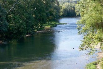
The Tano River, the basin’s primary watercourse, extends approximately 512 kilometers in length, although some sources indicate a length of 400 kilometers. It originates from the Boyem Mountain Ranges near Techiman, Ghana, and flows southwestward, eventually discharging into the Ehy/Tano/Aby Lagoon complex, a system that straddles the border between Ghana and Côte d’Ivoire. A notable portion of this lagoon system is located within Côte d’Ivoire. The river’s final few kilometers delineate the international land boundary between Ghana and Côte d’Ivoire. The basin features a well-developed drainage network, including the Tano River and its nine major tributaries, such as the Boin, Disue, Amama, and Abu rivers.
Administratively, the Tano Basin encompasses six regions and 29 District and Municipal Assemblies within Ghana. The Western North Region covers approximately 40% of the basin, followed by Ahafo (25%), Ashanti (15%), Western (10%), Bono (8%), and Bono East (2%). This extensive geographical spread underscores the river’s influence across a diverse array of local governance structures.
The Tano Basin is recognized as an ecologically and economically vital region, providing essential livelihoods for millions of people. Its rich terrestrial and aquatic ecosystems offer critical services, including water supply, biodiversity, and climate regulation. Key socio-economic activities supported by the basin include agriculture, forestry, mining, tourism, and fisheries. The estimated population within the basin, based on the 2021 Population and Housing Census, is 1,969,825. Approximately 54% of this population resides in urban communities (settlements with over 5,000 inhabitants), while 46% live in rural areas. The average population density across the basin is about 130 persons per square kilometer, aligning closely with the national average.
The transboundary nature of the Tano River Basin, explicitly shared between Ghana and Côte d’Ivoire, means that its effective management and the sustainability of its economic contributions are inherently linked to bilateral cooperation. Challenges such as pollution originating in Ghana and impacting Côte d’Ivoire highlight that the river’s status as an economic lifeline is deeply intertwined with the political and diplomatic relations between the two nations. This dynamic directly influences resource allocation, environmental protection efforts, and the overall facilitation of trade across the border.
1.2 Purpose and Scope of the Report
This report aims to provide a comprehensive examination of the Tano River’s role as an economic lifeline. It focuses specifically on how the river supports local economies through its contributions to irrigation for farming, transportation of goods, and the establishment of trade routes. Beyond these core areas, the report also analyzes other significant economic activities within the basin, identifies key challenges that impede sustainable development, and proposes actionable recommendations to enhance the river’s long-term economic utility. The scope encompasses both direct and indirect economic impacts, drawing upon available data and observations to offer a nuanced understanding for policymakers, development professionals, and other stakeholders.
2. Agriculture: Foundation of the Local Economy
2.1 Crop Production and Farming Practices
Agriculture constitutes the bedrock of the Tano Basin’s economy, serving as the primary occupation for over 27% of its population, a figure that rises to 47% in rural areas. Both commercial and subsistence farming are widely practiced, reflecting a diverse agricultural landscape that adapts to varying climatic and soil conditions across the basin’s administrative regions.
Major Crops by Region (Ghana):
- Western North Region: This region, situated within the moist semi-deciduous forest zone, is characterized by the cultivation of a variety of cash and food crops. Prominent among these are cocoa, coffee, oil palm, cashew, rubber, plantain, banana, and citrus.
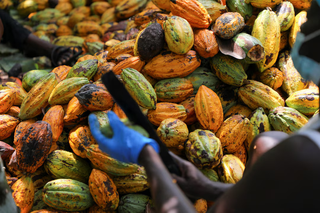
- Ahafo Region: Often referred to as the “bread basket of Ghana,” the Ahafo Region is a significant agricultural hub. Cocoa stands out as the predominant cash crop, while plantain and cassava are the major food crops, particularly in localities such as Sankore, Kwadwo Addaikrom, and Asumura. The region also boasts substantial cashew production, and vegetables like tomatoes, garden eggs, peppers, and okra are cultivated in significant quantities. The Mim Cashew & Agric Products company LTD, located in Mim, signifies the region’s agro-processing capabilities.
- Ashanti Region: As a major market for agricultural produce, the Ashanti Region plays a crucial role in Ghana’s food supply and export economy. It holds the distinction of being the second-largest cocoa producer globally. The main food crops cultivated include cooking plantain, rice, maize, cassava, taro-cocoyam, pineapple, and yam. Industrial crops such as cocoa, palm oil, tobacco, citrus, and cashew are also important.
- Western Region: This region is a leading producer of key cash crops, notably cocoa, rubber, and coconut, and is a major contributor to oil palm production. Staple food crops cultivated here include maize, cassava, plantain, yam, cocoyam, and rice.
- Bono Region: The Bono Region contributes to both cash and food crop production. Cash crops like cashew and timber are significant, while food crops such as maize, cassava, plantain, cocoyam, and tomatoes are widely grown. The region also has potential for large-scale agro-processing, as evidenced by a tomato processing factory in Berekum West district.
- Bono East Region: Agriculture is the dominant economic activity and the primary source of household income in the Bono East Region. Major food crops include yam, maize, cowpea, cassava, rice, plantain, groundnut, and beans. Additionally, cash crops like cashew and mango, and vegetables such as tomatoes, onions, and garden eggs, are cultivated.
Major Crops (Côte d’Ivoire – near Ehy/Aby Lagoon): In the areas surrounding the Aby Lagoon, where the Tano River discharges, the main crops are coconut, oil palm, banana, cocoa, and coffee. Horticulture, encompassing vegetables like tomatoes, peppers, lettuce, and fruits such as mangoes and pineapples, is a rapidly expanding industry, supported by favorable climatic conditions and government initiatives.
Farming Systems and Land Tenure: Traditional production methods, often reliant on rain-fed conditions, are common for staple crops like maize. Land tenure systems, such as ‘Abunu’ and ‘Abusa,’ are prevalent. In the ‘Abunu’ system, land is provided to a farmer, and the crops, typically food crops, are shared equally between the farmer and the landowner. The ‘Abusa’ system, on the other hand, involves the farmer receiving two-thirds of the cash crops, with the landowner taking the remaining one-third. These systems, while traditional, can sometimes pose challenges for large-scale commercial farming ventures.
The reliance on rain-fed agriculture for many staple crops across the Tano Basin, coupled with projections of increased water scarcity due to climate change, highlights a significant vulnerability in the region’s agricultural foundation. This dependence on seasonal rainfall, particularly in areas where the basin relies solely on surface water for crop production, exposes farmer livelihoods and regional food security to considerable risk from uneven rainfall distribution and prolonged dry periods. This situation necessitates urgent adaptation strategies to mitigate the potential for crop destruction and ensure agricultural resilience in the face of evolving climatic conditions.
2.2 Irrigation and Water Management for Farming
Despite the Tano River Basin’s extensive drainage network and its role as a major source of surface and groundwater, irrigation practices within the basin remain largely traditional and limited in scale. This presents a notable paradox: a significant water resource exists, yet its full potential for enhancing agricultural productivity through modern irrigation techniques is largely untapped. This underutilization represents a missed economic opportunity, perpetuating a reliance on less resilient rain-fed agriculture and exacerbating the vulnerability of farming communities to climate variability.
While the Tono Dam, a large-scale irrigation scheme, supports the cultivation of rice, soybean, and tomatoes for small-scale farmers, it is important to note that this dam is located in the Upper East Region and impounds the Tono River (a different river from the Tano River in this report’s focus), not the Tano River of the Tano Basin. This distinction is critical, as it indicates that while Ghana has experience with large-scale irrigation, its application directly within the Tano Basin is not widespread.
The Tano River Basin does serve as a major source of domestic water supply from both surface and groundwater sources. Groundwater is recognized as a crucial resource, although its quantity and quality, particularly regarding trace elements and microbiological loadings, are not fully understood due to limited research and groundwater logs.
Traditional irrigation methods observed in West Africa, which could be relevant to the Tano Basin, include various forms of flood or surface irrigation such as basin, furrow, and bay/border strip methods. These methods typically draw water from rivers, lakes, wells, or boreholes, often utilizing diesel generators and flexible hoses for pumping. While effective, these methods are known for their inefficiency in water usage, with much water lost to evaporation or soil absorption rather than direct plant uptake. More efficient technologies like sprinkler and drip irrigation exist, but their higher installation and maintenance costs often place them beyond the reach of smallholder farmers. Rainwater harvesting for irrigation is another practice employed, particularly in the Bono East Region, contributing to climate resilience.
The limited scale of modern irrigation in the Tano Basin, despite the availability of water, suggests constraints related to investment, infrastructure development, and effective water management strategies. The technical knowledge for large-scale irrigation exists within Ghana, as demonstrated by schemes like the Tono Dam. However, the specific challenges of applying such solutions within the Tano Basin, whether due to financial barriers, land tenure complexities, or insufficient extension services, prevent the full realization of its agricultural potential. Addressing this gap is vital for enhancing food security and improving farmer livelihoods.
2.3 Fisheries and Aquaculture
The Tano Basin supports fisheries as a socio-economic activity, contributing to the livelihoods of local communities. Around the Aby Lagoon, where the Tano River discharges, fishing is identified as a main economic activity, alongside agriculture. However, the fishing sector within the Tano Basin faces a complex interplay of challenges that significantly limit its economic contribution.
A unique cultural dimension impacts fishing in certain areas: residents of Tanoso, located in the Bono East Region, hold a deeply rooted belief that fish in the Tano River are sacred and akin to human beings. This reverence stems from the notion that the river god, Kwadwo Tano, regards the fish as his children, making their consumption a taboo. This cultural practice, while preserving a spiritual connection to the river, inherently restricts the local economic benefit that could otherwise be derived from direct consumption or sale of fish in these specific communities, even if fish populations were abundant and healthy.
Beyond cultural factors, severe environmental degradation poses a direct threat to the economic viability of fisheries:
- Water Hyacinth Invasion: The proliferation of invasive water weeds, particularly water hyacinth, in the Tano River and the Tano/Abby/Ehy lagoon complex presents a major challenge. These dense mats of vegetation obstruct fishing activities, leading to a significant reduction in income for fishermen and even halting boat operations. The invasion is exacerbated by nutrient-rich runoff from untreated wastewater, sewage, and fertilized farmlands, creating a reinforcing cycle of degradation.
- Pollution from Illegal Mining: Widespread illegal small-scale gold mining, locally known as “galamsey,” has severely jeopardized aquatic life in the Tano River. Studies have revealed alarming levels of heavy metal concentrations, including Chromium, Arsenic, and Mercury, in fish muscles from the Tano River. These levels frequently exceed permissible limits set by international standards, posing significant noncarcinogenic and carcinogenic risks to human consumers. This contamination renders fish unsafe for consumption, effectively destroying a potential food source and economic product.
The situation in the Tano Basin’s fisheries exemplifies a complex interplay where traditional beliefs, environmental degradation, and economic activity clash. The cultural non-consumption in some areas means that even if fish populations were robust and healthy, the local economic benefit from direct consumption or sale would be limited. More broadly, the pervasive pollution from illegal mining and the disruptive impact of invasive species directly undermine the economic potential of the fisheries sector. This forces communities to lose a vital livelihood source and can impact regional food security, despite the river’s inherent capacity to support aquatic life. Addressing these challenges requires not only environmental remediation but also culturally sensitive approaches to economic diversification and sustainable resource management.
2.4 Forestry and Non-Timber Forest Products (NTFPs)
Forestry stands as a significant socio-economic activity within the Tano Basin, playing a crucial role in supporting livelihoods and contributing to the regional economy. The basin’s terrestrial landscape is characterized by diverse forest types, including semi-deciduous dense forests, dry dense forests, and clear forests. These forest areas are extensive, with forest cover representing approximately 50% of the total landmass within the Tano Basin.
Logging and timber processing constitute major industries in the forested areas of the basin. Operations are concentrated in towns such as Berekum, Goaso, Mim, Sefwi-Wiawso, and Samreboi, where timber resources are harvested and processed. This sector provides direct employment and contributes to the local economy through the sale of wood products.
Beyond timber, Non-Timber Forest Products (NTFPs) play a vital role in supplementing the incomes of farming households. These products, gathered from community forests, can contribute up to 35% of farmers’ annual income, highlighting the importance of diverse forest resources for rural livelihoods.
Recognizing the critical link between forest health and river ecosystems, several forest reserves have been established specifically to protect river headwaters within the Tano Basin. These include the Boin Tano Forest Reserve (protecting the headwaters of the River Boin), Tano Suraw Forest Reserve (for River Suraw), Tano Suhien Forest Reserve (for River Suhien), and Disue Forest Reserve (for River Disue).
The reliance on forestry for economic gain, particularly through logging, presents a dual nature: it is a significant economic driver, but it also carries the risk of environmental degradation if not managed sustainably. The presence of “degraded lands” within the basin and the general understanding that deforestation contributes to land degradation and water erosion indicate that unsustainable forestry practices can undermine the very ecosystem services—such as water quality and flow regulation—that the river provides. The establishment of forest reserves to protect river headwaters underscores an awareness of this delicate balance and an effort to conserve vital ecological functions. This tension between economic exploitation and environmental sustainability necessitates robust forest management policies and their strict enforcement to ensure the long-term economic viability of the forestry sector and the health of the Tano River. Without such measures, short-term economic gains could lead to irreversible environmental damage, ultimately diminishing the river’s capacity to support diverse livelihoods.
3. Trade: Facilitating Economic Exchange
3.1 Historical Significance of Tano River Trade Routes
The Tano River has a rich history as a crucial artery for trade, profoundly shaping the economic and political landscape of pre-colonial West Africa. The Bono state, with its capital Bono Manso, flourished strategically near the headwaters of the Tano River. This location transformed Bono Manso into a significant trading center, connecting merchants across the broader African continent.
The river’s strategic position was particularly important as it marked the southernmost limit of safe caravan travel. Beyond this point, the prevalence of the tsetse fly rendered pack animal transport unviable, making the Tano River area a critical transshipment point and gateway to the forest-savanna transition zone. This geographical advantage facilitated the exchange of diverse commodities. The nearby town of Begho (also known as Nsɔkɔ) emerged as a complementary trading hub. Here, regional goods such as gold, kola nuts, ivory, and various forest products were exchanged for textiles, salt, and metal goods brought by Wangara merchants from northern markets like Djenné and Timbuktu.
Furthermore, the Aowin kingdom, a gold-rich entity that rose to prominence in the southwestern forests of present-day Ghana, leveraged the Tano River’s corridors for its expansion and trade dominance. The Aowin commanded strategic trade routes that linked the inland savannah to coastal markets, positioning themselves as key intermediaries between savannah-based markets (like Gonja and Bouna) and the burgeoning coastal trading posts operated by European merchants, including the Portuguese and later the Dutch. Their migration patterns often followed key river corridors, particularly the Tano River, as they settled in regions rich in alluvial gold and forest resources between the Tano and Bia Rivers.
The historical role of the Tano River as a critical trade artery for powerful states like Bono and Aowin demonstrates its inherent capacity to facilitate extensive regional economic exchange. The fact that it served as a nexus connecting diverse ecological zones and a hub for a wide array of commodities underscores its foundational importance in historical trade networks. This historical precedent offers a valuable blueprint for contemporary development strategies, suggesting that strategic investments in river-related infrastructure and trade facilitation could effectively leverage this enduring role for modern economic benefit. The river’s past as a connector of disparate economies highlights its potential as a catalyst for renewed economic integration and growth in the present day.
3.2 Current Trade Dynamics and Key Market Towns
In contemporary times, the Tano River continues to underpin local trade dynamics, with several large market towns serving as economic focal points within its basin. These include Techiman, Sunyani, Goaso, and Sefwi Wiawso, which function as centers for diversified urban economies, including trading, crafts, and small-scale industries. Techiman, notably, is also the capital of the Bono East Region, where the Tano River originates, reinforcing its significance as a regional hub.
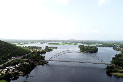
The river’s role in facilitating trade is often mediated by road infrastructure, particularly bridges that allow for the movement of goods and people across its course. The Ntotroso-Acherensua corridor, for instance, relies on a bridge over the Tano River and is recognized as a vital route for residents, farmers, traders, and businesses in the area.
The functionality of these trade routes, especially those dependent on river crossings, is directly tied to the condition of the infrastructure and the health of the river itself. A critical illustration of this interdependence is the impact of a bridge collapse on the Tano River. Such an event leads to immediate “transport disruptions,” making it exceedingly difficult for farmers and traders to convey their goods to market. This directly impacts the local economy, causing economic losses and potentially increasing prices for consumers due to supply chain bottlenecks. This causal relationship underscores that inadequate infrastructure or environmental degradation, such as river overflow during rainy seasons, can effectively sever trade linkages, leading to significant economic repercussions. Therefore, sustained investment in resilient infrastructure and effective river management are not merely engineering or environmental concerns but fundamental requirements for maintaining and enhancing trade flows and economic vitality in the Tano Basin.
3.3 Goods Traded and Economic Linkages
The Tano River Basin’s trade landscape has evolved from its historical roots, yet its fundamental role in facilitating the movement of goods remains. Historically, the Bono state, strategically located near the Tano’s headwaters, traded a diverse array of commodities including gold, kola nuts, salt, leather, and cloth, connecting various African markets. The Aowin kingdom also leveraged the river to trade gold and forest resources, acting as an intermediary between inland and coastal markets.
In the present day, agricultural products and timber continue to be central to the basin’s trade economy. When the Tano bridge collapsed near Sambreboi, for example, “tonnes of cocoa beans, timber, wood products, foodstuffs and other essential commodities” became “locked up”. These goods are typically destined for major export hubs like the Takoradi Port and other marketing centers. The disruption directly led to increased costs for these commodities, with foodstuffs seeing automatic price hikes, illustrating the immediate economic impact on both producers and consumers.
Beyond internal trade, the Tano River’s transboundary nature means that cross-border trade with Côte d’Ivoire is a significant, albeit sometimes constrained, economic linkage. The river forms part of the international land boundary between Ghana and Côte d’Ivoire. The Ivorian government has expressed concern over the severe pollution of the Tano River, which impacts its utility as a shared resource. Furthermore, calls to “open its land borders to promote trade” highlight a major impediment to cross-border economic activity. This situation reveals a significant bottleneck effect: even if the river itself were fully navigable and healthy, political and diplomatic factors, such as border closures, can act as non-physical barriers, preventing the full realization of the river’s potential as an international trade route. This implies that the economic utility of this shared natural resource is directly constrained by policy decisions and international relations, leading to lost economic opportunities for communities on both sides of the border. Addressing these political and environmental barriers is crucial for unlocking the full trade potential of the Tano River.
4. Transport: Connecting Communities and Markets
4.1 Navigability and Riverine Transport Methods
The Tano River, alongside the Volta and Ankobra Rivers, contributes to Ghana’s inland waterway network, providing 168 kilometers of perennial navigation suitable for launches and lighters. This capacity for year-round navigation indicates a significant inherent potential for transport within the basin. Specifically, the southern sector of the Tano River is navigable from its mouth for approximately 60 miles (95 kilometers) up to Tanoso. However, further upstream travel is naturally impeded by the Sutre Falls, which act as a geographical barrier to continuous navigation. Similarly, the Ankobra River is navigable for about 80 kilometers inland, and the Pra River was historically utilized for floating timber to the coast.
Riverine transportation, a component of inland waterways, is typically employed for short-distance travel. The vessels used are generally small to medium-sized, encompassing conventional cargo carriers, fishing vessels, barges, and ferries. These shallow-draft vessels are adapted to the limited depths of riverine environments.
At the local level, especially in instances of infrastructure failure, communities resort to more rudimentary methods. Hand-dug canoes are commonly used for ferrying people and goods across the river, particularly when conventional bridges become impassable.
The navigability of the Tano River presents a dual nature: it offers a natural opportunity for transport, but its full potential is constrained by both natural geographical features and severe anthropogenic degradation. While the river provides a perennial transport artery for a substantial stretch, natural obstacles like the Sutre Falls limit its continuous flow. More critically, human activities, particularly illegal mining, have polluted the river to such an extent that it is described as “literally good for nothing” beyond basic “boat transport across unauthorized routes”. This severe environmental impact fundamentally undermines the river’s capacity for broader commercial navigation. The reliance on “hand-dug canoes” when formal infrastructure fails not only highlights the resilience of local communities but also underscores the inadequacy of modern transport solutions in the face of environmental and infrastructural challenges. This situation points to a critical need for integrated planning that addresses both natural limitations and human-induced degradation to unlock the river’s full transport potential.
4.2 Key Transport Hubs and Landing Sites
While Ghana’s major seaports, Tema and Takoradi, handle the bulk of the nation’s import and export cargo, serving as critical international and national transport hubs , the Tano River itself facilitates a network of local transport points vital for regional commerce.
Along the Tano River, specific areas function as informal yet crucial landing sites, particularly in the absence of robust formal infrastructure. For instance, when the Tano bridge collapsed, areas around Sambreboi and Freetown became de facto landing sites where people and goods were ferried across the river using hand-dug canoes. This disruption directly impacted vital routes connecting towns like Asankragwa and Enchi, which serve as origins and destinations for goods and passengers. Thus, these towns, along with Sambreboi and Freetown, can be considered significant local transport hubs within the Tano Basin’s riverine network, albeit some operating informally in response to infrastructural deficiencies.
The reliance on informal landing sites and rudimentary transport methods in the event of infrastructure failure reveals a critical vulnerability in the regional transport network. The collapse of the Tano bridge, for example, forced a shift from formal, fixed infrastructure to informal, temporary solutions like canoes. While these informal methods demonstrate the adaptive capacity of local communities, they inevitably lead to increased travel times, higher costs, and reduced efficiency in the movement of goods and people. This informalization of transport directly impacts local economies by creating bottlenecks and increasing the cost of doing business. It underscores the urgent need for resilient infrastructure planning and investment that considers the dynamic nature of the river and the potential for disruptions, ensuring consistent and reliable connectivity for communities and markets.
4.3 Role of River Transport in Goods Movement
The Tano River plays a fundamental role in the movement of goods, serving as an essential conduit for local communities, agriculture, and fishing, and contributing to overall trade and transport within its basin. The river’s significance in this regard becomes acutely apparent during periods of infrastructural failure.
A compelling illustration of this is the impact of the Tano bridge collapse. When this critical crossing became impassable, “tonnes of cocoa beans, timber, wood products, foodstuffs and other essential commodities” were effectively “locked up”. These goods, vital for both local consumption and export, could not be efficiently conveyed to important destinations such as the Takoradi Port and other marketing centers. The direct consequence of this transport disruption was an immediate and tangible negative impact on the local economy. Farmers and traders faced immense challenges in getting their produce to market, leading to spoilage and lost income. Simultaneously, consumers experienced higher prices for essential goods, as the costs associated with alternative, more circuitous transport routes or the scarcity created by the blockage were passed on.
This scenario vividly demonstrates the critical ripple effect of transport disruptions on regional supply chains and local prices. A breakdown in river transport infrastructure, such as a bridge collapse, does not merely inconvenience commuters; it creates a systemic bottleneck that affects both producers and consumers. Producers are unable to sell their goods, leading to economic losses, while consumers face increased costs, potentially contributing to broader inflationary pressures within the local economy. This highlights that reliable river transport infrastructure is not just a convenience but a foundational element for maintaining economic stability and ensuring the smooth flow of goods, thereby directly supporting the livelihoods of countless individuals and businesses in the Tano River Basin.
5. Broader Economic Contributions and Potential
5.1 Mining Sector and its Economic Impact
The Tano Basin is endowed with significant mineral resources, particularly gold, which is extensively mined in areas such as Kenyase, Bibiani, and Sefwi-Surano. The mining sector is a major driver of economic growth in Ghana, contributing substantially to the country’s Gross Domestic Product (GDP), foreign exchange earnings, and investment. It is also a significant employer, with Ghanaians constituting approximately 98% of the direct workforce in mining operations. The industry provides quality, high-paying jobs and creates opportunities for Ghanaian companies to supply essential inputs, thereby generating multiplier effects throughout the economy.
However, the economic benefits derived from mining in the Tano Basin are significantly overshadowed by the widespread prevalence of illegal small-scale gold mining, locally known as “galamsey”. This illicit activity represents a classic manifestation of the “resource curse,” where the presence of valuable natural resources, when poorly managed or exploited illegally, leads to severe environmental and social consequences that undermine sustainable development.
Galamsey is the most significant source of pollution in the Tano River, transforming its waters into a “milky brown liquid” and rendering it “literally good for nothing”. This illegal mining introduces a cocktail of heavy metals, including mercury, arsenic, chromium, lead, and cadmium, into the water and aquatic life. These contaminants exceed permissible limits, posing severe health risks such as kidney failure, birth defects, cancer, and neurological disorders to communities reliant on the river.
Beyond water pollution, galamsey contributes to extensive environmental degradation, including deforestation, habitat destruction, and soil degradation. Major rivers like the Pra, Ankobra, and Birim have been contaminated, with the Tano River explicitly identified as suffering from this pollution. The Ghana Water Company Limited has reported alarming water turbidity levels, sometimes reaching 14,000 NTU (compared to a required 2,000 NTU for adequate treatment), and has issued warnings of severe water scarcity if galamsey is not curtailed.
The economic gains from illegal mining are often localized, benefiting a few individuals or powerful actors, but they do not translate into sustainable development or widespread poverty reduction for the broader community. Instead, they impose significant social and environmental costs, directly undermining other vital economic sectors such as agriculture and fisheries that depend on clean water. This unsustainable exploitation jeopardizes the long-term economic viability of the entire basin, highlighting the urgent need for effective governance and law enforcement to mitigate the negative impacts of the “resource curse.”
5.2 Oil and Gas Exploration and Local Benefits
The lower Tano Basin has emerged as a significant area for oil and gas exploration, contributing to Ghana’s national economy and offering opportunities for regional industrial growth. The Tano-Cape Three Points Basin, specifically, is an offshore sedimentary basin where productive oil fields are currently located. Ghana’s discovery of large oil deposits in this area in 2007, with production commencing in 2010, marked a pivotal moment for the nation’s energy sector.
The economic impact of this oil discovery and production has been notable at a national level. Studies indicate an increase in real income by 4% and employment by 4.5% in oil-producing regions. The positive effects on employment were predominantly concentrated in non-oil local sectors, particularly manufacturing and construction, suggesting some spillover benefits from the capital-intensive oil operations. Income gains were observed to be larger for skilled workers, reflecting the specialized nature of the industry.
However, the distribution of these benefits has been notably disparate, revealing a critical challenge for equitable local development. The oil and gas sector, being capital-intensive, primarily requires a highly skilled labor force. Consequently, the benefits have largely accrued to educated workers and those in specific sectors like manufacturing and construction. The studies found no significant impact on overall consumption or poverty reduction for the broader population, especially those engaged in traditional agricultural and service sectors, where a large proportion of individuals below the poverty line are employed. This means that while the industry boosts national economic indicators, its direct positive effects on poverty alleviation and widespread local economic benefits for communities along the Tano River have been limited.
This situation highlights a crucial observation: capital-intensive industries like oil and gas, despite their significant national economic contributions, may not automatically translate into broad-based local economic development or poverty reduction if the local workforce lacks the necessary skills or if effective linkages and spillover effects into traditional livelihoods are not intentionally fostered. This underscores the need for targeted local content policies that prioritize skills development and economic diversification to ensure a more equitable distribution of benefits from these high-value sectors across the Tano Basin.
5.3 Tourism and Ecotourism Potential
The Tano Basin possesses considerable potential for tourism and ecotourism, offering a blend of natural beauty and cultural heritage. Notable tourist attractions within the basin include the Ankasa Resource Reserve and various cultural heritage sites. The Tano River itself meanders through lush landscapes, providing serene opportunities for nature lovers and adventure seekers. Specific activities promoted along the river include canoeing, birdwatching, and riverside picnicking. The river serves as a haven for birdwatchers and wildlife enthusiasts, with its banks supporting diverse flora and fauna, including rare and migratory birds.
A significant cultural and ecotourism site is the Tano Boase Sacred Grove, located near the river’s source. This community-based ecotourism project features striking sandstone formations, hiking trails, and holds deep cultural significance as the dwelling place of Taakora, the highest of the Akan Gods on Earth. It is also the site of the annual Apoo festival, a time of spiritual cleansing.
However, the realization of this promising tourism potential is severely hampered by pervasive environmental degradation. The visible pollution of the Tano River, primarily from illegal mining activities, has transformed its natural appearance. The river, once clear, is now described as a “milky brown liquid” and has “lost its glory,” with some observers explicitly stating that it “can never be a tourist site” due to the pollution. This direct causal link between environmental degradation, particularly water pollution, and the inability to develop a thriving tourism sector is a critical impediment to economic diversification in the basin. The aesthetic and ecological integrity of the river, which forms the basis for ecotourism, has been compromised. This situation underscores that conservation and pollution control are not merely environmental imperatives but also essential economic prerequisites for unlocking the Tano Basin’s tourism potential. Without a concerted effort to restore the river’s ecological health, the economic benefits from this sector will remain largely unrealized.
5.4 Small-Scale Industries and Urban Economies
Beyond agriculture, trade, transport, and large-scale resource extraction, the Tano Basin’s economy is supported by a vibrant network of small-scale industries and diversified urban economies. Urban centers within the basin, including large market towns like Techiman, Sunyani, Goaso, and Sefwi Wiawso, serve as hubs for a variety of non-agricultural economic activities.
These urban economies are characterized by a broader range of livelihoods compared to the predominantly agricultural rural areas. They feature significant trading activities, a diverse array of crafts, and operations involving various machines. Small-scale industries are particularly prominent, encompassing activities such as carpentry, block making, soap manufacturing, and metalwork. These sectors provide employment opportunities, contribute to local production, and offer essential services to both urban and surrounding rural populations.
The diversification of economic activities in these urban centers suggests a greater degree of economic resilience compared to areas heavily reliant on a single sector like rain-fed agriculture. This economic breadth allows urban areas to absorb labor from traditional sectors that may be declining or facing environmental pressures. Consequently, these urban centers can function as crucial growth poles for the Tano Basin, offering alternative livelihoods and fostering economic stability. This implies that strategic investments in urban infrastructure, vocational training, and support for small and medium-sized enterprises (SMEs) can further enhance their capacity to drive regional development and provide a more robust economic future for the basin’s population.
5.5 Hydropower Development Potential
The Tano River Basin holds significant potential for small hydropower (SHP) development, presenting a promising avenue for sustainable energy solutions and contributing to Ghana’s broader renewable energy and rural electrification efforts. Studies conducted within the basin have identified as many as 24 sites along the Tano River with substantial energy potential.
Specific projects are already underway to harness this potential. The Tanoso hydroelectric plant, with a planned capacity of 56 MW, is currently in the pre-construction phase and is projected to be operational by 2028. Another notable project is the 25 MW Asuoso Hydropower Project, which is currently in a procedural status, indicating ongoing development towards its construction on the Tano River basin. These projects are anticipated to yield significant environmental benefits, including substantial CO2 emissions savings, contributing to climate change mitigation efforts.
The development of hydropower, while offering clear benefits in terms of clean energy and economic growth, necessitates a careful balance with the ecological integrity of the river system. The construction of dams and diversion schemes inherently leads to hydromorphological alterations, which can pose threats to river ecosystems and impact local communities dependent on the river’s natural flow and resources. This implies a critical need for thorough environmental and social impact assessments (ESIAs) to be conducted for all hydropower projects. Such assessments are essential to identify and mitigate potential negative externalities on other river-based livelihoods, such as agriculture and fisheries, and to ensure that energy benefits do not come at the cost of further ecological degradation or displacement of vulnerable communities. The economic advantages of hydropower must be carefully weighed against and integrated with broader environmental protection and social equity considerations to ensure truly sustainable development in the Tano Basin.
6. Challenges to the Tano River’s Economic Utility
The Tano River, despite its vital role as an economic lifeline, faces a complex web of interconnected challenges that significantly compromise its utility and the sustainability of livelihoods within its basin. These challenges stem from a combination of environmental degradation, resource management deficiencies, and socio-economic constraints.
6.1 Water Quality Degradation (Pollution from Mining, Agriculture, Waste)
Water quality degradation is arguably the most pervasive and damaging challenge to the Tano River’s economic utility, stemming from multiple anthropogenic sources.
- Illegal Mining (Galamsey): This illicit activity is the most significant source of pollution. It has visibly transformed the Tano River into a “milky brown liquid,” rendering it “literally good for nothing” for most traditional uses. Galamsey operations introduce a dangerous cocktail of heavy metals, including mercury, arsenic, chromium, lead, cadmium, and zinc, into the river water and, critically, into fish. These concentrations often exceed permissible limits, posing severe health risks (e.g., kidney failure, birth defects, cancer, neurological disorders) to communities that rely on the river for drinking water or consume contaminated fish. The high turbidity levels (up to 14,000 NTU) reported in rivers affected by galamsey make water treatment extremely difficult and costly.
- Agricultural Runoff: Intensive agricultural practices along the river contribute to pollution through the runoff of pesticide residues and agrochemicals. These substances have been detected in the downstream Tano Basin, particularly during the rainy season, contributing to heavy metal contamination.
- Domestic and Industrial Waste: The river suffers from microbial contamination due to raw urban and rural effluent, widespread open defecation, and the notable absence of adequate sewage treatment facilities. Additionally, industrial effluent discharges from various sectors (e.g., dyes, wood preservation, leather tanning, chrome plating) introduce heavy metals into the water.
The pollution of the Tano River is not attributable to a single source but rather to a complex and cumulative interplay of illegal mining, agricultural runoff, and domestic/industrial waste. Each source introduces distinct contaminants, ranging from heavy metals and pesticides to microbial agents. The combined effect is a severe degradation of water quality, rendering the water unsafe for drinking, severely impacting aquatic life, and making it unsuitable for other economic uses such as irrigation or fishing without extensive and costly treatment. This complex interaction of pollutants highlights that a piecemeal approach to remediation will likely be insufficient. A comprehensive, multi-faceted, and integrated strategy is essential to restore the river’s overall health and safeguard its long-term economic utility.
6.2 Environmental Threats (Water Hyacinth Invasion, Deforestation, Climate Change Impacts)
Beyond direct pollution, the Tano River’s economic utility is further undermined by a range of environmental threats, many of which are interconnected and create reinforcing feedback loops.
- Water Hyacinth Invasion: The proliferation of invasive water weeds, particularly water hyacinth, is a major challenge within the Tano/Abby/Ehy lagoon complex and along a 25-kilometer stretch of the river from its confluence with the lagoon. This invasive species forms dense mats that physically block water bodies, severely disrupting economic activities. It destroys farm produce by impeding access to farms, increases travel time for farmers who must clear pathways, and brings boat operations and fishing to a halt, leading to significant income reductions for affected communities. This invasion is exacerbated by “erosion run-off carrying plant nutrients from untreated wastewater, sewage, fertilized farmlands, and decomposed plant and animal residues,” creating a vicious cycle where pollution fuels the growth of the invasive species, which in turn further degrades the river’s economic utility.
- Deforestation: While logging and timber processing are significant industries in the basin , unsustainable practices contribute to deforestation. This loss of forest cover leads to land degradation and increased water erosion. The destruction of natural vegetation intended to protect river buffer zones exacerbates the entry of pollutants and sediment into the river, further compromising water quality and contributing to siltation. This creates a reinforcing loop where economic activities in forestry, if not sustainably managed, directly undermine the health of the river.
- Climate Change Impacts: The Tano River Basin is vulnerable to the effects of climate change, particularly altered rainfall patterns. Analysis of drought patterns suggests a potential negative impact on agricultural production and drinking water supply, a critical concern given the basin’s reliance solely on surface water for these purposes. Climate change is projected to increase overall water scarcity in the future, intensifying pressure on the already strained water resources. The uneven distribution of rainfall, both geographically and seasonally, further complicates crop water requirements and agricultural planning.
These environmental stressors are not isolated but form complex, reinforcing feedback loops that accelerate the degradation of the Tano River and undermine its economic functions. For instance, pollution fuels water hyacinth growth, which then impedes transport and fishing. Similarly, deforestation increases erosion and siltation, impacting water quality and navigability. This interconnectedness means that addressing one environmental issue in isolation may yield limited results; a holistic approach is required to break these negative cycles and restore the river’s ecological health and economic resilience.
6.3 Resource Management and Governance Issues
Underlying many of the environmental and economic challenges facing the Tano River are significant deficiencies in resource management and governance. These issues often represent the root causes of the basin’s declining economic utility.
- Illegal Mining (Galamsey) Control: Despite being illegal, galamsey is widespread and notoriously difficult to control. The perceived involvement of “powerful people,” such as politicians, who own the heavy equipment used in these operations, creates a significant barrier to effective enforcement and prosecution. Even when arrests are made, perpetrators are often released without prosecution or fines, indicating a systemic failure in policy enforcement and accountability. This highlights a profound governance deficit where illicit activities persist due to a lack of political will or institutional capacity to enforce existing laws.
- Lack of Enforcement and Compromised Buffer Zones: Buffer zones, designed as protective strips along riverbanks to prevent runoff and pollution, have been substantially compromised by anthropogenic activities. There is a clear lack of effective enforcement of environmental protection laws, including those pertaining to these crucial buffer zones. This allows agricultural runoff, waste disposal, and other polluting activities to directly impact the river’s water quality.
- Traditional vs. Formal Authority: Traditional institutions along the Tano River have historically played a role in regulating river use based on sacred beliefs (e.g., prohibiting fishing in certain areas). However, these indigenous knowledge systems and practices face challenges due to the absence of formal bye-laws or legislative instruments to support their enforcement in the modern context. Furthermore, there is a perceived lack of respect for traditional authority by some community members, with some local authorities themselves allegedly involved in illegal mining, further eroding effective local governance. This disconnect and lack of integration between traditional and formal governance structures impede cohesive resource management.
- Transboundary Management Deficit: The Tano River Basin is shared between Ghana and Côte d’Ivoire, making it a transboundary resource. However, there is currently “no operational arrangement for water cooperation” for the Tano River Basin between the two countries. This absence of formal, collaborative management mechanisms complicates efforts to address shared challenges like pollution and resource allocation, as actions in one country can directly impact the other without a coordinated response.
- Limited Data and Understanding: Despite the river’s importance, the quantity and quality of groundwater resources, particularly regarding trace elements and microbiological loadings, remain poorly understood due to a lack of groundwater logs and limited research. This knowledge gap hinders informed decision-making and effective resource management planning.
The pervasive nature of these governance issues suggests that technological or financial interventions alone may be insufficient to address the Tano River’s challenges. Without fundamental reforms in governance, strengthening institutional capacity, ensuring accountability, and fostering multi-stakeholder engagement (including traditional authorities and transboundary partners), the efforts to restore the river’s health and safeguard its economic utility will likely be undermined. This governance deficit is a critical bottleneck to achieving sustainable development in the Tano Basin.
6.4 Infrastructure and Market Access Constraints
Beyond the direct issues of water quality and governance, the Tano River’s economic utility is also constrained by inadequate infrastructure and persistent challenges in market access. These factors directly impact the efficiency of economic activities and the profitability of local producers.
- Transport Infrastructure: The inadequacy and poor maintenance of transport infrastructure, particularly bridges over the Tano River, pose a significant impediment. The collapse of critical crossings, such as the Tano bridge near Ntotroso-Acherensua, leads to severe “transport disruptions”. This results in increased travel times, higher transportation costs for goods, and a negative impact on local economies. Farmers and traders face immense difficulties in getting their produce to market, leading to spoilage, lost sales, and increased prices for consumers. This physical barrier directly undermines the river’s role in facilitating trade and connecting communities.
- Labor Shortages: The phenomenon of urban drift, where people migrate from rural to urban areas, contributes to a scarcity of agricultural labor. This makes it increasingly difficult for farmers to find sufficient workforce, especially during critical major cropping seasons (e.g., April–July), impacting agricultural productivity and expansion.
- Financial Constraints for Farmers: Smallholder farmers in the Tano Basin face a range of financial limitations. These include challenges in the affordability and accessibility of essential agricultural inputs like fertilizer, general financial constraints that limit investment in modern farming techniques, and difficulties in obtaining crucial services such as tractor plowing. Furthermore, traditional land tenure systems, while culturally significant, can sometimes hinder the establishment of large-scale commercial farming ventures that might require different land access arrangements. These financial barriers limit farmers’ capacity to increase productivity and adopt more resilient practices.
- Lack of Ready Market: For some agricultural produce, particularly from irrigation schemes, a lack of readily accessible markets is a major challenge. This can lead to a decline in production, as farmers may not have reliable outlets for their crops, diminishing the economic incentive to produce more. This issue highlights a disconnect between agricultural production and market demand, undermining the potential benefits of improved farming practices.
The interplay of inadequate physical infrastructure and socio-economic barriers creates a complex set of challenges for agricultural productivity and overall economic utility in the Tano Basin. A bridge collapse directly impedes the transport of goods, leading to immediate economic losses. Simultaneously, issues such as labor availability, access to credit, and reliable market linkages prevent farmers from fully capitalizing on the river’s agricultural potential, even with efforts to improve water management. This indicates that a holistic development strategy must address both the physical bottlenecks and the socio-economic constraints to truly unlock the Tano River’s full economic potential and ensure equitable benefits for its communities.
7. Recommendations for Sustainable Economic Development
To transform the Tano River from a system facing significant challenges into a truly sustainable economic lifeline, a multi-pronged, integrated, and collaborative approach is essential. The following recommendations address the identified issues across agriculture, trade, transport, and broader economic sectors, emphasizing environmental protection and robust governance.
7.1 Enhancing Agricultural Productivity and Water Use Efficiency
Modernizing agricultural practices and optimizing water use are critical for ensuring food security and increasing farmer incomes in the Tano Basin.
- Modernizing Irrigation Systems: Promote and support the adoption of water-efficient irrigation technologies, such as sprinkler and drip irrigation systems, and encourage the use of solar-powered pumps. This will reduce over-reliance on increasingly unreliable rain-fed agriculture and enable year-round cultivation of high-value crops, particularly during the dry season. To facilitate this, programs addressing the affordability of these technologies and improving farmers’ access to credit are crucial.
- Integrated Water Resources Management (IWRM): Fully implement and operationalize the Integrated Water Resources Management Plan for the Tano Basin. This plan should include specific interventions to manage water weeds, control pollution, and ensure a sustainable and equitable water supply for all uses. Integral to this is the incorporation of robust climate change adaptation strategies, such as drought management and water conservation techniques, to build resilience against future water scarcity.
- Promoting Sustainable Farming Practices: Encourage and provide training on sustainable agricultural practices. This includes the correct and judicious use of agro-chemicals, the adoption of improved crop varieties suited to local conditions, and the implementation of minimum tillage techniques to preserve soil health. Additionally, support efforts to restore and sustain traditional flood plain agriculture, which can be resilient and productive when managed appropriately.
- Strengthening Agricultural Extension Services: Address the current limitations in agricultural extension services, such as the low ratio of extension officers to farmers. Increase the number of trained extension personnel and equip them with the resources necessary to effectively transfer knowledge and new technologies to smallholder farmers, ensuring that improved practices are widely adopted.
- Value Chain Development and Agro-Processing: Support the development of robust agricultural value chains by promoting agro-processing industries within the basin. Initiatives such as the tomato processing factory in the Bono Region should be replicated and expanded. This will enable value addition to raw agricultural produce, reduce post-harvest losses, create non-farm employment opportunities, and enhance the profitability of farming, particularly for export-oriented crops.
7.2 Improving Transport Infrastructure and River Navigability
Reliable transport infrastructure and a navigable river are fundamental for economic exchange and market access.
- Bridge Maintenance and Construction: Prioritize the regular maintenance and, where necessary, the construction of resilient bridges over the Tano River, such as the vital Ntotroso-Acherensua bridge. This will ensure year-round connectivity for the movement of goods and people, preventing economic losses, reducing transport costs, and stabilizing market prices.
- Dredging and Invasive Weed Control: Implement comprehensive and sustained strategies for clearing invasive aquatic weeds, particularly water hyacinth, from the Tano River and its associated lagoon complex. This is crucial for restoring river navigability for both transport and fishing activities, which have been severely impeded by these weeds.
- Formalizing and Upgrading Landing Sites: Develop and formalize river landing sites along the Tano River to support efficient loading and unloading of goods and passengers. These sites should be integrated with existing road networks to create seamless multimodal transport linkages, enhancing the efficiency of local commerce.
7.3 Promoting Sustainable Trade and Value Chains
Leveraging the Tano River’s transboundary nature and historical trade significance requires strategic interventions to foster sustainable trade.
- Cross-Border Cooperation and Border Management: Establish and operationalize formal bilateral arrangements for transboundary water cooperation with Côte d’Ivoire specifically for the Tano Basin. This will facilitate shared resource management and create a framework for coordinated trade policies. Actively advocate for the opening of land borders between Ghana and Côte d’Ivoire to alleviate the economic toll on border communities and promote cross-border trade, unlocking the full potential of the river as a trade route.
- Strengthening Market Linkages: Improve market access for agricultural produce by addressing challenges such as the lack of ready markets for certain crops. This can involve strengthening farmer producer organizations, facilitating direct market connections, and exploring digital platforms to link farmers with buyers, both domestically and internationally.
7.4 Strengthening Environmental Protection and Resource Governance
Addressing the pervasive environmental degradation and governance deficiencies is paramount for the long-term sustainability of the Tano River’s economic utility.
- Combatting Illegal Mining (Galamsey): Implement stringent enforcement of mining laws, ensuring that all offenders, regardless of their influence, are prosecuted. Deploy effective monitoring mechanisms, including satellite imagery and community surveillance, to curb illegal mining activities that severely pollute the river. This requires political will and adequate resources for regulatory bodies.
- Enforcing Buffer Zone Protection: Strictly enforce existing buffer zone protection laws along the riverbanks. This will prevent encroachment and pollution from agricultural runoff, waste disposal, and other anthropogenic activities, thereby safeguarding water quality and riverine ecosystems.
- Improving Waste Management and Sanitation: Invest in and implement proper sewage treatment facilities and integrated waste disposal systems in both urban and rural areas. This will significantly reduce microbial and chemical contamination from domestic and industrial effluent entering the river, improving public health and water quality.
- Continuous Monitoring and Research: Establish and maintain a comprehensive system for continuous monitoring and assessment of water quality, including heavy metal concentrations and microbial loads, in both surface and groundwater resources. This data is essential for informed management decisions, identifying pollution hotspots, and evaluating the effectiveness of interventions. Further research is needed to better understand groundwater quantity and quality.
- Integrated Governance and Stakeholder Engagement: Foster enhanced coordination and collaboration among formal institutions (e.g., Water Resources Commission, Metropolitan, Municipal, and District Assemblies, Environmental Protection Agency) and traditional authorities in river basin management. Leverage indigenous knowledge and customary practices by enacting supporting bye-laws and empowering local communities to participate actively in resource management and enforcement. This ensures a more holistic and locally relevant approach to governance.
7.5 Fostering Diversified Economic Opportunities
Diversifying the economic base of the Tano Basin will enhance its resilience and create more equitable opportunities.
- Sustainable Ecotourism Development: Once water quality is restored, strategically invest in and promote sustainable ecotourism initiatives along the Tano River and within its basin. This includes developing infrastructure and marketing for activities such as canoeing, birdwatching, and cultural heritage tours (e.g., Tano Boase Sacred Grove). Ensure that these initiatives are community-based, providing direct economic benefits and promoting local ownership and conservation.
- Responsible Hydropower Development: Carefully plan and implement small hydropower projects, ensuring that thorough environmental and social impact assessments are conducted and adhered to. This will help balance the region’s energy needs with the imperative of preserving ecosystem integrity and safeguarding the livelihoods of river-dependent communities.
- Skills Development and Local Content: Implement targeted vocational training and skills development programs for the local population. This will enable a broader segment of the community to participate in and benefit from capital-intensive industries like oil and gas, ensuring that economic growth translates into improved livelihoods for more people, not just skilled workers from outside the region.
- Promoting Alternative Livelihoods: Develop and support alternative livelihood opportunities for communities severely affected by environmental degradation (e.g., those impacted by illegal mining or water hyacinth invasion). This will reduce pressure on overexploited or degraded natural resources and provide sustainable income sources, fostering economic resilience.
8. Conclusion
The Tano River stands as an indispensable economic lifeline for the diverse communities inhabiting its basin across Ghana and Côte d’Ivoire. Its waters are fundamental to a robust agricultural sector, supporting a wide array of food and cash crops that form the backbone of local livelihoods. Historically, the river has served as a critical trade artery, connecting distant markets and facilitating the exchange of valuable commodities, a role that continues to underpin regional commerce, albeit often through informal channels. Furthermore, the river and its basin contribute to broader economic activities, including forestry, mining, emerging oil and gas exploration, and hold significant potential for hydropower and ecotourism.
However, the Tano River’s capacity to sustain these vital economic functions is severely threatened by a confluence of complex and interconnected challenges. Pervasive water quality degradation, primarily driven by widespread illegal mining, agricultural runoff, and inadequate waste management, has rendered large sections of the river unsafe for human use and detrimental to aquatic life. Environmental threats, such as the debilitating invasion of water hyacinth, deforestation, and the increasing impacts of climate change, further exacerbate the river’s ecological decline. These environmental issues are compounded by significant governance deficiencies, including weak enforcement of regulations, a lack of coordination between formal and traditional authorities, and the absence of operational transboundary cooperation. Inadequate transport infrastructure and market access constraints further limit the economic potential of the basin’s agricultural producers and traders.
The analysis underscores that the challenges facing the Tano River are not isolated but form complex feedback loops, where environmental degradation exacerbates economic vulnerability, and governance failures perpetuate unsustainable practices. Addressing these issues requires an urgent, integrated, and multi-sectoral approach. By prioritizing investments in modern, water-efficient agricultural practices, building resilient transport infrastructure, fostering robust cross-border trade mechanisms, and rigorously enforcing environmental protection laws, the Tano Basin can mitigate current threats. Simultaneously, strategically developing diversified economic opportunities such as sustainable ecotourism and hydropower, coupled with targeted skills development programs, will ensure that economic growth is both inclusive and environmentally responsible.
In essence, the future prosperity of the Tano River Basin hinges on a concerted commitment to integrated water resource management, strengthened governance, and strategic investment that balances economic development with ecological preservation. Only through such comprehensive and collaborative efforts can the Tano River truly fulfill its role as a resilient and equitable economic lifeline for generations to come.