
Introduction
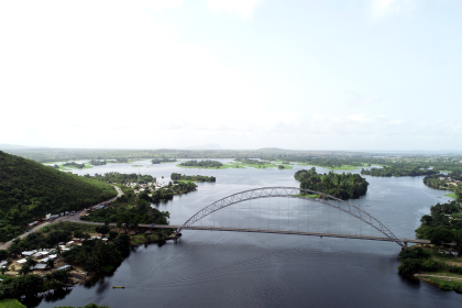
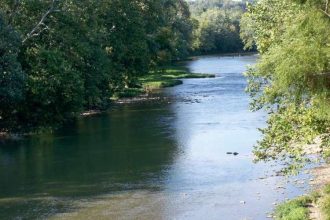
The Tano River, flowing through southwestern Ghana and into the Gulf of Guinea, is not only a vital ecological and cultural symbol—it is also the surface expression of one of West Africa’s most dynamic geological features: the Tano Basin. Known also as the Western Basin or Cape Three Points Basin, this Cretaceous-aged sedimentary basin has been central to Ghana’s hydrocarbon discoveries and continues to captivate scientists, investors, and energy stakeholders across the globe.
This article delves into the stratigraphy, tectonic history, petroleum potential, and broader regional connections of the Tano Basin, based on the most up-to-date academic and technical research.
Geological Context: Part of a Greater Whole
The Tano Basin is part of the West African Transform Margin (WATM), a tectonic province that runs along the coasts of Côte d’Ivoire, Ghana, Togo, Benin, and Nigeria. This province includes several related basins—Ivory Coast, Saltpond, Keta, and Dahomey Embayment—formed as a result of the opening of the South Atlantic Ocean during the breakup of Gondwana in the Late Jurassic and Early Cretaceous periods.
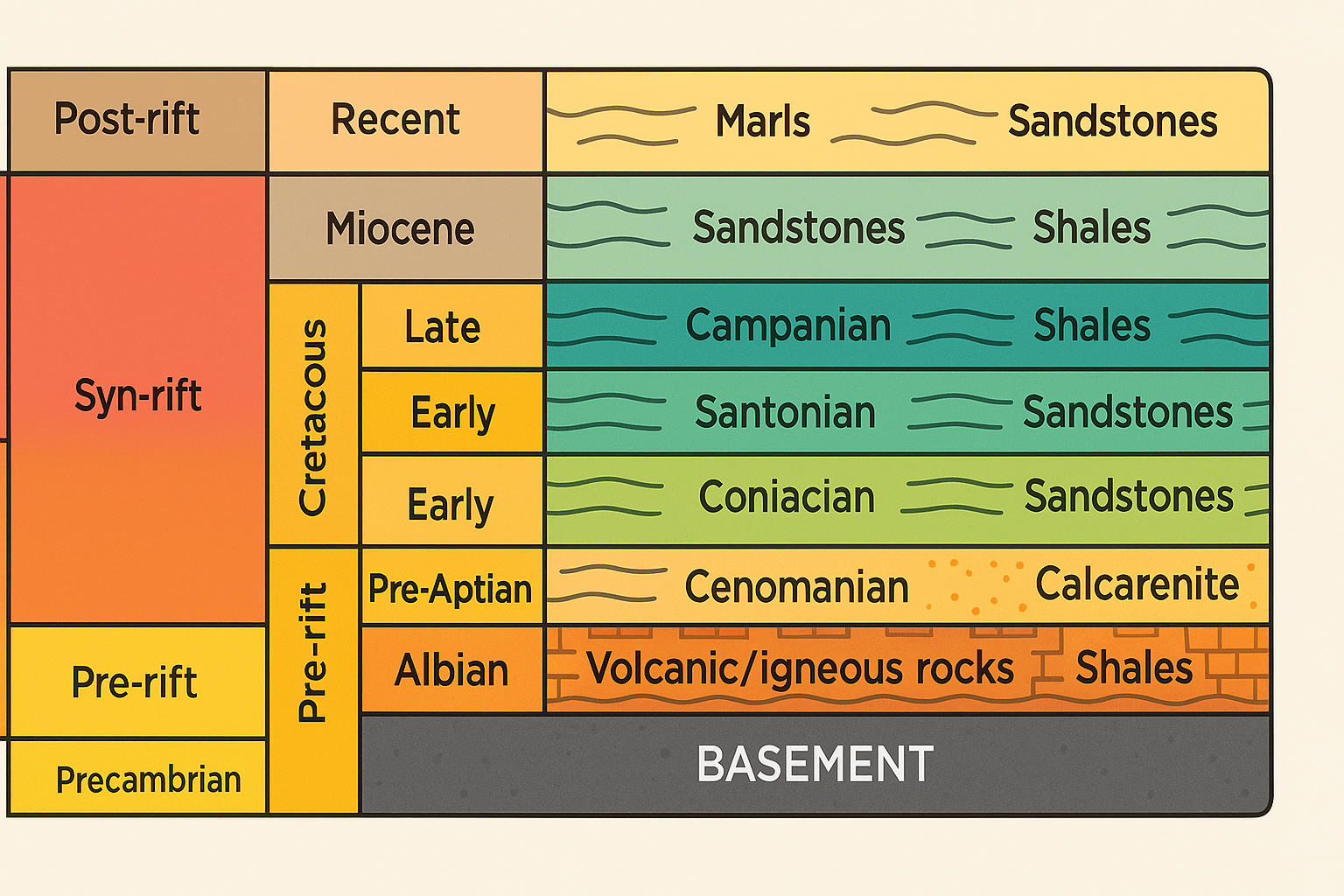
The Tano Basin alone covers over 3,000 km², stretching largely offshore but with critical onshore extensions. Geologically, it has evolved through three main tectonic phases:
- Pre-rift (Precambrian to Triassic),
- Syn-rift (Aptian to Albian),
- Post-rift (Cenomanian to Present).
These phases have dictated the deposition, deformation, and petroleum system architecture of the basin.
The Rock Record: A Journey Through Time
Basement and Pre-rift
The oldest rocks in the Tano Basin are Precambrian crystalline basement rocks, likely granites, gneisses, and metasediments. These are buried deep beneath the basin and are inferred from seismic profiles and regional comparisons since no well has yet penetrated them.
Above the basement lie continental siliciclastic deposits from the Pre-Aptian to Albian period, marking the Pre-rift phase of the basin’s development. These include sandstones and conglomerates laid down by rivers and shallow lakes.
Syn-rift Stratigraphy
The Syn-rift phase is characterized by:
- Volcanic intrusions and faulting during the Early Cretaceous (especially Aptian to Albian),
- Shale-rich lacustrine facies, indicating the presence of ancient lakes and restricted marine incursions,
- Localized turbidite fans and deltaic sands, often interbedded with claystones.
This phase ends with a significant erosional surface known as the Albian Unconformity, found in both the Tano Basin and its Brazilian counterparts—evidence of their shared tectonic history before continental drift separated them.
Post-rift Sedimentation
During the Cenomanian to Holocene, the basin filled with thick sequences of:
- Marine shales (Cenomanian–Turonian),
- Carbonate deposits (especially Cenomanian calcarenites),
- Deepwater turbidite sands (Campanian–Maastrichtian),
- Marls, silts, and clays through the Tertiary.
These layers host many of the basin’s hydrocarbon reservoirs and source rocks. The Campanian interval in particular has been a focus of recent exploration, revealing over 400 meters of slope fans rich in hydrocarbons.
Structural Influences: Fractures and Ridges
The Romanche Fracture Zone (RFZ), a massive east-west fault line, cuts through the basin and influences its structural configuration. Its tectonic effects—subsidence, uplift, folding, and fracturing—created localized mini-basins such as the South Tano Ridge and South Dixcove Ridge.
These structures affect:
- The distribution of sedimentary facies,
- The trapping mechanisms of hydrocarbons,
- The potential for future exploration and field development.
The basin also shows signs of post-transform tectonics, such as transpressional folding and the Miocene–Oligocene Unconformity (MOU), which reflect a phase of regional uplift and erosion.
Hydrocarbon Potential and Discoveries
The Tano Basin is one of the most productive petroleum provinces in West Africa. Key discoveries include:
- Jubilee Field (discovered 2007): Ghana’s first major offshore commercial oil field.
- TEN Fields (Tweneboa, Enyenra, Ntomme): Located in deepwater, producing both oil and gas.
- Sankofa Gye Nyame Field: Part of the Offshore Cape Three Points area, focused on gas for power generation.
The petroleum system includes:
- Source rocks: Marine shales from the Albian, Cenomanian, and Turonian.
- Reservoir rocks: Turbidite sands and shallow marine sandstones.
- Traps: Fault blocks, stratigraphic pinch-outs, and turbidite lobes.
- Seals: Intraformational shales and mudstones.
Tano Basin vs Other Ghanaian Basins
The Tano Basin is closely related to:
- Keta Basin (Cretaceous, similar rift-drift sequences),
- Saltpond Basin (Paleozoic, older and structurally different).
While they share tectonic origins, the Tano and Keta Basins have better petroleum systems due to thicker sediment fill and more active tectonics. Some stratigraphic units even correlate across the Atlantic with Brazilian basins, strengthening the case for a shared pre-drift origin.
Future Research and Conservation
The Tano Basin remains under study, with over 200 wells drilled, but large portions—especially deep-water sections and Precambrian basement—are still not fully understood. Some unresolved questions include:
- The origin of Cenomanian calcarenite layers—are they reworked sands or primary carbonates?
- The exact nature of volcanic/igneous intrusions during the Aptian-Albian period.
- The role of climate and erosion in shaping sedimentation patterns during the Miocene and Oligocene.
Given its hydrocarbon wealth and geological complexity, the Tano Basin deserves both scientific attention and sustainable management, especially with increasing exploration pressure offshore.
Conclusion: A Treasure Beneath the River
The Tano Basin is more than just a source of oil—it is a geological chronicle of Africa’s tectonic, sedimentary, and climatic evolution. It holds clues to the birth of the South Atlantic Ocean, the dynamics of petroleum formation, and the environmental forces that shaped West Africa’s coastline.
As you explore the cultural and ecological wonders of the Tano River, remember: below the water’s surface lies a world just as rich—written not in legends or rituals, but in layers of rock and time.