

Executive Summary
This report provides a comprehensive analysis of the Tano River Basin’s environment and biodiversity, highlighting its critical ecological and socio-economic importance as a transboundary ecosystem shared by Ghana and Côte d’Ivoire. The basin encompasses diverse terrestrial and aquatic habitats, supporting a rich array of flora and fauna, including several species of significant conservation concern. Despite its vital role in regional water supply, agriculture, and livelihoods, the Tano River Basin faces escalating threats from anthropogenic activities, primarily pollution from illegal mining and agricultural runoff, and extensive deforestation. Compounding these challenges are the projected impacts of climate change, which threaten to exacerbate water scarcity and alter hydrological patterns. Effective, integrated management, coupled with robust enforcement of environmental regulations and community engagement, is essential for safeguarding the long-term health and sustainability of this invaluable natural resource.
1. Introduction to the Tano River Basin
The Tano River Basin represents a cornerstone of the West African landscape, providing essential ecological services and supporting the livelihoods of millions. Its unique geographical, hydrological, and climatic characteristics define its environmental dynamics and biodiversity.
1.1. Geographic and Hydrological Profile
The Tano River Basin is a critical transboundary river system, shared between Ghana and Côte d’Ivoire, and constitutes one of Ghana’s four primary southwestern river systems, alongside the Ankobra, Bia, and Pra basins. Geographically, the basin is situated between latitudes 5°00′ N and 7°40′ N and longitudes 1°48′ W and 3°05′ W, predominantly covering the western-northern part of Ghana. The total area of the basin spans approximately 16,060 square kilometers, with a significant majority—about 92.6% (14,875 km²)—located within Ghana, and the remaining 7.4% (1,185 km²) extending into Côte d’Ivoire.
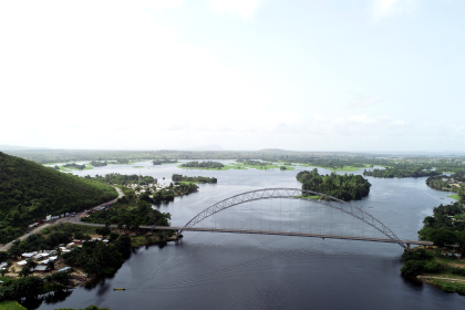
The Tano River, the basin’s main watercourse, extends approximately 512 kilometers in length. Its journey begins in the Boyem Mountain Ranges near Techiman in Ghana’s Bono East Region, flowing southwestward before ultimately discharging into the Ehy/Tano/Aby Lagoon complex, which straddles the border between Ghana and Côte d’Ivoire, eventually entering the Atlantic Ocean. A notable feature is that the river forms the final few kilometers of the international land boundary between the two nations , with most of the lagoon system situated within Côte d’Ivoire.
Topographically, the basin presents a varied landscape. Upstream areas, particularly around the Boyem Mountain Ranges, are characterized by highlands with average elevations of approximately 540 meters above sea level. The middle sections of the basin experience a drop to about 225 meters, while the southern regions are considerably flatter, ranging from 0 to 15 meters, with an average elevation of 50 meters above sea level. The Tano River system boasts a well-developed drainage network, fed by nine major tributaries. These include the Boin (821 km²), Disue (1,715 km²), Amama (958 km²), Abu (1,650 km²), Gaw (984 km²), Suraw (640 km²), Samre (487 km²), Totua (440 km²), and Disri (370 km²). Geologically, the Tano Basin is predominantly underlain by metamorphosed and folded rocks of the Birimian system, part of Ghana’s extensive Precambrian basement complex. Key geological formations in the basin include Granite (38.1%), Birimian Sediments (31.9%), and Birimian Volcanics (25.5%).
The shared nature of the Tano River Basin between Ghana and Côte d’Ivoire means that environmental challenges, particularly those related to pollution and resource allocation, necessitate a collaborative approach. Actions taken by one nation, such as the discharge of pollutants or excessive water abstraction, inevitably affect the downstream or transboundary regions in the other country. Conversely, conservation initiatives in one area may be undermined if not complemented by similar efforts across the border. This underscores the imperative for joint policy development, monitoring, and enforcement mechanisms between Ghana and Côte d’Ivoire to ensure effective and sustainable management of the river system.
The extensive length of the Tano River, its numerous tributaries, and the substantial area of its basin highlight its foundational significance as a primary water source and a vital ecological corridor. This vast and interconnected hydrological network spans multiple administrative regions and supports the socio-economic activities and livelihoods of millions of people who depend on its water for domestic use, agriculture, and various industries. The river system also serves as a crucial ecological pathway, linking diverse habitats and sustaining a broad spectrum of biodiversity. Consequently, any widespread degradation of the river or its basin would have profound and cascading negative consequences for human well-being, regional economies, and overall ecological stability, emphasizing its indispensable role in the region.
1.2. Climatic Conditions and Hydrological Patterns
The Tano River Basin experiences a sub-equatorial climate, also described as wet semi-equatorial and south-western equatorial climatic zones, characterized by two distinct rainy periods. These primary rainy seasons typically occur from May to July and again from September to November. Mean annual rainfall across the basin exhibits spatial variation, ranging from 1100 mm in the northern areas to 1800 mm in the south, with an approximate average of 1390 mm. Another source indicates a mean annual rainfall of 870.4 mm. Historically, precipitation levels have shown a notable decrease.
Regarding temperature and humidity, the annual relative humidity typically ranges between 75% and 85% during the rainy seasons, dropping to about 55%–60% in the dry season. Historical temperature records indicate a significant upward trend.
Projections for climate change in the Tano River Basin for the period 2021-2050 suggest notable shifts in hydrological patterns. Under the Representative Concentration Pathway (RCP) 4.5 scenario, mean annual rainfall of 1401.9 mm is projected to increase slightly by 0.5% but with an overall decreasing trend of 1.22 mm/year. Under the more severe RCP8.5 scenario, rainfall is projected to decrease by 3.2% with a decreasing trend of 0.3 mm/year. Conversely, another study predicts an annual rainfall increase of up to 20% (341 mm/year) by the late 21st century, potentially leading to more intense rainfall events. Mean annual temperature is projected to increase significantly by 2.1 °C under RCP4.5 and 2.6 °C under RCP8.5, with statistically significant increasing trends of 0.07 and 0.09 °C/year, respectively. One projection even suggests a more substantial temperature rise of 3.2 °C by the late 21st century. Evapotranspiration (ET) is also projected to increase, with a non-significant upward trend of 0.74 mm/year under RCP4.5 and 1.07 mm/year under RCP8.5 scenarios. Critically, mean annual streamflow is projected to decrease, with a more pronounced reduction of 37.5% under the RCP8.5 scenario compared to 19.9% under RCP4.5. Despite these challenges, the Tano River Basin possesses potential for small hydropower development, with twenty-four identified sites along the river capable of generating between 4.6 and 46.4 GWh of firm energy.
The Tano Basin exhibits a high degree of vulnerability to climate change. The projected decline in streamflow, even with potential increases in intense rainfall events, presents a significant challenge. This apparent contradiction arises because higher temperatures and increased evapotranspiration rates lead to greater water loss to the atmosphere. Furthermore, intense, short-duration rainfall often results in rapid surface runoff, contributing to erosion and flash floods, rather than effectively recharging groundwater or sustaining river base flows during dry periods. This combination of factors points to a worsening water security situation, where water availability becomes more erratic and less dependable. Such conditions directly impact the ecosystems and human populations that rely on the river for their survival and livelihoods.
Given that water security is already a pressing concern in the Tano River Basin, the projected impacts of climate change underscore the urgent need for robust adaptation strategies. Scientific studies explicitly recommend that policymakers develop and implement such strategies, guided by future climate scenarios. The existing stress on water resources, even before the full manifestation of climate change effects, amplifies the criticality of these adaptation measures. Delaying action will likely lead to compounded problems, increased economic burdens, and greater social and environmental disruption. Therefore, proactive, science-informed policy implementation is not merely advantageous but absolutely necessary to safeguard the basin’s future and avert a more severe crisis.
2. Ecosystems and Biodiversity
The Tano River Basin is characterized by a rich tapestry of ecosystems, supporting a diverse array of flora and fauna that are integral to the region’s ecological health and human well-being.
2.1. Terrestrial Ecosystems: Forests, Savannas, and Land Use Patterns
The Tano Basin is home to a diverse range of terrestrial ecosystems, shaped by its unique climate and geographical features. The primary components of the basin’s terrestrial landscape include semi-deciduous dense forests, dry dense forests, clear forests, farmlands, and degraded lands. Forest cover is a significant land use, representing the second-highest percentage of the total landmass, at approximately 50%. These forest ecosystems are crucial for regulating freshwater supply by supporting natural flow, filtration, and maintaining water quality within the basin.
In an effort to protect vital water sources, several forest reserves have been established within the Tano Basin. These include the Boin Tano Forest Reserve, which safeguards the headwaters of the River Boin; the Tano Suraw Forest Reserve, protecting the River Suraw; the Tano Suhien Forest Reserve, dedicated to the River Suhien; and the Disue Forest Reserve, which protects the River Disue.
While the Tano Basin is predominantly forested, the Bono East Region, where the river originates, features a “modified tropical continental or interior savannah climate”. More broadly, Ghana’s vegetation includes a northern savanna zone characterized by tall Guinea grass and scattered low trees such as shea butter, acacia, and baobabs. Coastal savannas also exist in the southeastern plains. Research indicates the presence of rainforest-savanna transects in Ghana, with ongoing studies on carbon cycling and plant traits in these areas. Savannas are grassland ecosystems defined by sparsely distributed trees, allowing ample light penetration to support a continuous layer of grasses. These ecosystems often serve as transitional zones between deserts or prairies and forested areas. They can exhibit higher moisture levels than typical grasslands and may include important wetland ecosystems.
Land use patterns in the Tano Basin are heavily influenced by human activities. Arable lands constitute the largest percentage of the total landmass. Agriculture is the primary occupation for over 27% of the population, rising to 47% in rural areas, with cocoa being the dominant cash crop. Other significant crops cultivated include oil palm, rubber, coffee, plantain, cassava, and coconut. Human settlements occupy only about 10% of the landmass.
The coexistence of extensive agricultural land and savanna zones alongside dense forests creates a complex mosaic of ecosystems, each with unique vulnerabilities to shifts in land use and climate. Changes in one type of land use or ecosystem inevitably affect others. For example, agricultural expansion, a primary driver of deforestation, directly reduces forest cover, leading to habitat fragmentation and soil degradation. Runoff from these agricultural areas then impacts aquatic ecosystems. The presence of savanna, often a transitional ecosystem, suggests areas that are particularly susceptible to desertification if rainfall patterns change or if there is degradation from overgrazing. This intricate interplay underscores that managing the Tano Basin requires a holistic, landscape-level approach, recognizing the interconnected vulnerabilities across its diverse ecosystems.
While the establishment of forest reserves to protect headwaters is a crucial conservation measure, their effectiveness faces significant challenges due to the widespread agricultural land use and the potential for encroachment. Historical data indicate that extensive farming and timber exploitation have substantially reduced Ghana’s dense forest zone. This suggests that these reserves may function as isolated ecological islands within a human-dominated landscape, making them susceptible to edge effects, illegal activities, and external pressures. Therefore, a conservation strategy focused solely on establishing protected areas is insufficient. True long-term conservation requires not only the maintenance of these reserves but also the promotion of sustainable land management practices in the surrounding agricultural areas. This includes enforcing buffer zone protection laws, providing alternative livelihoods for local communities, and fostering community engagement to reduce pressure on forest resources, thereby ensuring the viability of both the protected headwaters and the broader ecosystem.
Table 2.1: Major Forest Reserves within the Tano Basin and their Protected Headwaters
| Reserve Name | River Headwater Protected | General Condition (GSBA Area) | IUCN Category |
| Boin Tano Forest Reserve | River Boin | Good condition | V |
| Tano Suraw Forest Reserve | River Suraw | Not specified | Not specified |
| Tano Suhien Forest Reserve | River Suhien | Not specified | Not specified |
| Disue Forest Reserve | River Disue | Not specified | Not specified |
| Tano Nimiri Forest Reserve* | Not specified | Good condition | Not specified |
| Krokosua Hills Forest Reserve* | Not specified | Slightly degraded | Not specified |
Export to Sheets
Note: Tano Nimiri and Krokosua Hills are adjacent or assessed alongside Boin Tano in some studies, indicating their ecological connection within the broader Tano Basin region, though not explicitly listed as protecting Tano River headwaters directly. Boin Tano is explicitly stated as protecting River Boin headwaters. General condition refers to assessment from 2005 RAP survey.
2.2. Aquatic Ecosystems: Riverine and Lagoon Systems
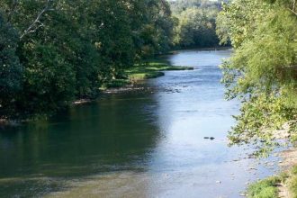
The Tano River, along with its extensive network of tributaries, forms the primary aquatic ecosystem within the basin, providing a habitat for a diverse range of aquatic species. The river’s flow culminates in its discharge into the Ehy/Tano/Aby Lagoon complex, which is predominantly located in Côte d’Ivoire.
A significant environmental challenge observed in the basin is the widespread proliferation of water weeds within the Tano/Aby/Ehy lagoon complex and extending along a 25-kilometer stretch of the river from its confluence with the lagoon. This overgrowth of aquatic vegetation serves as a strong indicator of nutrient pollution and an imbalance within the ecosystem, likely stemming from upstream anthropogenic activities. Excessive nutrient loading, typically from sources such as agricultural runoff containing fertilizers, untreated domestic sewage, and industrial effluents, fuels the rapid growth of these weeds. The observed proliferation downstream is a visible symptom of widespread and unmanaged pollution throughout the basin, signaling a severe degradation of water quality and overall ecosystem health.
Wetlands are integral components of the Tano Basin’s aquatic environment, functioning as dynamic ecosystems that provide critical services such as water filtration, habitat provision for wildlife, and carbon storage. These areas are vital habitats for numerous aquatic species, many of which are classified as threatened or endangered. Wetlands across Ghana are ecologically valuable, supporting diverse wildlife and offering essential life-supporting services, including food sources, roosting and nesting sites for migratory birds, and habitats for marine turtles and fish species. While specific “savanna wetlands” within the Tano Basin are not explicitly detailed in all available information, it is recognized that savannas can be water-logged, thereby creating important wetland ecosystems. The Tano Basin’s southern areas, characterized by flatter topography and elevations ranging from 0 to 15 meters, and its discharge into a lagoon complex, suggest the presence and importance of such wetland areas.
The combined effect of projected decreases in streamflow and the existing proliferation of water weeds presents a compounding threat to the aquatic biodiversity and ecosystem services of the Tano River. Reduced streamflow implies a lower volume of water available for dilution, which would concentrate existing pollutants and nutrients, further exacerbating conditions favorable for water weed growth. This increased biomass of aquatic vegetation, particularly in diminished water volumes, can lead to significant reductions in dissolved oxygen levels when these plants decompose. Such oxygen depletion directly endangers aquatic fauna, including fish and invertebrates, potentially resulting in fish kills and a broader collapse of the aquatic food web. This negative feedback loop—where the impacts of climate change, such as reduced flow, intensify the effects of pollution, like weed proliferation and subsequent oxygen depletion—creates a more severe and complex challenge for the basin’s aquatic biodiversity and the critical ecosystem services, such as fisheries, that the river provides to local communities.
2.3. Flora: Key Plant Species and Endemism
The Tano River Basin supports a rich and diverse flora, characteristic of Ghana’s varied climatic zones and forest types. The basin’s terrestrial landscape includes semi-deciduous dense forests, dry dense forests, and clear forests. These forest ecosystems are crucial for regulating freshwater supply and maintaining water quality. The region’s overall flora includes a high degree of endemism, particularly in its forest ecosystems.
Among the most significant plant species in the Tano Basin and broader Ghanaian context is Talbotiella gentii. This evergreen leguminous tree is critically endangered and endemic to Ghana, meaning it is found nowhere else in the world. Its distribution is narrowly restricted to specific areas in eastern Ghana, particularly the margins of the forest zone that have suffered extensive fire damage in recent decades.
Talbotiella gentii typically occurs in small, almost monospecific patches within mixed dry forests, often on rocky ground, forming a belt between savanna and deciduous rainforest. Despite being accorded the highest conservation status in Ghana, it faces severe threats from fire, charcoal cutting, and farming activities. The species is also vulnerable due to low genetic diversity, issues with fertilization rates, and high fruit abortion rates, which limit its regeneration. Its naturally fragmented distribution along the southern scarp of the Akwapim-Atewa hills, where soils are interrupted by rocky outcrops, further contributes to its precarious status. The vulnerability of this endemic species highlights the broader fragility of the basin’s unique plant life.
The critically endangered status and narrow distribution of Talbotiella gentii underscore a profound vulnerability within the Tano Basin’s unique flora. The fact that this species is found only in Ghana, and in very specific, fragmented habitats, means that any localized environmental degradation can have disproportionately severe impacts on its survival. Its susceptibility to anthropogenic pressures such as fire, charcoal cutting, and agricultural expansion, coupled with natural limitations in its reproductive biology, points to a high risk of extinction. The precarious situation of Talbotiella gentii serves as a clear indicator of the broader threats to the basin’s floral endemism and the urgent need for targeted, effective conservation interventions that address both direct human impacts and intrinsic biological vulnerabilities.
Table 2.2: Endemic and Critically Endangered Flora in the Tano Basin (Example: Talbotiella gentii)
| Species Name | Conservation Status (IUCN) | Distribution (Ghana) | Key Threats | Significance |
| Talbotiella gentii | Critically Endangered | Restricted to eastern Ghana (Afram and Volta Basins), in small, monospecific stands in rocky areas of seasonally dry forest; e.g., Bandai Hills, Sapawsu, Yongwa Forest Reserves | Fire, charcoal cutting, farming, habitat degradation and loss, low genetic diversity, fruit abortion | Endemic to Ghana, indicator of rare ecosystem of conservation importance |
2.4. Fauna: Aquatic and Terrestrial Species
The Tano River Basin is characterized by a rich and diverse fauna across both its aquatic and terrestrial environments.
Fish Species: The Tano River and its associated lagoon complex are home to various fish species. One notable species is Tylochromis jentinki, a cichlid found in coastal rivers from Gambia to the Tano River in Ghana, reaching up to 27 cm in length. Another cichlid,
Tilapia busumana, is native to the Tano River Basin, among other Ghanaian river systems, and can grow up to 18 cm. The electric catfish,
Malapterurus tanoensis, is endemic to the Ofin and Tano Rivers in Côte d’Ivoire and Ghana, growing up to 26 cm. Other prominent fish species in Ghana’s freshwater systems, likely present in the Tano Basin, include the North African catfish (
Clarias gariepinus), Nile tilapia (Oreochromis niloticus), and spotted tilapia (Pelmatolapia mariae). Ghana’s freshwater fish fauna includes 157 species across 28 families and 73 genera. Several species are endemic to Ghana’s freshwater systems, such as
Limbochromis robertsi, Enteromius subinensis, Enteromius walkeri, Chrysichthys walkeri, and Irvineia voltae.
Amphibians and Reptiles: Ghana boasts a significant diversity of amphibians and reptiles, with 221 recorded species. The Tano Basin’s forest reserves, such as Draw River, Boi-Tano, and Krokosua Hills, have been subjects of biological assessments. These assessments documented 39 amphibian species and 18 reptile species in these reserves. Notable amphibian findings include a new species of
Arthroleptis, Geotrypetes seraphini (a rare caecilian), and Phrynobatrachus phyllophilus (an Upper Guinean endemic). Reptile species of conservation concern found include
Osteolaemus tetraspis (Dwarf Crocodile), listed as “Vulnerable” by IUCN and CITES Appendix I, and Chamaeleo gracilis (Chameleon). Ghana is also home to four species of marine turtles and three species of crocodiles.
Birds: The Tano River basin is recognized as a haven for birdwatchers, supporting a diverse array of avian species, including rare and migratory birds along its riverbanks. Ghana records as many as 724 species of birds. Biological assessments in forest reserves within the broader Tano region, such as Draw River, Boi-Tano, and Krokosua Hills, documented 170 bird species. Among these, five species are of global conservation concern:
Bleda eximia (Vulnerable), Criniger olivaceus (Vulnerable), and Bycanistes cylindricus, Illadopsis rufescens, and Lamprotornis cupreocauda (Near Threatened). The Boin Tano Forest Reserve has been designated an Important Bird Area (IBA) by BirdLife International due to its support for significant bird populations.
Mammals: Ghana’s mammalian diversity is considerable, with 225 species recorded nationally. The Tano River Basin supports a variety of mammals, including several of conservation concern. Assessments in the associated forest reserves documented 31 small mammal species and 20 large mammal species (excluding primates). Key mammalian species include the African bush elephant (
Loxodonta africana cyclotis), listed as “Vulnerable,” and various duiker species (Cephalophus maxwelli, C. niger, C. dorsalis), and Neotragus pygmaeus, all listed as “Near Threatened”. Primates are also present, with the West African Chimpanzee (
Pan troglodytes verus) listed as “Endangered,” and the Olive Colobus (Procolobus verus) listed as “Near Threatened”. The last few individuals of Miss Waldron’s Red Colobus (
Piliocolobus badius waldronae), one of the world’s most threatened primates, are believed to inhabit the forest between the Tano River and Ehy Lagoon. There is also a project focused on the conservation and protection of the endangered Pygmy Hippopotamus (
Choeropsis liberiensis) within a 130km stretch of the Tano River. The Pygmy Hippopotamus is listed as Endangered by the IUCN, with an estimated wild population of fewer than 2,500 individuals, primarily threatened by habitat loss due to logging, farming, and mining.
The Tano River Basin, with its rich biodiversity, represents a critical hotspot for numerous aquatic and terrestrial species, including several that are endemic, endangered, or threatened. The presence of species like Miss Waldron’s Red Colobus and the Pygmy Hippopotamus, both facing severe threats, underscores the basin’s immense ecological value and its vulnerability. The concentration of such species means that the basin functions as a vital refuge, and their precarious status highlights the urgent need for targeted conservation efforts. The continued survival of these species is directly linked to the health of the Tano ecosystem, making their protection a priority for maintaining overall biodiversity in the region.
Table 2.3: Notable Aquatic Fauna in the Tano River Basin
| Species Name | Type | Conservation Status (IUCN) | Notes |
| Tylochromis jentinki | Fish (Cichlid) | Least Concern | Found in coastal rivers from Gambia to Tano River; max length 27 cm |
| Tilapia busumana | Fish (Cichlid) | Least Concern | Native to Tano River Basin; max length 18 cm |
| Malapterurus tanoensis | Fish (Electric Catfish) | Least Concern | Endemic to Ofin and Tano Rivers; max length 26 cm |
| Limbochromis robertsi | Fish (Cichlid) | Not specified | Endemic to Ghana’s freshwater systems |
| Enteromius subinensis | Fish (Cyprinid) | Not specified | Endemic to Ghana’s freshwater systems |
| Enteromius walkeri | Fish (Cyprinid) | Not specified | Endemic to Ghana’s freshwater systems |
| Chrysichthys walkeri | Fish (Claroteid) | Not specified | Endemic to Ghana’s freshwater systems |
| Irvineia voltae | Fish (Schilbeid) | Not specified | Endemic to Ghana’s freshwater systems |
| West African Dwarf Crocodile (Osteolaemus tetraspis) | Reptile | Vulnerable (IUCN) | Recorded in forest reserves within the Tano region |
| Marine Turtles | Reptile | Threatened (Ghana) | Wetlands in Ghana serve as habitats |
Table 2.4: Notable Terrestrial Fauna in the Tano River Basin
| Species Name | Type | Conservation Status (IUCN) | Notes |
| West African Chimpanzee (Pan troglodytes verus) | Mammal (Primate) | Endangered (IUCN) | Confirmed presence (feeding remains) in Tano Nimiri/Krokosua Hills forest reserves |
| Olive Colobus (Procolobus verus) | Mammal (Primate) | Near Threatened (IUCN) | Confirmed presence in Tano Nimiri/Krokosua Hills forest reserves |
| Miss Waldron’s Red Colobus (Piliocolobus badius waldronae) | Mammal (Primate) | Critically Endangered (IUCN) | Believed to live in forest between Tano River and Ehy Lagoon |
| Pygmy Hippopotamus (Choeropsis liberiensis) | Mammal | Endangered (IUCN) | Small herd resident in a 130km stretch of Tano River |
| African Bush Elephant (Loxodonta africana cyclotis) | Mammal | Vulnerable (IUCN) | Recorded in forest reserves within the Tano region |
| Bleda eximia | Bird | Vulnerable (IUCN) | Recorded in forest reserves within the Tano region |
| Criniger olivaceus | Bird | Vulnerable (IUCN) | Recorded in forest reserves within the Tano region |
| Bycanistes cylindricus | Bird | Near Threatened (IUCN) | Recorded in forest reserves within the Tano region |
| Illadopsis rufescens | Bird | Near Threatened (IUCN) | Recorded in forest reserves within the Tano region |
| Lamprotornis cupreocauda | Bird | Near Threatened (IUCN) | Recorded in forest reserves within the Tano region |
3. Environmental Threats to the Tano River Ecosystem
The Tano River Basin, despite its ecological significance, faces a multitude of severe environmental threats, primarily driven by human activities and exacerbated by climate change.
3.1. Water Quality Degradation and Pollution
Water quality in the Tano River Basin is significantly compromised by various forms of pollution, posing risks to both ecosystems and human health.
Heavy Metal Contamination: Anthropogenic activities are strongly suspected of contributing to heavy metal and metalloid pollution in the Tano Basin. Studies have identified significantly higher concentrations of heavy metals/metalloids and physicochemical levels in experimental sites along the basin compared to source/control sites. For instance, arsenic (As) levels increased from 0.001 ± 0.11 mg/L at the source to 0.014 ± 0.88 mg/L in experimental sites. Similarly, mercury (Hg) and chromium (Cr), undetected at the source, reached 0.051 ± 0.76 mg/L and 0.299 ± 0.42 mg/L respectively in experimental areas. Lead (Pb), also undetected at the source, was found at 0.428 ± 0.44 mg/L in experimental sites. While control water pH was slightly acidic (5.38 ± 3.4), experimental sites were near neutrality (7.35 ± 2.1). Heavy metals can originate from both natural processes like rock weathering and anthropogenic activities, including industrial discharges (e.g., from dye production, leather tanning, chrome plating), agricultural practices, urbanization, and commercial activities. Less than 1% of heavy metals entering water bodies remain dissolved, with the majority (99%) becoming trapped in sediment.
Microbial Contamination: The Tano River Basin grapples with substantial microbial contamination, particularly from Escherichia coli (E. coli). Primary sources include raw urban and rural effluent, open defecation, and polluted agricultural runoff. The lack of adequate sewage treatment facilities further exacerbates this problem. Studies indicate that point sources, mainly human feces and livestock manure, account for 44% of E. coli concentrations, followed by upstream pollution (34%) and non-point sources (22%). Non-point sources become the dominant contributors during periods of maximum discharge due to runoff from land and the dilution of point sources. Measured and modeled E. coli concentrations have been high, with the highest recordings during the rainy season.
Other Pollutants and Sources: Beyond heavy metals and microbes, other pollutants contribute to water quality degradation. High Total Suspended Solids (TSS) concentrations, ranging from 18 to 48 mg/L with a mean of 28.7 mg/L, have been observed, particularly near farms and communities due to significant silt influx. While these readings were within tolerable bounds (50 mg/L), they indicate localized impacts. Chlorophyll-a (Chl-a) levels, an indicator of algal biomass and nutrient enrichment, varied from 0.206 to 13.5 mg/L, averaging 5.1 mg/L. These concentrations can be attributed to effluent from settlements near the lake and the inflow of fertilizers from nearby farms. Sewage from households, urban runoff, industrial effluents, and farm waste are primary sources of excessive organic compounds and metal ions in freshwater systems.
The presence of heavy metals and microbial contaminants, coupled with elevated levels of suspended solids and chlorophyll-a, indicates a significant threat to human health for communities dependent on the Tano River for water consumption. The detection of non-carcinogenic and carcinogenic risks for water consumption by children and adults in experimental sites, where pollution is prevalent, is a direct consequence of these contaminants. This situation is further compounded by the widespread microbial contamination from human and livestock waste, which can lead to waterborne diseases. The direct link between land use activities (industrial, agricultural, commercial) and the observed pollution levels means that human health risks are not merely theoretical but are actively manifesting in areas where communities interact with the river.
Illegal mining activities are a major contributor to the severe pollution observed in the Tano River Basin. Investigations have revealed mining taking place directly on the riverbed at key pollution points, with mining residue flowing directly into the river. This practice violates regulations that typically require a 50-meter buffer zone from water bodies. The widespread nature of illegal mining is highlighted by reports indicating that over 90% of river bodies in Ghana are polluted by such activities. The direct discharge of mining waste, which often contains heavy metals, significantly elevates contaminant levels in the water. This direct link between illegal mining and water pollution clearly demonstrates a critical failure in regulatory enforcement and poses an immediate and severe threat to the river’s ecological integrity and the health of dependent communities.
3.2. Land Use Changes and Habitat Loss
Land use changes, driven primarily by human activities, are major contributors to habitat loss and environmental degradation in the Tano River Basin.
Deforestation: Deforestation is a significant threat to the Tano Basin’s environment. While forest cover still represents about 50% of the total landmass, the dense forest zone of Ghana has been drastically reduced from approximately 78,000 km² to less than 21,000 km², largely due to farming activities and timber exploitation. Deforestation is primarily driven by agricultural expansion, cattle breeding, and the demand for raw materials like palm oil and timber. The removal of forest cover has profound impacts on the environment: it intensifies climate change by turning carbon sinks into net emitters, increases the risk of wildfires, disrupts the water cycle by decreasing precipitation and affecting river flow, and leads to soil erosion by exposing land to wind and rain. The loss of trees also depletes soil nutrients, which are vital for plants and animals, and destroys the homelands of indigenous communities, forcing migration and compromising their resources.
Agricultural Expansion: Arable lands constitute the highest percentage of land use in the Tano Basin, with agriculture being the primary occupation for a significant portion of the population. Commercial farming of crops like cocoa, oil palm, rubber, coffee, plantain, cassava, and coconut drives land conversion. This expansion often necessitates the clearing of forests, directly contributing to deforestation and habitat fragmentation. Agricultural runoff is a major source of microbial contamination and nutrient enrichment, leading to water quality degradation and the proliferation of water weeds in the river and lagoon systems.
Mining Activities: The Tano Basin is rich in mineral resources, particularly gold, which is extensively mined in areas like Kenyase, Bibiani, and Sefwi-Surano. However, illegal mining (galamsey) is widespread and is a significant contributor to water pollution. Illegal mining activities directly impact the Tano River, with operations taking place on the riverbed itself, leading to direct discharge of mining residue and massive devastation of forests and watercourses. This has resulted in polluted water sources for farming communities, forcing them to seek alternative water supplies. A truck carrying sulfuric acid also plunged into the Tano River in 2020, causing contamination and prompting warnings against water consumption, though the river was later reportedly restored.
Impacts on Soil and Water Cycle: Land use changes, particularly deforestation, have a strong effect on runoff regimes and soil health. Forests typically decrease discharges in river basins due to increased interception, transpiration, and soil permeability, and reduced soil moisture. Conversely, deforestation increases surface runoff and soil erosion, especially on steep terrains, and can lead to gully development. This not only reduces water quality but also diminishes soil fertility. The loss of forest cover leaves soil exposed, making it vulnerable to being washed away.
The synergistic effects of deforestation, agricultural expansion, and mining activities create a complex and escalating threat to the Tano River ecosystem. Each of these human-driven land use changes independently degrades the environment, but their combined impact is far greater. Deforestation, for instance, not only removes critical habitats but also exacerbates soil erosion, which then feeds into agricultural runoff, increasing sediment and nutrient loads in the river. Mining activities, often occurring in deforested areas, directly introduce heavy metals and other pollutants into the water, further compromising water quality already strained by agricultural chemicals and human waste. This interconnectedness means that addressing one threat in isolation is insufficient; a comprehensive strategy must tackle these activities holistically to prevent a cascading collapse of ecosystem functions.
The environmental degradation in the Tano River Basin has profound socio-economic consequences for the dependent communities. Deforestation and land degradation directly impact agricultural productivity, threatening food security for millions who rely on farming for their livelihoods. The pollution of water sources by mining and agricultural runoff means that communities lose access to safe drinking water, leading to increased health risks, including non-carcinogenic and carcinogenic effects from heavy metals and waterborne diseases from microbial contamination. The destruction of forest homelands forces indigenous communities to migrate, disrupting their traditional ways of life and access to essential resources. This highlights a critical feedback loop: unsustainable economic activities degrade the environment, which in turn undermines the very economic and social well-being of the communities, creating a cycle of poverty and environmental decline.
3.3. Climate Change Impacts
Climate change is an overarching threat that exacerbates existing environmental challenges in the Tano River Basin.
Temperature and Rainfall Shifts: The basin experiences a sub-equatorial climate with two rainy seasons. However, projections indicate significant changes: mean annual temperatures are expected to rise by 2.1 °C to 2.6 °C by 2050, with some models suggesting a 3.2 °C increase by the late 21st century. While mean annual rainfall might slightly increase in total volume under some scenarios, historical data show a decreasing trend in precipitation, and future projections suggest a decrease under the RCP8.5 scenario. Crucially, there is a prediction for more intense rainfall events.
Impact on Streamflow and Evapotranspiration: The rising temperatures are projected to lead to increased evapotranspiration (ET), with rates increasing by 0.74 to 1.07 mm/year. This increased atmospheric water demand, combined with altered rainfall patterns, is projected to result in a significant decrease in mean annual streamflow, with reductions of 19.9% under RCP4.5 and a more severe 37.5% under RCP8.5. This reduction in streamflow directly threatens water security, which is already a challenge in the basin.
Increased Extreme Events: Climate change is expected to increase the incidence of extreme short-term rainfall events. Such events can lead to flash floods and increased surface runoff, which, especially in deforested areas, can intensify soil erosion and the flow of pollutants into the river.
The projected impacts of climate change, particularly the decrease in streamflow and increase in evapotranspiration, create reinforcing negative feedback loops within the Tano River ecosystem. Reduced water volume in the river concentrates existing pollutants, such as heavy metals and microbial contaminants, making the water quality worse even if pollution inputs remain constant. Lower flow also exacerbates the proliferation of water weeds by reducing dilution and increasing water residence time, which in turn leads to further oxygen depletion as the weeds decompose. This degraded water quality then directly impacts aquatic biodiversity, making fish and other aquatic life more vulnerable. Furthermore, the combination of intense rainfall and reduced forest cover from deforestation increases soil erosion, washing more sediment and pollutants into the river, thereby accelerating the cycle of degradation. This intricate web of interconnected environmental changes means that climate change is not merely an additive threat but a multiplier, intensifying all other existing pressures on the Tano River Basin.
4. Conservation Efforts and Management Initiatives
Recognizing the critical importance of the Tano River Basin, various conservation efforts and management initiatives are underway, though significant challenges remain.
4.1. Protected Areas and Reserves
Existing Forest Reserves: Several forest reserves have been strategically established within the Tano Basin to protect vital river headwaters and their associated ecosystems. These include the Boin Tano Forest Reserve (protecting River Boin headwaters), Tano Suraw Forest Reserve (River Suraw), Tano Suhien Forest Reserve (River Suhien), and Disue Forest Reserve (River Disue). These forest ecosystems are essential for regulating freshwater supply through natural flow, filtration, and maintaining water quality.
Globally Significant Biodiversity Areas (GSBAs): Some of these forest reserves, such as Draw River, Boi-Tano, Tano Nimiri, and Krokosua Hills, contain areas designated as Globally Significant Biodiversity Areas (GSBAs) by the Government of Ghana. These designations underscore their international importance for biodiversity conservation. For instance, the Boi-Tano Forest Reserve ranks highly among Ghanaian forests for its Genetic Heat Index (GHI), indicating a richness in rare plant species, and has been found to be in relatively good condition in its GSBA areas.
Challenges to Protected Area Effectiveness: Despite their establishment, the effectiveness of these protected areas is challenged by several factors. Extensive agricultural land use, which occupies the highest percentage of the basin’s total landmass, and historical deforestation have significantly reduced Ghana’s dense forest cover. This means that many reserves exist as isolated patches within a human-dominated landscape, making them vulnerable to edge effects, encroachment, and external pressures such as illegal logging and cocoa cultivation. High hunting pressure is also a major threat in some areas like Krokosua Hills.
The establishment of protected areas, while a necessary step, is insufficient on its own to ensure the long-term health of the Tano River Basin. The pervasive nature of agricultural land use and the historical reduction of forest cover suggest that these reserves are often isolated islands within a landscape heavily modified by human activity. This isolation makes them susceptible to external pressures, such as encroachment from farming, illegal logging, and pollution originating from outside their boundaries. Therefore, effective conservation must extend beyond simply designating protected areas. It requires integrated land management strategies that promote sustainable practices in the surrounding agricultural zones, enforce buffer zone protection laws, and provide alternative, environmentally friendly livelihoods for local communities. This broader, landscape-level approach is essential to mitigate pressures on the reserves and ensure their ecological viability.
4.2. Water Resource Management Plans
Integrated Water Resources Management (IWRM) Plans: An Integrated Water Resources Management (IWRM) Plan has been developed for the Tano Basin to address its challenges. The Water Resources Commission (WRC) and Ghana Water Partnership (CWP-Ghana) are actively involved in reviewing and implementing these IWRM plans for the Tano and Pra Basins. This involves re-developing basin maps to account for new districts, demographic shifts, land-use/cover changes, and newly granted water use permits. Water Evaluation and Planning (WEAP) models are being re-run to incorporate current water users and abstraction rates, guiding decision-making on water allocation.
Role of Water Resources Commission (WRC): The WRC plays a central role in sensitizing the public, including Senior High School students and institutions, on water management and the importance of protecting water bodies within the Tano River Basin. The WRC emphasizes the Tano River Basin as a major source of potable drinking water for many Ghanaians, highlighting the necessity of its preservation.
Indigenous Knowledge Integration: Traditional knowledge systems also contribute to water resource management. In the upper Tano River Basin, indigenous practices include holding the river as a sacred god and prohibiting fishing in certain areas, with deities mounted along the river and managed by sub-chiefs to regulate its use. However, indigenous institutions face challenges, such as the lack of existing bye-laws or legislative instruments to support the enforcement of this traditional knowledge. Recommendations include enacting bye-laws by the WRC basin secretariat and municipal/district assemblies to support the enforcement of indigenous knowledge, recognizing its potential for significant contribution to water resource management.
The Tano River Basin’s complex environmental challenges, particularly those stemming from its transboundary nature and diverse land use, necessitate a holistic and adaptive management approach. The existence of IWRM plans and the involvement of the Water Resources Commission are positive steps, but their effectiveness hinges on comprehensive implementation that integrates scientific data with local realities. The recognition of indigenous knowledge as a valuable component of water management, despite current enforcement gaps, points to the need for culturally sensitive and participatory governance structures. This integrated approach is crucial because environmental issues in the basin are interconnected; for instance, climate change impacts on streamflow are exacerbated by land degradation from agriculture and mining. Therefore, effective management requires not only technical solutions but also strong institutional frameworks, cross-border cooperation, and community empowerment to address the multifaceted pressures on the river system.
4.3. Species-Specific Conservation
Targeted conservation efforts are crucial for the most vulnerable species within the Tano River Basin.
Pygmy Hippopotamus Conservation: The endangered Pygmy Hippopotamus (Choeropsis liberiensis) is a focus of conservation efforts in the Tano River Basin. A project aims to rebuild and maintain socio-ecological production landscapes along a 130 km stretch of the Tano River, specifically between Sienkyem (near Goaso in Brong-Ahafo Region) and Tano-Odumase (near Bibiani in Ashanti Region), to protect a small resident herd. This project’s goal is to systematically generate baseline data on species population status and trends using methods like camera trapping and radio telemetry to assess movements, home ranges, and habitat use. It also seeks to explore suitable habitats and wildlife corridors, expand environmental education, promote sustainable land management, and foster community-managed eco-tourism. The Pygmy Hippopotamus is listed as Endangered by the IUCN, with fewer than 2,500 individuals remaining in the wild, primarily threatened by habitat loss from logging, farming, and mining.
Miss Waldron’s Red Colobus: Miss Waldron’s Red Colobus (Piliocolobus badius waldronae) is considered one of the world’s most threatened primates, with the last few individuals believed to reside in the forest between the Tano River and Ehy Lagoon. However, as of mid-2008, this critical habitat was slated for logging by Unilever, with intentions to convert it into oil palm plantations. The available information does not provide updates on the current conservation status or specific ongoing protection efforts for this species beyond the threat identified in 2008.
The targeted species protection efforts for the Pygmy Hippopotamus and the critically endangered Miss Waldron’s Red Colobus underscore the basin’s role as a refuge for highly vulnerable fauna. The focus on systematic data collection, habitat exploration, and community engagement for the Pygmy Hippopotamus demonstrates a comprehensive approach to species recovery that recognizes the link between habitat health and species survival. However, the lack of updated information and the historical threat of habitat conversion for Miss Waldron’s Red Colobus highlight a potential gap in ongoing monitoring and intervention for some of the basin’s most imperiled species. This situation emphasizes the need for continuous, species-specific assessments and adaptive management strategies that respond to evolving threats and integrate with broader land-use planning to prevent further biodiversity loss.
4.4. Community Engagement and Awareness
Community involvement and public awareness are fundamental to successful conservation in the Tano River Basin.
Sensitization Programs: The Water Resources Commission actively conducts sensitization programs for Senior High School students and public/private institutions on water management and the importance of preserving water bodies within the Tano River Basin. These initiatives aim to educate the public on judicious water use and the benefits of protecting water bodies, including improved livelihoods, aquaculture, and reduced waterborne diseases.
Livelihood Diversification: Conservation projects in the Tano Basin are integrating poverty reduction strategies by promoting alternative livelihoods. For example, initiatives have trained unemployed youth in bamboo craft making, supported bee hive farming, and provided training and resources for grasscutter farming and plantain sucker multiplication. These efforts aim to reduce reliance on unsustainable practices that degrade the environment.
Enforcement of Buffer Zone Laws: Public sensitization efforts specifically urge farmers to cease farming along riverbanks and the general public to desist from illegal alluvial mining and throwing rubbish into rivers and streams. The importance of enforcing buffer zone protection laws, particularly in areas affected by industrial, agricultural, and commercial activities, has been recommended to mitigate heavy metal and other pollution.
Community participation is recognized as indispensable for the long-term sustainability of the Tano River Basin. The success of conservation efforts, particularly in a region where agriculture is the primary occupation and illegal mining is prevalent, hinges on the active involvement and behavioral change of local communities. Sensitization programs, coupled with the provision of alternative livelihoods, aim to create a direct stake for residents in environmental protection by demonstrating the tangible benefits of sustainable practices. Without community buy-in and a shared understanding of the impacts of their activities, enforcement of environmental regulations, such as buffer zone laws, becomes challenging. Therefore, empowering local institutions, strengthening community-managed programs, and fostering environmental education are not merely supportive activities but are foundational to achieving lasting ecological health and socio-economic resilience in the Tano Basin.
5. Conclusions and Recommendations
The Tano River Basin is a critical transboundary ecosystem, vital for the environment and human populations of Ghana and Côte d’Ivoire. Its diverse terrestrial and aquatic ecosystems, including semi-deciduous and dry forests, riverine systems, and lagoons, support a rich biodiversity, including critically endangered species like Talbotiella gentii, Miss Waldron’s Red Colobus, and the Pygmy Hippopotamus. The basin’s hydrological patterns, characterized by a sub-equatorial climate with two rainy seasons, are increasingly threatened by climate change, with projections indicating significant temperature increases, rising evapotranspiration, and a notable decrease in streamflow.
The environmental health of the Tano River is severely compromised by widespread anthropogenic activities. Illegal mining is a primary driver of heavy metal and microbial pollution, directly contaminating water sources and devastating riparian habitats. Agricultural expansion, while a key economic activity, contributes to deforestation, habitat loss, and nutrient-laden runoff, further degrading water quality and exacerbating the proliferation of invasive water weeds. These human-induced pressures, combined with the reinforcing effects of climate change, create a complex web of interconnected threats that undermine the basin’s ecological integrity and the well-being of its dependent communities. The presence of significant health risks from contaminated water underscores the immediate human cost of environmental degradation.
To ensure the long-term sustainability and ecological resilience of the Tano River Basin, a multi-faceted and integrated approach is imperative.
Recommendations:
- Strengthen Transboundary Governance and Cooperation: Given the river’s transboundary nature, establishing and reinforcing joint management bodies and agreements between Ghana and Côte d’Ivoire is crucial. This should include harmonized environmental policies, shared monitoring protocols for water quality and biodiversity, and coordinated enforcement mechanisms to address pollution and resource exploitation across borders.
- Intensify Enforcement Against Illegal Activities: Implement rigorous and consistent enforcement of existing environmental laws, particularly against illegal mining and logging. This requires increased surveillance, legal prosecution, and the dismantling of illegal operations, with a focus on protecting buffer zones along the riverbanks.
- Promote Sustainable Land Use Practices: Develop and incentivize sustainable agricultural practices that minimize deforestation and reduce chemical and microbial runoff. This includes promoting agroforestry, organic farming methods, and responsible waste management in rural and urban areas. Support for the establishment and enforcement of buffer zones around water bodies is critical.
- Implement Climate Change Adaptation Strategies: Prioritize and fund the development and implementation of climate change adaptation strategies as recommended by scientific studies. This should include water conservation measures, drought-resistant agricultural techniques, and ecosystem-based adaptations such as reforestation and wetland restoration to enhance the basin’s natural resilience to altered hydrological patterns.
- Enhance Protected Area Management and Expansion: While existing forest reserves are valuable, their effectiveness needs to be enhanced through improved management, increased ranger presence, and community-based conservation initiatives. Consider expanding the network of protected areas and establishing ecological corridors to mitigate habitat fragmentation and support species movement.
- Invest in Water Quality Monitoring and Infrastructure: Establish a robust, continuous water quality monitoring program for heavy metals, microbial contaminants, and other pollutants throughout the basin. Invest in improved sanitation infrastructure and wastewater treatment facilities to reduce the discharge of untreated effluents into the river.
- Deepen Species-Specific Conservation Efforts: Continue and expand targeted conservation programs for critically endangered and threatened species within the basin, such as the Pygmy Hippopotamus and Miss Waldron’s Red Colobus. This requires dedicated funding, ongoing research, habitat restoration, and active community involvement in species protection.
- Empower Local Communities through Education and Livelihood Diversification: Scale up environmental education and awareness programs that highlight the importance of the Tano River and the impacts of unsustainable practices. Crucially, provide viable alternative livelihood opportunities that reduce communities’ reliance on environmentally damaging activities, fostering a sense of ownership and stewardship over the basin’s natural resources. Integrating and formally supporting indigenous knowledge in water resource management can also provide valuable, culturally appropriate solutions.